Old Maps of Storey County, Nevada for Genealogy
Trace your family roots with 86 historic maps of Storey County. These high-res maps reveal old neighborhoods, homesites, landmarks, and streets — helping you uncover where your ancestors lived and how the area evolved over time.
- Explore historic neighborhoods: Identify where your relatives may have lived in the 1800s or 1900s.
- Compare maps over time: Trace the changes in streets, buildings, and landmarks for multi-generational research.
- Perfect for genealogy & ancestry research: Used by family historians and researchers to map out lineage and migration.
These maps are an incredible resource for exploring your personal connection to Storey County's past.
Storey County, NV maps
(86)- 1890 Map of Wadsworth, 1954 Print
 1890 Wadsworth1954 Print · USGSNorthern Nevada's high desert reveals its late 19th-century rail and water patterns along the border of Washoe and Churchill counties. Local historians can trace the route of the Central Pacific Railroad through Wadsworth or locate the site of the Eagle Salt Works and the Piute Indian Agency.
 - 1891 Map of Carson
 1891 Carson1891 Print · USGSSilver mining and rail expansion dominate this late-century look at the Comstock Lode region, from the heights of Virginia to the capital at Carson. Researchers can trace the winding Virginia and Truckee Railroad and locate early sites like Gold Hill, Sutro, and the State Prison.
 - 1891 Map of Wabuska
 1891 Wabuska1891 Print · USGSWestern Nevada’s high desert comes into focus in the 1890s, centering on the vital rail connection at Wabuska. Researchers can trace the early layout of Mason Valley and locate vanished station stops and landmarks like Stockton Well and Clifton.
 - 1891 Map of Reno
 1891 Reno1891 Print · USGSReno and the high desert valleys of Washoe County were undergoing a rail-driven expansion in the early 1890s. Genealogists and historians can trace early settlements like Poeville and Glendale or follow the path of the Central Pacific Railroad through Truckee Meadows.
 - 1892 Map of Wadsworth
 1892 Wadsworth1892 Print · USGSWestern Nevada at the close of the frontier era centers on the vital Truckee River corridor and the Central Pacific Railroad. Genealogists and historians can trace early settlements and infrastructure like the Piute Indian Agency, Eagle Salt Works, and the town of Wadsworth.
 - 1893 Map of Carson
 1893 Carson1893 Print · USGSThe Comstock Lode era is in full view here during the 1890s, centering on the silver mining centers and early rail networks of the Nevada territory. Trace the path of the Virginia and Truckee R.R. and locate historic sites like Sutro, Gold Hill, and the State Prison near Carson.9 unique versions available
 - 1893 Map of Reno
 1893 Reno1893 Print · USGSWashoe and Storey counties come to life in the late nineteenth century as Reno emerges as a major railroad hub. Researchers can trace the early paths of the Central Pacific Railroad and locate vanished outposts like Poeville and Junction House.7 unique versions available
 - 1894 Map of Wadsworth
 1894 Wadsworth1894 Print · USGSWashoe and Churchill counties are captured in the 1890s at a critical junction of the transcontinental rail line and the Truckee River. Genealogists and historians can trace early Great Basin life through landmarks like the Piute Indian Agency, Wadsworth, and the Eagle Salt Works.5 unique versions available
 - 1894 Map of Wabuska
 1894 Wabuska1894 Print · USGSWestern Nevada at the close of the century shows a landscape of rail-connected outposts and river-fed valleys. Researchers can trace the early tracks of the Colorado River Railroad as it passes through Wabuska and the Walker Lake Indian Reservation.6 unique versions available
 - 1950 Map of Virginia City, 1955 Print
 1950 Virginia City1955 Print · USGSVirginia City and the Comstock mining corridor are seen here at mid-century, amidst a dense concentration of historic shafts and early settlement sites. Researchers can trace the legacy of silver mining through Gold Hill, the Utah Shaft, and several cemeteries that overlook the mountain ranges.3 unique versions available
 - 1952 Map of Virginia City
 1952 Virginia City1952 Print · USGSStorey County's mining heartland is revealed in the mid-century, documenting the legendary Comstock Lode settlements and engineering works. Researchers can trace the massive Sutro Tunnel, locate the Lousetown (Site), and find family roots in Gold Hill or Virginia City.2 unique versions available
 - 1957 Map of Churchill Butte, 1959 Print
 1957 Churchill Butte1959 Print · USGSThe Carson River valley in the late fifties reveals a landscape of pioneer ruins and active mining. Trace the remnants of Fort Churchill near the Southern Pacific tracks or locate high-desert mines like the Ramsey Comstock Mine and Talapoosa.3 unique versions available
 - 1957 Map of Vista, 1959 Print
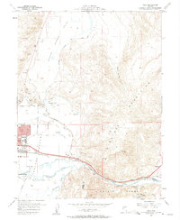 1957 Vista1959 Print · USGSSparks and the Truckee River corridor are captured during a period of mid-century growth and industrial expansion. Genealogists and local historians can trace the development of neighborhood schools like Lincoln Park Sch or locate the Dominican Brothers Monastery and the railroad stop at Vista.2 unique versions available
 - 1957 Map of Spanish Springs Valley, 1959 Print
 1957 Spanish Springs Valley1959 Print · USGSWashoe County at the end of the fifties shows the transition from historic ranching life to early suburban growth. Genealogists and historians can trace the Southern Pacific corridor through Mustang and Hafed or locate family sites like the Wilcox Ranch and Home Ranch.3 unique versions available
 - 1957 Map of Wadsworth, 1959 Print
 1957 Wadsworth1959 Print · USGSThe Truckee River corridor comes alive in the late fifties as a vital artery for rail and water management. Genealogists and historians can trace the foundations of Wadsworth, locate cemeteries near the river, and explore remote mining sites like the Celetom Mine or Olinghouse.3 unique versions available
 - 1957 Map of Reno, 1963 Print
 1957 Reno1963 Print · USGSWestern Nevada in the early sixties is a land of sprawling desert sinks and rising mountain ranges. Genealogists and historians can trace the rail-and-river network connecting Reno, the mining legacy of Rawhide Mine, and the boundaries of the Pyramid Lake Indian Reservation.5 unique versions available
 - 1959 Map of Reno
 1959 Reno1959 Print · USGSWestern Nevada in the late fifties was a land of expanding military airbases and high-desert irrigation projects. You can trace the lineage of the Comstock era through Carson City, locate the Pony Express Monument, or study the rail networks of the Southern Pacific RR.
 - 1960 Map of Reno
 1960 Reno1960 Print · USGSThe high desert of western Nevada comes alive in this mid-century survey of the Reno-Tahoe region. Genealogists and historians can trace rail lines like the Southern Pacific RR and locate remote outposts such as Olinghouse, Nixon, and the Olinghouse Mine.2 unique versions available
 - 1960 Map of Virginia City, 1976 Print
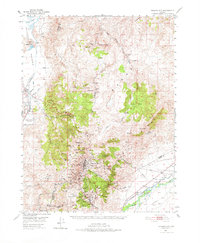 1960 Virginia City1976 Print · USGSThe Comstock Lode is shown in detail at mid-century, mapping the industrial footprint of the silver mining boom. Genealogists and historians can locate mining infrastructure, the Sutro Tunnel, and settlements like Gold Hill, Silver City, and American Flat.
 - 1967 Map of Chalk Hills, 1970 Print
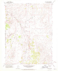 1967 Chalk Hills1970 Print · USGSStorey County in the late sixties is a landscape of high desert ranges and hidden history. Researchers can locate ancient Petroglyphs, trace the course of Lousetown Creek, and find old Prospects near Washington Hill.5 unique versions available
 - 1967 Map of Flowery Peak, 1970 Print
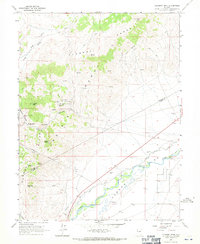 1967 Flowery Peak1970 Print · USGSStorey County mining and Carson River irrigation are captured in detail during the late sixties. Researchers can trace the subterranean path of the Sutro Tunnel or locate historic extraction sites like the Lady Bryan Mine and Monte Cristo (Site).4 unique versions available
 - 1967 Map of Virginia City, 1971 Print
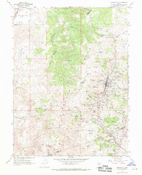 1967 Virginia City1971 Print · USGSVirginia City and the Comstock Lode mining district are shown here in the late sixties, highlighting the intense industrial footprint of the Nevada silver boom. Local historians can trace the foundations of Gold Hill, the Sutro Tunnel, and family sites near the Hebrew Cem.3 unique versions available
 - 1967 Map of Steamboat, 1971 Print
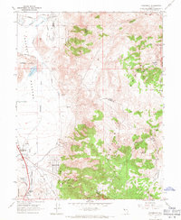 1967 Steamboat1971 Print · USGSWashoe and Storey counties meet along the rugged Virginia Range during the late sixties, where mining prospects and ranching roads intersect. Genealogists and researchers can locate Washington (Site), the Brown-Washoe Sch No 3, and the Castle Peak Mine.4 unique versions available
 - 1970 Map of Patrick, 1973 Print
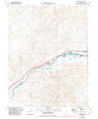 1970 Patrick1973 Print · USGSThe Truckee River valley in the late 1970s shows a critical intersection of Nevada's rail industry and power infrastructure. Genealogists and historians can trace riverside settlements like Patrick and Hafed or locate the storied 102 Ranch and Old Lonesome near the railroad.
 - 1974 Map of Virginia City, 1977 Print
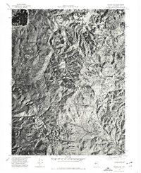 1974 Virginia City1977 Print · USGSVirginia City and the Comstock region are seen from above in the mid-1970s, revealing the dense settlement patterns and the mining-scarred landscape. Trace historic drainages like Gold Canyon or examine the rugged layout of the Virginia Range.
Showing maps 1-25 of 86
Top cities of Storey County
Frequently asked questions
- What are the different types of historical maps available for Storey County?
- What is the oldest map of Storey County?
- Where can I purchase historical maps of Storey County for my home or office?
- Where can I download high-res historical maps of Storey County?
- Are there historical topographic maps available for Storey County?
- Is there historical aerial imagery available for Storey County?
- Where are historical maps of Storey County sourced from?