Old Maps of Barnstead, New Hampshire for Genealogy
Trace your family roots with 35 historic maps of Barnstead. These high-res maps reveal old neighborhoods, homesites, landmarks, and streets — helping you uncover where your ancestors lived and how the area evolved over time.
- Explore historic neighborhoods: Identify where your relatives may have lived in the 1800s or 1900s.
- Compare maps over time: Trace the changes in streets, buildings, and landmarks for multi-generational research.
- Perfect for genealogy & ancestry research: Used by family historians and researchers to map out lineage and migration.
These maps are an incredible resource for exploring your personal connection to Barnstead's past.
Barnstead, NH maps
(35)- 1919 Map of Gilmanton
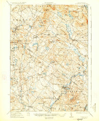
 1919 Gilmanton1919 Print · USGSBelknap and Merrimack counties are mapped here just after the Great War, showing a landscape of specialized hamlets and water-driven industry. Researchers can trace the Suncook Valley RR and locate ancestral landmarks like Shaker Village or the Smith Meetinghouse.2 unique versions available
 - 1919 Map of Alton
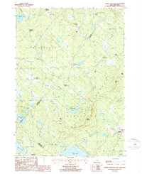
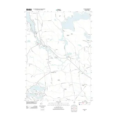
 1919 Alton1919 Print · USGSEastern New Hampshire in the years following the Great War reveals a landscape of high ridges and valley settlements. Trace ancestral roots through small rural outposts like Middleton Corners and schools like the Willeytown School or Ten Rod School.6 unique versions available
 - 1927 Map of Gilmanton
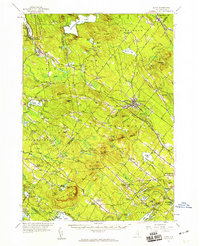
 1927 Gilmanton1927 Print · USGSBelknap and Merrimack Counties appear here in the late twenties, showing a landscape of rural schoolhouses and established hill towns. Genealogists can trace family names through landmarks like Smith Meetinghouse, Shaker Village, and the South Pittsfield Friends Meetinghouse.5 unique versions available
 - 1949 Map of Portland
 1949 Portland1949 Print · USGSCoastal Maine and the New Hampshire interior are shown in detail during the late forties, from the bustling harbors to the lakeside villages. Researchers can trace historical rail networks like the Boston & Maine RR and locate coastal defenses such as Fort Preble.3 unique versions available
 - 1956 Map of Portland, 1963 Print
 1956 Portland1963 Print · USGSSouthern Maine and eastern New Hampshire are captured here in the mid-fifties, during a time of major highway expansion and military growth. You can trace the path of the Maine Turnpike and locate landmarks like the Portsmouth Naval Shipyard and Sebago Lake.4 unique versions available
 - 1957 Map of Alton, 1959 Print
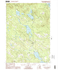
 1957 Alton1959 Print · USGSEastern New Hampshire’s Lakes Region and the Blue Hill Range are captured here during the late 1950s. Genealogists and researchers can locate old schoolhouses and crossroads, including Austin Cate Academy, Gerrish Chapel, and the Nute Ridge Sch.4 unique versions available
 - 1957 Map of Gilmanton, 1960 Print
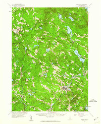 1957 Gilmanton1960 Print · USGSBelknap and Merrimack Counties are shown in the late 1950s, a period when rural schoolhouses and communal religious sites still anchored these small towns. Researchers can locate family landmarks like Pearls Corner, the historic Shaker Village, and the prominent Gilmanton Ironworks settlement.5 unique versions available
 - 1959 Map of Portland
 1959 Portland1959 Print · USGSThe Maine and New Hampshire coastlines meet in this mid-century portrait of maritime commerce and inland rail networks. Researchers can trace the legacy of coastal defense at Fort Williams and follow the historic path of the Maine Central RR through the White Mountain National Forest.2 unique versions available
 - 1963 Map of Portland
 1963 Portland1963 Print · USGSCoastal Maine and New Hampshire thrived as maritime and industrial hubs during the mid-sixties, linked by a dense network of rail and river. Researchers can trace historic transit corridors like the Maine Central RR and locate key sites such as the Portsmouth Naval Shipyard or Pease Air Force Base.3 unique versions available
 - 1986 Map of Concord
 1986 Concord1986 Print · USGSCentral New Hampshire in the mid-eighties shows a landscape of river-valley cities and rural villages connected by the growing interstate system. Genealogists and historians can trace old community centers like Gilmanton Ironworks or follow the Boston and Maine Railroad through Concord and Tilton.
 - 1987 Map of Alton
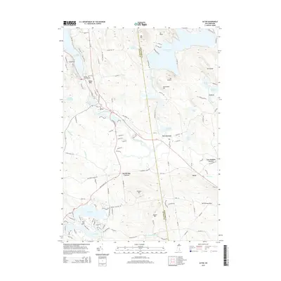
 1987 Alton1987 Print · USGSThe southeastern shore of Lake Winnipesaukee comes alive in the late eighties, showing the transition from lakeside recreation to permanent residential growth. Genealogists can trace family lines through Stockbridge Corners and New Durham Corner, while local historians can locate the Fish Hatchery and Alton Bay State Forest.2 unique versions available
 - 1987 Map of Pittsfield
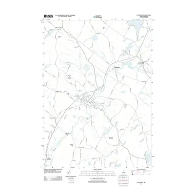
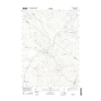
 1987 Pittsfield1987 Print · USGSMerrimack County comes into focus in the late 1980s as the Suncook River flows through the industrial hub of Pittsfield. Genealogists and local historians can trace the Old Railroad Grade or locate family landmarks like Websters Mill and Sanborn Hill.
 - 1987 Map of Gilmanton Ironworks
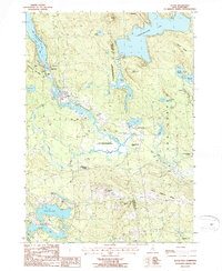
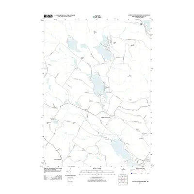
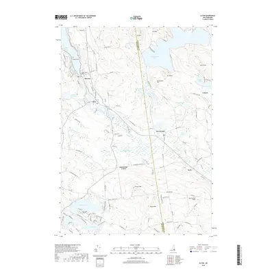
 1987 Gilmanton Ironworks1987 Print · USGSBelknap County, New Hampshire, is captured in the late twentieth century as its lakeside communities and mountain forests thrived. Genealogists and local historians can trace the areas around Gilmanton Ironworks, the shores of Crystal Lake, and family-named landmarks like Halls Hill.2 unique versions available
 - 1987 Map of Parker Mountain
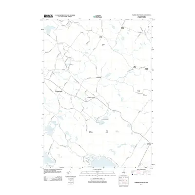
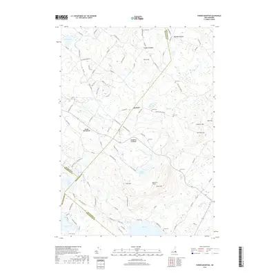
 1987 Parker Mountain1987 Print · USGSThe rural hills of Strafford and Barnstead are captured here in the late twentieth century, showing a landscape defined by traditional family-named crossroads. Researchers can locate historic burial sites at several mapped cemeteries or trace the geography of old homesteads near Lockes Corner, Shackford Corners, and the shores of Bow Lake.2 unique versions available
 - 1988 Map of Concord
 1988 Concord1988 Print · USGSCentral New Hampshire in the late eighties centers on the industrial and political hub of Concord. Researchers can trace the Boston and Maine RR along the Merrimack River or locate recreation landmarks like Bear Brook State Park and Massabesic Lake.
 - 2012 Map of Parker Mountain, 2012 Print
 2012 Parker Mountain2012 Print · USGSCovers Barnstead, including Farmington, Pittsfield, and other nearby areas
 - 2012 Map of Pittsfield, 2012 Print
 2012 Pittsfield2012 Print · USGSCovers Barnstead, including Loudon, Epsom, and other nearby areas
 - 2012 Map of Alton, 2012 Print
 2012 Alton2012 Print · USGSCovers Barnstead, including Farmington, New Durham, and other nearby areas
 - 2012 Map of Gilmanton Ironworks, 2012 Print
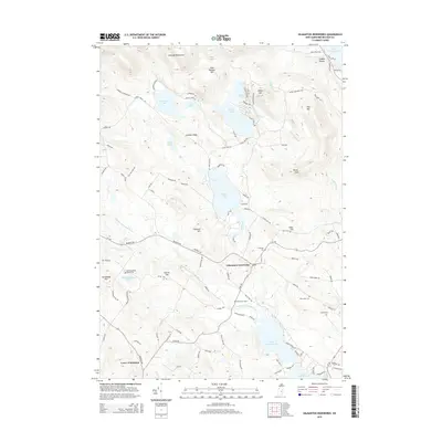
 2012 Gilmanton Ironworks2012 Print · USGSCovers Barnstead, including Gilford, Gilmanton, and other nearby areas
 - 2015 Map of Gilmanton Ironworks, 2015 Print
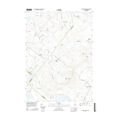
 2015 Gilmanton Ironworks2015 Print · USGSCovers Barnstead, including Gilford, Gilmanton, and other nearby areas
 - 2015 Map of Parker Mountain, 2015 Print
 2015 Parker Mountain2015 Print · USGSCovers Barnstead, including Farmington, Pittsfield, and other nearby areas
 - 2015 Map of Pittsfield, 2015 Print
 2015 Pittsfield2015 Print · USGSCovers Barnstead, including Loudon, Epsom, and other nearby areas
 - 2015 Map of Alton, 2015 Print
 2015 Alton2015 Print · USGSCovers Barnstead, including Farmington, New Durham, and other nearby areas
 - 2018 Map of Parker Mountain, 2018 Print
 2018 Parker Mountain2018 Print · USGSCovers Barnstead, including Farmington, Pittsfield, and other nearby areas
 - 2018 Map of Alton, 2018 Print
 2018 Alton2018 Print · USGSCovers Barnstead, including Farmington, New Durham, and other nearby areas
Showing maps 1-25 of 35
Top cities near Barnstead
- Concord historical maps
- Rochester historical maps
- Laconia historical maps
- Barrington historical maps
- Gilford historical maps
- Bow historical maps
See more
Top neighborhoods of Barnstead
Frequently asked questions
- What are the different types of historical maps available for Barnstead?
- What is the oldest map of Barnstead?
- Where can I purchase historical maps of Barnstead for my home or office?
- Where can I download high-res historical maps of Barnstead?
- Are there historical topographic maps available for Barnstead?
- Is there historical aerial imagery available for Barnstead?
- Where are historical maps of Barnstead sourced from?