1900s (20th Century) Maps of East Sandwich, Sandwich
Explore 9 historic maps of East Sandwich from the 1900s (20th Century). These maps offer a rare glimpse into what life looked like during the 1900s — showing old roads, neighborhoods, homes, and landmarks that have changed or disappeared over time.
Whether you're researching your family's past, planning a metal detecting trip, or studying how East Sandwich's landscape evolved across the 1900s, these high-resolution maps are a powerful tool for exploring the history of this region.
- Focus on a specific era: All maps on this page are from the 1900s, giving you a focused view of this time period.
- See what’s changed: Compare century-old streets, trails, and buildings to today's modern landscape using overlays and satellite layers.
- Research with precision: Use these maps for genealogy, historical research, land use analysis, or educational projects.
- View, download, or print: Maps are fully viewable online in high resolution, and can be downloaded or printed for your own records.
Start exploring East Sandwich's history through authentic maps from the 1900s. This is your window into the past.
East Sandwich, Sandwich maps
(9)- 1931 Map of Mt. Chocorua
 1931 Mt. Chocorua1931 Print · USGSCarroll County’s timber and mountain landscape is captured here in the late Prohibition era. Researchers can trace the path of the Beebe River RR, locate old schoolhouses like Fellows Sch, and find family sites near Wonalancet or Center Sandwich.7 unique versions available
 - 1949 Map of Portland
 1949 Portland1949 Print · USGSCoastal Maine and the New Hampshire interior are shown in detail during the late forties, from the bustling harbors to the lakeside villages. Researchers can trace historical rail networks like the Boston & Maine RR and locate coastal defenses such as Fort Preble.3 unique versions available
 - 1956 Map of Portland, 1963 Print
 1956 Portland1963 Print · USGSSouthern Maine and eastern New Hampshire are captured here in the mid-fifties, during a time of major highway expansion and military growth. You can trace the path of the Maine Turnpike and locate landmarks like the Portsmouth Naval Shipyard and Sebago Lake.4 unique versions available
 - 1958 Map of Mt. Chocorua, 1960 Print
 1958 Mt. Chocorua1960 Print · USGSThe Sandwich Range and Tamworth valley are captured here in the late fifties as modern forest access began to expand. Family historians can trace rural schoolhouses and numerous local burial grounds, including Riverside Cem and Wonalancet Cem.3 unique versions available
 - 1959 Map of Portland
 1959 Portland1959 Print · USGSThe Maine and New Hampshire coastlines meet in this mid-century portrait of maritime commerce and inland rail networks. Researchers can trace the legacy of coastal defense at Fort Williams and follow the historic path of the Maine Central RR through the White Mountain National Forest.2 unique versions available
 - 1963 Map of Portland
 1963 Portland1963 Print · USGSCoastal Maine and New Hampshire thrived as maritime and industrial hubs during the mid-sixties, linked by a dense network of rail and river. Researchers can trace historic transit corridors like the Maine Central RR and locate key sites such as the Portsmouth Naval Shipyard or Pease Air Force Base.3 unique versions available
 - 1986 Map of Lake Winnipesaukee
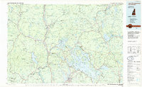 1986 Lake Winnipesaukee1986 Print · USGSThe Lakes Region in the mid-eighties shows a landscape of dense water bodies and mountain ranges at the peak of its twentieth-century character. Trace the legacy of old rail lines like the Boston and Maine RR and locate historic centers from Rumney Depot to Melvin Village.2 unique versions available
 - 1987 Map of Tamworth
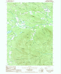 1987 Tamworth1987 Print · USGSCarroll County's mountain-and-river landscape is documented here in the late 1980s, showcasing the development of small New England villages. Researchers can trace historic properties near Tamworth, locate the Covered Bridge, and explore high-elevation landmarks like Black Snout Mtn.2 unique versions available
 - 1998 Map of Tamworth, 2001 Print
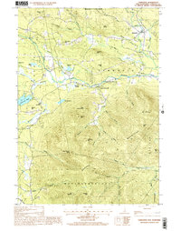 1998 Tamworth2001 Print · USGSThe Carroll County highlands at the end of the twentieth century show a landscape shaped by the Bearcamp River and the high peaks of the Ossipee Mountains. Genealogists and hikers can locate old settlements like South Tamworth and Whittier or trace the drainage of Cold Brook through the state forests.
End of results
Showing maps 1-9 of 9
Top cities near East Sandwich
- Laconia historical maps
- Gilford historical maps
- Moultonborough historical maps
- Ossipee historical maps
- Conway historical maps
- Campton historical maps
See more
Frequently asked questions
- What are the different types of historical maps available for East Sandwich?
- What is the oldest map of East Sandwich?
- Where can I purchase historical maps of East Sandwich for my home or office?
- Where can I download high-res historical maps of East Sandwich?
- Are there historical topographic maps available for East Sandwich?
- Is there historical aerial imagery available for East Sandwich?
- Where are historical maps of East Sandwich sourced from?