1970s Maps of Fitzwilliam, New Hampshire
Explore 4 historic maps of Fitzwilliam from the 1970s. These maps offer a rare glimpse into what life looked like during the 1970s — showing old roads, neighborhoods, homes, and landmarks that have changed or disappeared over time.
Whether you're researching your family's past, planning a metal detecting trip, or studying how Fitzwilliam's landscape evolved across the 1970s, these high-resolution maps are a powerful tool for exploring the history of this region.
- Focus on a specific era: All maps on this page are from the 1970s, giving you a focused view of this time period.
- See what’s changed: Compare century-old streets, trails, and buildings to today's modern landscape using overlays and satellite layers.
- Research with precision: Use these maps for genealogy, historical research, land use analysis, or educational projects.
- View, download, or print: Maps are fully viewable online in high resolution, and can be downloaded or printed for your own records.
Start exploring Fitzwilliam's history through authentic maps from the 1970s. This is your window into the past.
Fitzwilliam, NH maps
(4)- 1971 Map of Winchendon, 1973 Print
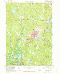 1971 Winchendon1973 Print · USGSWinchendon and the northern Massachusetts borderlands are captured here in the early 1970s as a landscape of river-driven industry and forest. Trace the rail-and-river history of Waterville, the legacy of the Boston and Maine Railroad, and the Birch Hill Dam.5 unique versions available
 - 1971 Map of Royalston, 1973 Print
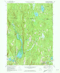 1971 Royalston1973 Print · USGSThe Worcester County highlands are captured here in the early 1970s, showing the distinct settlements of Royalston and South Royalston before modern development. You can trace family history through the Center Cem and Riverside Cem or follow the historic Boston and Maine rail line along the Millers River.5 unique versions available
 - 1975 Map of Winchendon, 1981 Print
 1975 Winchendon1981 Print · USGSNorth-central Massachusetts and the New Hampshire border are seen here in the mid-1970s. Trace the mill town layouts of Winchendon and Waterville along the Millers River or locate property near Lake Monomonac.
 - 1975 Map of Royalston, 1981 Print
 1975 Royalston1981 Print · USGSRoyalston and the northern Worcester County highlands are seen here in the mid-seventies through detailed aerial orthophotography. Researchers can trace the village layouts of West Royalston and Tully or the natural shorelines of Laurel Lake.
End of results
Showing maps 1-4 of 4
Top cities near Fitzwilliam
- Keene historical maps
- Gardner historical maps
- Athol historical maps
- Winchendon historical maps
- Westminster historical maps
- Templeton historical maps
See more
Top neighborhoods of Fitzwilliam
- State Line historical maps
- Bowkerville historical maps
- Rockwood historical maps
- Fitzwilliam Depot historical maps
Frequently asked questions
- What are the different types of historical maps available for Fitzwilliam?
- What is the oldest map of Fitzwilliam?
- Where can I purchase historical maps of Fitzwilliam for my home or office?
- Where can I download high-res historical maps of Fitzwilliam?
- Are there historical topographic maps available for Fitzwilliam?
- Is there historical aerial imagery available for Fitzwilliam?
- Where are historical maps of Fitzwilliam sourced from?