Old Maps of Idlewilde, Pittsburg for Academic Research
Study the evolution of Idlewilde with 14 high-resolution historic maps. Whether you're teaching, researching, or modeling changes in land use, these maps provide essential visual documentation of urban, environmental, and geographic change.
- Analyze long-term change: Track patterns in development, transportation, and natural features.
- Ideal for environmental or urban studies: Support academic projects with primary historical map data.
- Use in the classroom or lab: Educators and researchers rely on these maps to bring historical context to life.
These maps are a powerful tool for teaching, research, and visualizing how Idlewilde has changed over the decades.
Idlewilde, Pittsburg maps
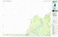
(14)- 1927 Map of Second Lake, 1955 Print
 1927 Second Lake1955 Print · USGSNorthern New Hampshire's high timberlands and the Connecticut River headwaters appear in the late twenties, spanning from the Canadian border down to the academy grants. Researchers can locate remote logging outposts like Depot Camp and Camp No 32 or trace the early shorelines of Second Lake and First Connecticut Lake.6 unique versions available
 - 1932 Map of Second Lake
 1932 Second Lake1932 Print · USGSThe northern New Hampshire wilderness and Maine borderlands are captured here in the early 1930s, showing a landscape of logging camps and high peaks. Genealogists and historians can trace old sites like Idlewild, the Deer Mtn Fire Tower, and remote outposts such as Camp No 36.4 unique versions available
 - 1949 Map of Jackman
 1949 Jackman1949 Print · USGSThe Quebec and Maine borderlands are shown in great detail during the late 1940s, highlighting the industrial and natural geography of the region. Trace old rail lines like the Canadian Pacific and locate settlements from Sherbrooke to Scotstown.2 unique versions available
 - 1963 Map of Jackman
 1963 Jackman1963 Print · USGSThe international borderlands of Maine and Quebec come alive in the mid-twentieth century, showing a landscape of timber towns and rail connections. Genealogists and historians can trace the paths of the Canadian Pacific Railway through Jackman or locate families in Sherbrooke and Megantic.
 - 1966 Map of Sherbrooke
 1966 Sherbrooke1966 Print · USGSThe borderlands of Quebec and Maine come alive in the mid-1960s, documenting the industrial towns and deep woods of the Northeast. Genealogists can trace family lines through Sherbrooke and Coaticook, or locate remote logging outposts along the Moose River and Flagstaff Lake.
 - 1976 Map of Sherbrooke
 1976 Sherbrooke1976 Print · USGSThe northern Maine woods and Quebec’s Eastern Townships meet in this mid-century survey of the rugged international borderlands. Genealogists and historians can trace rail-and-river connections through Thetford Mines, follow the Dead River to Flagstaff Lake, or locate small border crossings at Stanhope and Beecher Falls.2 unique versions available
 - 1986 Map of Sherbrooke
 1986 Sherbrooke1986 Print · USGSThe Great North Woods of the mid-eighties appear in detail across this survey of the New Hampshire and Canadian borderlands. Researchers can trace the entire chain of the First Connecticut Lake through the fourth, alongside remote settlements like Pittsburg and Beecher Falls.2 unique versions available
 - 1989 Map of Second Connecticut Lake
 1989 Second Connecticut Lake1989 Print · USGSThe high headwaters of the New Hampshire North Country are captured here in the late 1980s, tracing the river's path from the Canadian border. Researchers can locate the small settlement of Idlewild or follow the numerous timber-country drainages like Perry Stream and Moose Brook.
 - 1997 Map of Second Connecticut Lake, 2000 Print
 1997 Second Connecticut Lake2000 Print · USGSThe northernmost reaches of New Hampshire meet the Canadian border in the late nineties, documenting the pristine headwaters of the Connecticut River. Researchers can locate the seasonal settlement at Idlewild and trace the complex network of Scott Bog and Moose Falls.
 - 2012 Map of Second Connecticut Lake, 2012 Print
 2012 Second Connecticut Lake2012 Print · USGSCovers Idlewilde, including Pittsburg, Notre-Dame-des-Bois, and other nearby areas
 - 2015 Map of Second Connecticut Lake, 2015 Print
 2015 Second Connecticut Lake2015 Print · USGSCovers Idlewilde, including Pittsburg, Notre-Dame-des-Bois, and other nearby areas
 - 2018 Map of Second Connecticut Lake, 2018 Print
 2018 Second Connecticut Lake2018 Print · USGSCovers Idlewilde, including Pittsburg, Notre-Dame-des-Bois, and other nearby areas
 - 2021 Map of Second Connecticut Lake, 2021 Print
 2021 Second Connecticut Lake2021 Print · USGSCovers Idlewilde, including Pittsburg, Notre-Dame-des-Bois, and other nearby areas
 - 2024 Map of Second Connecticut Lake, 2024 Print
 2024 Second Connecticut Lake2024 Print · USGSThe headwaters of the Connecticut River at the Canadian border are captured in this modern survey of the North Country's lake chain. Outdoor enthusiasts and local historians can trace the remote paths near Idlewilde, Moose Falls, and the high peaks of Salmon Mtn.
End of results
Showing maps 1-14 of 14
Top cities near Idlewilde
- Colebrook historical maps
- Stewartstown historical maps
- Pittsburg historical maps
- Clarksville historical maps
- Lincoln Plantation historical maps
- Dixville historical maps
See more
Frequently asked questions
- What are the different types of historical maps available for Idlewilde?
- What is the oldest map of Idlewilde?
- Where can I purchase historical maps of Idlewilde for my home or office?
- Where can I download high-res historical maps of Idlewilde?
- Are there historical topographic maps available for Idlewilde?
- Is there historical aerial imagery available for Idlewilde?
- Where are historical maps of Idlewilde sourced from?