1950s Maps of Grafton County, New Hampshire
Explore 15 historic maps of Grafton County from the 1950s. These maps offer a rare glimpse into what life looked like during the 1950s — showing old roads, neighborhoods, homes, and landmarks that have changed or disappeared over time.
Whether you're researching your family's past, planning a metal detecting trip, or studying how Grafton County's landscape evolved across the 1950s, these high-resolution maps are a powerful tool for exploring the history of this region.
- Focus on a specific era: All maps on this page are from the 1950s, giving you a focused view of this time period.
- See what’s changed: Compare century-old streets, trails, and buildings to today's modern landscape using overlays and satellite layers.
- Research with precision: Use these maps for genealogy, historical research, land use analysis, or educational projects.
- View, download, or print: Maps are fully viewable online in high resolution, and can be downloaded or printed for your own records.
Start exploring Grafton County's history through authentic maps from the 1950s. This is your window into the past.
Grafton County, NH maps
(15)- 1950 Map of Crawford Notch
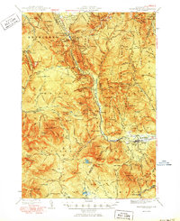 1950 Crawford Notch1950 Print · USGSGrafton and Carroll Counties are shown here during the mid-century peak of White Mountain hiking and rail travel. Researchers can trace historic trails like the Davis Path, find old mountain outposts like Willey House PO, or locate the logging settlement of Livermore.3 unique versions available
 - 1950 Map of Glens Falls
 1950 Glens Falls1950 Print · USGSThe Adirondacks and the Green Mountains meet in this mid-century survey of the New York and Vermont borderlands. Researchers can trace the industrial rail corridors of the Rutland RR and Delaware & Hudson RR connecting Glens Falls, Rutland, and the shores of Lake George.
 - 1950 Map of Lake Champlain
 1950 Lake Champlain1950 Print · USGSThe Lake Champlain valley and its surrounding peaks are captured in detail during the late 1940s, showing the vital rail and road connections between New York and Vermont. Researchers can trace the routes of the Central Vermont Railway or locate old industrial centers like Mineville and Witherbee.2 unique versions available
 - 1950 Map of Lewiston
 1950 Lewiston1950 Print · USGSThe Maine and New Hampshire borderlands come alive in this post-war survey of the White Mountains and Androscoggin valley. Genealogists and historians can trace rail lines like the Maine Central Railroad and find high-altitude landmarks from Mount Washington to Bretton Woods.2 unique versions available
 - 1956 Map of Cardigan, 1958 Print
 1956 Cardigan1958 Print · USGSGrafton County's high ridges and lake shores are captured here during the mid-fifties, showing the region's transition toward recreation and conservation. Genealogists and hikers can trace the Boston and Maine rail line through Grafton Center or locate old district sites like the Red Sch and Alexandria Mica Mine.3 unique versions available
 - 1956 Map of Holderness, 1959 Print
 1956 Holderness1959 Print · USGSNew Hampshire’s Lakes Region and the Pemigewasset valley are captured here in the mid-fifties as the area’s rail-and-road network supported growing tourism and local industry. Genealogists can trace family sites at the Bay Meetinghouse, North Sanbornton, and small rural schoolhouses like River Road Sch.3 unique versions available
 - 1956 Map of Portland, 1963 Print
 1956 Portland1963 Print · USGSSouthern Maine and eastern New Hampshire are captured here in the mid-fifties, during a time of major highway expansion and military growth. You can trace the path of the Maine Turnpike and locate landmarks like the Portsmouth Naval Shipyard and Sebago Lake.4 unique versions available
 - 1956 Map of Glens Falls, 1968 Print
 1956 Glens Falls1968 Print · USGSUpper New York and the Vermont mountains are captured here in the mid-fifties, showing the rugged rail-and-river network of the Northeast. Researchers can trace the paths of the Delaware and Hudson RR and Rutland RR as they wind through valley towns like Poultney and Whitehall.3 unique versions available
 - 1956 Map of Lewiston, 1975 Print
 1956 Lewiston1975 Print · USGSThe Northern New England interior is documented here in the mid-fifties, from the industrial Androscoggin River to the high peaks of the White Mountains. Trace the Grand Trunk Railway through mountain passes or locate family landmarks near Sabbathday Lake and Bretton Woods.
 - 1958 Map of Lake Champlain
 1958 Lake Champlain1958 Print · USGSThe Champlain Valley and surrounding high peaks are captured here in the late fifties, showcasing the cross-border region from the Adirondacks to the Green Mountains. Researchers can trace historic rail routes like the Rutland Railway or locate old valley settlements such as Keeseville and Vergennes.2 unique versions available
 - 1958 Map of Mt. Chocorua, 1960 Print
 1958 Mt. Chocorua1960 Print · USGSThe Sandwich Range and Tamworth valley are captured here in the late fifties as modern forest access began to expand. Family historians can trace rural schoolhouses and numerous local burial grounds, including Riverside Cem and Wonalancet Cem.3 unique versions available
 - 1959 Map of Glens Falls
 1959 Glens Falls1959 Print · USGSUpper New York and Vermont are captured here during the late 1950s, a period of transition for these mountain communities. Researchers can trace the legacy of the region's river-and-rail economy through landmarks like Lake George, Saratoga Springs, and Killington Peak.2 unique versions available
 - 1959 Map of Portland
 1959 Portland1959 Print · USGSThe Maine and New Hampshire coastlines meet in this mid-century portrait of maritime commerce and inland rail networks. Researchers can trace the legacy of coastal defense at Fort Williams and follow the historic path of the Maine Central RR through the White Mountain National Forest.2 unique versions available
 - 1959 Map of Hanover, 1961 Print
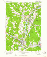 1959 Hanover1961 Print · USGSThe Upper Valley at the close of the fifties reveals a landscape defined by the Connecticut River and the halls of Dartmouth College. Genealogists and researchers can locate family plots in Hillside Cem or trace the early rail paths of the Central Vermont through White River Junction.5 unique versions available
 - 1959 Map of North Hartland, 1961 Print
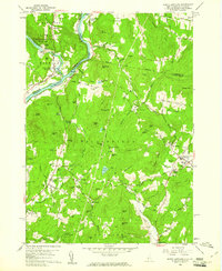 1959 North Hartland1961 Print · USGSThe Upper Connecticut River Valley at the end of the 1950s shows a landscape of river-driven industry and academic tradition. Genealogists and historians can trace the foundations of Meriden, identify the location of the Kimball Union Academy, and locate dozens of family cemeteries such as Gallup Cem.4 unique versions available
End of results
Showing maps 1-15 of 15
Top cities of Grafton County
- Lebanon historical maps
- Hanover historical maps
- Littleton historical maps
- Plymouth historical maps
- Enfield historical maps
- Haverhill historical maps
See more
Frequently asked questions
- What are the different types of historical maps available for Grafton County?
- What is the oldest map of Grafton County?
- Where can I purchase historical maps of Grafton County for my home or office?
- Where can I download high-res historical maps of Grafton County?
- Are there historical topographic maps available for Grafton County?
- Is there historical aerial imagery available for Grafton County?
- Where are historical maps of Grafton County sourced from?