Old Maps of Waterville Valley, New Hampshire for Genealogy
Trace your family roots with 48 historic maps of Waterville Valley. These high-res maps reveal old neighborhoods, homesites, landmarks, and streets — helping you uncover where your ancestors lived and how the area evolved over time.
- Explore historic neighborhoods: Identify where your relatives may have lived in the 1800s or 1900s.
- Compare maps over time: Trace the changes in streets, buildings, and landmarks for multi-generational research.
- Perfect for genealogy & ancestry research: Used by family historians and researchers to map out lineage and migration.
These maps are an incredible resource for exploring your personal connection to Waterville Valley's past.
Waterville Valley, NH maps
(48)- 1895 Map of Crawford Notch
 1895 Crawford Notch1895 Print · USGSThe White Mountains in the mid-1890s are shown here as a landscape of rail-accessible mountain passes and logging outposts. Genealogists and historians can trace the early tourism hubs of Crawford House and Willey House or the industrial roots of Livermore.
 - 1896 Map of Crawford Notch
 1896 Crawford Notch1896 Print · USGSHigh peaks and early railroad travel define this White Mountain landscape in the 1890s. Genealogists and historians can trace the foundations of Livermore, the Maine Central Railroad route, and landmark hotels like the Crawford House.9 unique versions available
 - 1928 Map of Plymouth, 1953 Print
 1928 Plymouth1953 Print · USGSGrafton County is captured in the late 1920s as its river towns and mountain resorts began to modernize. Genealogists can trace family footprints at Blair Cemetery or locate old schoolhouses like Pulsifer Hill Sch and Thornton Center Sch along the valley roads.5 unique versions available
 - 1931 Map of Plymouth
 1931 Plymouth1931 Print · USGSGrafton County communities are linked by the Boston and Maine Railroad during the early thirties. Genealogists can trace family roots through numerous rural landmarks like Thornton Center, Blair Sch, and the riverside landings at Livermore Falls.5 unique versions available
 - 1931 Map of Mt. Chocorua
 1931 Mt. Chocorua1931 Print · USGSCarroll County’s timber and mountain landscape is captured here in the late Prohibition era. Researchers can trace the path of the Beebe River RR, locate old schoolhouses like Fellows Sch, and find family sites near Wonalancet or Center Sandwich.7 unique versions available
 - 1946 Map of Crawford Notch, 1955 Print
 1946 Crawford Notch1955 Print · USGSThe White Mountains in the mid-1940s reveal a network of historic rail corridors and backcountry shelters. Trace the Maine Central Railroad through the notch or locate early landmarks like Crawford House and the Willey House P.O.9 unique versions available
 - 1949 Map of Portland
 1949 Portland1949 Print · USGSCoastal Maine and the New Hampshire interior are shown in detail during the late forties, from the bustling harbors to the lakeside villages. Researchers can trace historical rail networks like the Boston & Maine RR and locate coastal defenses such as Fort Preble.3 unique versions available
 - 1950 Map of Crawford Notch
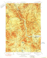 1950 Crawford Notch1950 Print · USGSGrafton and Carroll Counties are shown here during the mid-century peak of White Mountain hiking and rail travel. Researchers can trace historic trails like the Davis Path, find old mountain outposts like Willey House PO, or locate the logging settlement of Livermore.3 unique versions available
 - 1950 Map of Lewiston
 1950 Lewiston1950 Print · USGSThe Maine and New Hampshire borderlands come alive in this post-war survey of the White Mountains and Androscoggin valley. Genealogists and historians can trace rail lines like the Maine Central Railroad and find high-altitude landmarks from Mount Washington to Bretton Woods.2 unique versions available
 - 1956 Map of Portland, 1963 Print
 1956 Portland1963 Print · USGSSouthern Maine and eastern New Hampshire are captured here in the mid-fifties, during a time of major highway expansion and military growth. You can trace the path of the Maine Turnpike and locate landmarks like the Portsmouth Naval Shipyard and Sebago Lake.4 unique versions available
 - 1956 Map of Lewiston, 1975 Print
 1956 Lewiston1975 Print · USGSThe Northern New England interior is documented here in the mid-fifties, from the industrial Androscoggin River to the high peaks of the White Mountains. Trace the Grand Trunk Railway through mountain passes or locate family landmarks near Sabbathday Lake and Bretton Woods.
 - 1958 Map of Mt. Chocorua, 1960 Print
 1958 Mt. Chocorua1960 Print · USGSThe Sandwich Range and Tamworth valley are captured here in the late fifties as modern forest access began to expand. Family historians can trace rural schoolhouses and numerous local burial grounds, including Riverside Cem and Wonalancet Cem.3 unique versions available
 - 1959 Map of Portland
 1959 Portland1959 Print · USGSThe Maine and New Hampshire coastlines meet in this mid-century portrait of maritime commerce and inland rail networks. Researchers can trace the legacy of coastal defense at Fort Williams and follow the historic path of the Maine Central RR through the White Mountain National Forest.2 unique versions available
 - 1961 Map of Lewiston
 1961 Lewiston1961 Print · USGSWestern Maine and the White Mountains appear here during the early sixties, showing the industrial river towns and vast timberlands before the modern interstate era. Genealogists and historians can trace the Grand Trunk RR through Berlin or locate landmarks like Old Speck Mountain and Elephant Mountain.
 - 1962 Map of Lewiston
 1962 Lewiston1962 Print · USGSThe industrial river valleys and high peaks of Maine and New Hampshire define the region in the early sixties. Trace the rail-and-river network from Lewiston to the White Mountains, passing through mill towns like Berlin and Rumford.
 - 1963 Map of Portland
 1963 Portland1963 Print · USGSCoastal Maine and New Hampshire thrived as maritime and industrial hubs during the mid-sixties, linked by a dense network of rail and river. Researchers can trace historic transit corridors like the Maine Central RR and locate key sites such as the Portsmouth Naval Shipyard or Pease Air Force Base.3 unique versions available
 - 1969 Map of Lewiston
 1969 Lewiston1969 Print · USGSThe northern New England highlands come into focus during the mid-fifties, showing the vital rail and river networks connecting industrial centers to the deep woods. Researchers can trace the path of the Grand Trunk RR or locate landmarks like Mt Washington and Rangeley Lake.
 - 1980 Map of Waterville Valley, 1981 Print
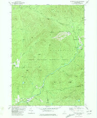 1980 Waterville Valley1981 Print · USGSWaterville Valley and the surrounding peaks of the White Mountains are captured here in the early 1980s as the recreation economy matured. Researchers can locate the Mad River Cem, trace the old Sandwich Notch Road, and identify historic bridges like Sixmile Bridge.3 unique versions available
 - 1986 Map of Lake Winnipesaukee
 1986 Lake Winnipesaukee1986 Print · USGSThe Lakes Region in the mid-eighties shows a landscape of dense water bodies and mountain ranges at the peak of its twentieth-century character. Trace the legacy of old rail lines like the Boston and Maine RR and locate historic centers from Rumney Depot to Melvin Village.2 unique versions available
 - 1986 Map of Mount Washington
 1986 Mount Washington1986 Print · USGSThe northern New England highlands are shown here in the mid-eighties, centered on the high peaks and river valleys of the New Hampshire borderlands. Researchers can trace historic transportation lines like the Mount Washington Cog Railway and the Maine Central Railroad near Gorham and Lancaster.
 - 1987 Map of Mount Tripyramid
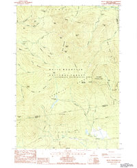 1987 Mount Tripyramid1987 Print · USGSThe high peaks of the Sandwich Range are documented in the late 1980s, detailing a period of established wilderness preservation and backcountry recreation. Researchers can trace historic access points like Livermore Pass, locate Sabbaday Falls, and study the drainage of Flat Mountain Ponds.
 - 1987 Map of Mount Carrigain
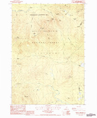 1987 Mount Carrigain1987 Print · USGSThe White Mountains in the late 1980s offer a detailed view of the high peaks and river headwaters near Grafton and Carroll counties. Hikers and historians can trace established paths like the Sawyer River Trail and find landmarks such as Sawyer Pond and Kancamagus Pass.
 - 1987 Map of Mount Chocorua
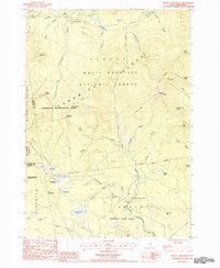 1987 Mount Chocorua1987 Print · USGSThe Sandwich Range and White Mountain foothills come alive in the late eighties, showing a landscape defined by wilderness protection and historical trail networks. Researchers can trace old routes like Old Mast Road and locate sites such as Passaconaway, Ferncroft, and Tilton Pond.
 - 1988 Map of Mount Washington, 1989 Print
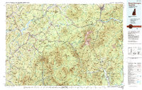 1988 Mount Washington1989 Print · USGSThe New Hampshire high country in the late 1980s is defined by its iconic peaks and the legacy of mountain tourism. Trace the routes of the historic Mount Washington Cog Railway and the Maine Central RR through the gaps of Crawford Notch State Park.
 - 1995 Map of Mount Carrigain, 2000 Print
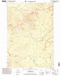 1995 Mount Carrigain2000 Print · USGSThe high peaks of the White Mountains are shown here in the 1990s, when conservation and trail networks defined the region. Hikers and historians can trace the route over Kancamagus Pass or locate remote landmarks like Stillwater and Signal Ridge.
Showing maps 1-25 of 48
Top cities near Waterville Valley
- Moultonborough historical maps
- Plymouth historical maps
- Ossipee historical maps
- Campton historical maps
- Bartlett historical maps
- Tamworth historical maps
See more
Top neighborhoods of Waterville Valley
Frequently asked questions
- What are the different types of historical maps available for Waterville Valley?
- What is the oldest map of Waterville Valley?
- Where can I purchase historical maps of Waterville Valley for my home or office?
- Where can I download high-res historical maps of Waterville Valley?
- Are there historical topographic maps available for Waterville Valley?
- Is there historical aerial imagery available for Waterville Valley?
- Where are historical maps of Waterville Valley sourced from?