2000s (21st Century) Maps of Gerrish Corner, Webster
Explore 6 historic maps of Gerrish Corner from the 2000s (21st Century). These maps offer a rare glimpse into what life looked like during the 2000s — showing old roads, neighborhoods, homes, and landmarks that have changed or disappeared over time.
Whether you're researching your family's past, planning a metal detecting trip, or studying how Gerrish Corner's landscape evolved across the 2000s, these high-resolution maps are a powerful tool for exploring the history of this region.
- Focus on a specific era: All maps on this page are from the 2000s, giving you a focused view of this time period.
- See what’s changed: Compare century-old streets, trails, and buildings to today's modern landscape using overlays and satellite layers.
- Research with precision: Use these maps for genealogy, historical research, land use analysis, or educational projects.
- View, download, or print: Maps are fully viewable online in high resolution, and can be downloaded or printed for your own records.
Start exploring Gerrish Corner's history through authentic maps from the 2000s. This is your window into the past.
Gerrish Corner, Webster maps
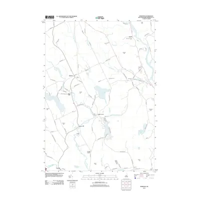
(6)- 2000 Map of Webster, 2001 Print
 2000 Webster2001 Print · USGSMerrimack County at the close of the millennium reveals a landscape shaped by its river systems and early mill settlements. Researchers can trace the development of Dingit Corner and Swetts Mills or locate family landmarks near Pillsbury Lake.
 - 2012 Map of Webster, 2012 Print
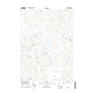
 2012 Webster2012 Print · USGSCovers Gerrish Corner, including Concord, Hopkinton, and other nearby areas
 - 2015 Map of Webster, 2015 Print
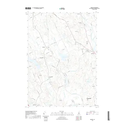
 2015 Webster2015 Print · USGSCovers Gerrish Corner, including Concord, Hopkinton, and other nearby areas
 - 2018 Map of Webster, 2018 Print
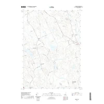
 2018 Webster2018 Print · USGSCovers Gerrish Corner, including Concord, Hopkinton, and other nearby areas
 - 2021 Map of Webster, 2021 Print
 2021 Webster2021 Print · USGSCovers Gerrish Corner, including Concord, Hopkinton, and other nearby areas
 - 2024 Map of Webster, 2024 Print
 2024 Webster2024 Print · USGSMerrimack County’s rural character is on full display in this modern survey of the river valleys and high hills. Researchers can locate numerous burial grounds like Beaver Dam Cem and explore old settlements such as Swetts Mills or Gerrish.
End of results
Showing maps 1-6 of 6
Top cities near Gerrish Corner
- Manchester historical maps
- Concord historical maps
- Goffstown historical maps
- Hooksett historical maps
- Weare historical maps
- Franklin historical maps
See more
Frequently asked questions
- What are the different types of historical maps available for Gerrish Corner?
- What is the oldest map of Gerrish Corner?
- Where can I purchase historical maps of Gerrish Corner for my home or office?
- Where can I download high-res historical maps of Gerrish Corner?
- Are there historical topographic maps available for Gerrish Corner?
- Is there historical aerial imagery available for Gerrish Corner?
- Where are historical maps of Gerrish Corner sourced from?