1900s (20th Century) Maps of Rockingham County, New Hampshire
Explore 123 historic maps of Rockingham County from the 1900s (20th Century). These maps offer a rare glimpse into what life looked like during the 1900s — showing old roads, neighborhoods, homes, and landmarks that have changed or disappeared over time.
Whether you're researching your family's past, planning a metal detecting trip, or studying how Rockingham County's landscape evolved across the 1900s, these high-resolution maps are a powerful tool for exploring the history of this region.
- Focus on a specific era: All maps on this page are from the 1900s, giving you a focused view of this time period.
- See what’s changed: Compare century-old streets, trails, and buildings to today's modern landscape using overlays and satellite layers.
- Research with precision: Use these maps for genealogy, historical research, land use analysis, or educational projects.
- View, download, or print: Maps are fully viewable online in high resolution, and can be downloaded or printed for your own records.
Start exploring Rockingham County's history through authentic maps from the 1900s. This is your window into the past.
Rockingham County, NH maps
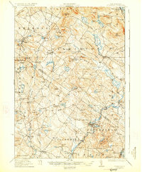
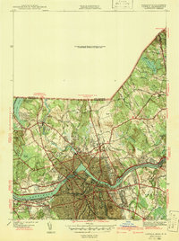
(123)- 1905 Map of Manchester
 1905 Manchester1905 Print · USGSSouthern New Hampshire at the turn of the century reveals a bustling region of river-powered industry and growing rail towns. Genealogists and historians can trace the early footprints of Manchester and Nashua or locate landmarks like Thorntons Ferry and the Londonderry Lithia Spring.4 unique versions available
 - 1916 Map of Dover
 1916 Dover1916 Print · USGSCoastal New Hampshire and the Maine borderlands are captured here during the height of the rail era. Genealogists can locate dozens of district schools like Madbury School and trace the paths of the Boston and Maine Railroad through Portsmouth and Dover.2 unique versions available
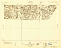
 - 1917 Map of Mt. Pawtuckaway, 1957 Print
 1917 Mt. Pawtuckaway1957 Print · USGSSoutheast New Hampshire in the early 1900s was a landscape of concentrated village centers and active rail lines. Genealogists can locate family landmarks like Rundlett Hills and Winkley School or trace the early paths of the Isinglass River and Pawtuckaway Pond.
 - 1918 Map of Lowell
 1918 Lowell1918 Print · USGSGreater Lowell and the Merrimack Valley are shown at their industrial peak during the First World War. Genealogists can trace family connections to mill-town life in Middlesex Village or locate rural landmarks like Flat Rock Quarry and the Old Middlesex Canal.
 - 1918 Map of Dover
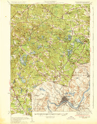
 1918 Dover1918 Print · USGSCoastal New Hampshire and the Maine borderlands are captured here during the First World War era, showing a landscape defined by tidal rivers and rail networks. Genealogists can trace family landmarks and early civic life through the State College in Durham, the Kittery Depot, and local schoolhouses like Marshwood.6 unique versions available
 - 1918 Map of Lawrence
 1918 Lawrence1918 Print · USGSGreater Lawrence and the Merrimac Valley are captured here during the late First World War era, showing a landscape defined by industrial rail and historic village centers. Researchers can trace the sprawling Boston and Maine Railroad network to specific sites like the State Almshouse or the Andover Theological Seminary.2 unique versions available
 - 1919 Map of Mt. Pawtuckaway
 1919 Mt. Pawtuckaway1919 Print · USGSSoutheastern New Hampshire is captured just after the Great War, showing a landscape of upland farms and rural villages connected by the Boston and Maine Railroad. Genealogists can locate family-named landmarks and institutions like the Winkley School, Nottingham Square, and the County Farm.5 unique versions available
 - 1919 Map of Gilmanton
 1919 Gilmanton1919 Print · USGSBelknap and Merrimack counties are mapped here just after the Great War, showing a landscape of specialized hamlets and water-driven industry. Researchers can trace the Suncook Valley RR and locate ancestral landmarks like Shaker Village or the Smith Meetinghouse.2 unique versions available
 - 1919 Map of Alton
 1919 Alton1919 Print · USGSEastern New Hampshire in the years following the Great War reveals a landscape of high ridges and valley settlements. Trace ancestral roots through small rural outposts like Middleton Corners and schools like the Willeytown School or Ten Rod School.6 unique versions available
 - 1920 Map of York
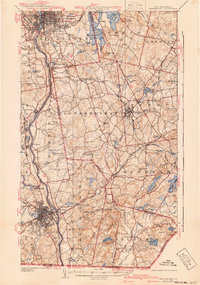
 1920 York1920 Print · USGSThe Maine and New Hampshire shoreline comes to life during the late 1910s, showing a region balanced between naval defense and coastal commerce. Genealogists and historians can locate old landmarks like the Lincoln School, the Coast Guard Sta, and the path of the Electric Railway.6 unique versions available
 - 1921 Map of Suncook
 1921 Suncook1921 Print · USGSMerrimack and Suncook River valleys thrive in the early 1920s as bustling centers of rail travel and local education. Genealogists can locate family homesteads near dozens of rural schoolhouses like Borough School or trace the old Boston and Maine Railroad through Suncook and Hooksett.5 unique versions available
 - 1921 Map of Lowell
 1921 Lowell1921 Print · USGSThe industrial corridor of the Merrimack Valley is captured here during the early twentieth century, showing the dense urban grid of Lowell alongside rural Middlesex County. Researchers can trace the extensive reach of the Boston and Maine Railroad and locate local landmarks like the Poor Farm or Flat Rock Quarry.
 - 1927 Map of Gilmanton
 1927 Gilmanton1927 Print · USGSBelknap and Merrimack Counties appear here in the late twenties, showing a landscape of rural schoolhouses and established hill towns. Genealogists can trace family names through landmarks like Smith Meetinghouse, Shaker Village, and the South Pittsfield Friends Meetinghouse.5 unique versions available
 - 1931 Map of Lowell
 1931 Lowell1931 Print · USGSSouthern New Hampshire and northern Massachusetts met along the river and rail lines in the early thirties. Local researchers can trace family lands near St Marie Convent, the site of Musquash Sch, and the heights of Jeremy Hill.
 - 1932 Map of Newburyport
 1932 Newburyport1932 Print · USGSThe New Hampshire seacoast and southern Rockingham County are shown here in the early thirties, just as coastal recreation and inland farming reached a mature balance. Genealogists can locate family-named landmarks like Nason Corner, Dearborn Academy, and various district schools.4 unique versions available
 - 1934 Map of Exeter
 1934 Exeter1934 Print · USGSThe New Hampshire seacoast and Merrimack Valley met the Atlantic in the mid-thirties as a network of rail and river commerce. Genealogists can trace family lines through Newbury Old Town or locate historic institutions like Phillips Exeter Academy and Dearborn Academy.5 unique versions available
 - 1935 Map of Lowell
 1935 Lowell1935 Print · USGSGreater Lowell and the Merrimack Valley are captured in the mid-1930s, showing a region defined by its industrial riverfront and extensive rail networks. Researchers can trace historic neighborhoods like Wamesit, local landmarks like St Marie Convent, and early industry at Flat Rock Quarry.3 unique versions available
 - 1935 Map of Haverhill
 1935 Haverhill1935 Print · USGSThe borderlands of New Hampshire and Massachusetts appear here in the mid-1930s, showing a landscape defined by the Merrimack River and a dense rail network. Genealogists can trace family landmarks like Philbrick Hill or locate old schoolhouses including South Road Sch and the Depot Sch.5 unique versions available
 - 1939 Map of Mt. Pawtuckaway
 1939 Mt. Pawtuckaway1939 Print · USGSSoutheastern New Hampshire is shown just before the mid-century as a land of granite hills, numerous ponds, and deep-rooted villages. Trace the path of the Boston and Maine Railroad or locate family sites like the Poore Farm School and Nottingham Square.
 - 1941 Map of Manchester
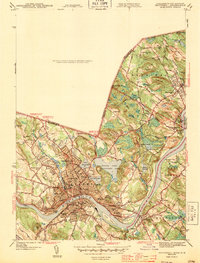
 1941 Manchester1941 Print · USGSSouthern New Hampshire is captured here just before the mid-century boom, showing the river-and-rail corridor between Manchester and Nashua. Researchers can trace old ferry sites like Thorntons Ferry and find vanished rural landmarks like Londonderry Lithia Spring or the Musquash School.3 unique versions available
 - 1941 Map of Dover
 1941 Dover1941 Print · USGSCoastal New Hampshire and the Maine borderlands are captured here just before the mobilization of the early 1940s. Genealogists can trace family lands near Garrison Hill, old district schools like Witchtrot Sch, and the rail depots at Greenland Village Sta.
 - 1941 Map of Lowell
 1941 Lowell1941 Print · USGSThe industrial hub of Lowell and the surrounding Middlesex County landscape are captured here just before the Second World War. Researchers can trace historic family burial sites like Oak Grove Cem or locate early civic landmarks including the Lowell Textile Institute and Nickel Mine.2 unique versions available
 - 1943 Map of Lowell
 1943 Lowell1943 Print · USGSCentral New England industrial hubs and rural borderlands are mapped here during the early 1940s. Genealogists can trace family names across Mt Misery, Barrett Hill, and small settlements like Collinsville or North Pelham.
 - 1943 Map of Haverhill
 1943 Haverhill1943 Print · USGSThe Merrimack River valley during the early 1940s reveals a bustling corridor of industry and education between Haverhill and Groveland. Genealogists and historians can trace neighborhood school sites like Hannah Duston Sch and significant cemeteries such as Linwood Cem.2 unique versions available
 - 1943 Map of Ayers Village
 1943 Ayers Village1943 Print · USGSThe Massachusetts-New Hampshire borderlands are captured here during the Second World War as the suburbs of Haverhill expanded. Genealogists and local historians can trace family-named sites like Grosvenor Corner, Tozier Corner, and the West Parish Ch.2 unique versions available
Showing maps 1-25 of 123
Top cities of Rockingham County
- Derry historical maps
- Salem historical maps
- Londonderry historical maps
- Portsmouth historical maps
- Hampton historical maps
- Windham historical maps
See more
Frequently asked questions
- What are the different types of historical maps available for Rockingham County?
- What is the oldest map of Rockingham County?
- Where can I purchase historical maps of Rockingham County for my home or office?
- Where can I download high-res historical maps of Rockingham County?
- Are there historical topographic maps available for Rockingham County?
- Is there historical aerial imagery available for Rockingham County?
- Where are historical maps of Rockingham County sourced from?