1990s Maps of Rockingham County, New Hampshire
Explore 6 historic maps of Rockingham County from the 1990s. These maps offer a rare glimpse into what life looked like during the 1990s — showing old roads, neighborhoods, homes, and landmarks that have changed or disappeared over time.
Whether you're researching your family's past, planning a metal detecting trip, or studying how Rockingham County's landscape evolved across the 1990s, these high-resolution maps are a powerful tool for exploring the history of this region.
- Focus on a specific era: All maps on this page are from the 1990s, giving you a focused view of this time period.
- See what’s changed: Compare century-old streets, trails, and buildings to today's modern landscape using overlays and satellite layers.
- Research with precision: Use these maps for genealogy, historical research, land use analysis, or educational projects.
- View, download, or print: Maps are fully viewable online in high resolution, and can be downloaded or printed for your own records.
Start exploring Rockingham County's history through authentic maps from the 1990s. This is your window into the past.
Rockingham County, NH maps
(6)- 1992 Map of Exeter, 1998 Print
 1992 Exeter1998 Print · USGSCoastal New Hampshire's transition from historic river towns to modern energy infrastructure is captured here in the early nineties. Genealogists and local historians can trace family-named crossroads like Eastman Corners, locate the campus of Phillips Exeter Academy, and identify old industrial sites like Coffins Mill.
 - 1995 Map of Kittery, 1999 Print
 1995 Kittery1999 Print · USGSThe Maine and New Hampshire coastlines meet here in the late twentieth century, centered on the historic maritime corridor of the Piscataqua River. Researchers can trace the layout of the Portsmouth Naval Base and explore coastal defense sites like Fort Stark St Hist Site and Ft McClary State Park.
 - 1995 Map of Epping, 1999 Print
 1995 Epping1999 Print · USGSRockingham County at the close of the twentieth century remains a landscape of historic river villages and rural cemeteries. Genealogists can trace family names at Plumer Cem and Sleeper Cem, or explore old centers like Nottingham Square and Wadley Falls.
 - 1995 Map of Barrington, 1999 Print
 1995 Barrington1999 Print · USGSBarrington and its surrounding hamlets are shown in the mid-nineties as the region balanced its rural character with growing university and recreational footprints. Genealogists and local researchers can trace historic property markers and burial grounds like Pine Grove Cem or locate the UNH Recreation Area at Mendums Pond.
 - 1995 Map of Gossville, 1999 Print
 1995 Gossville1999 Print · USGSMerrimack and Rockingham County hills come into focus in the mid-nineties, showing the rural character of the Suncook River valley. Genealogists can locate family sites at McClary Cem, the Epsom Central Sch, and the old Suncook Valley Railroad corridor.
 - 1995 Map of Northwood, 2000 Print
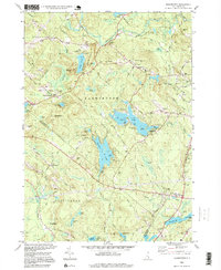
 1995 Northwood2000 Print · USGSNorthwood and Deerfield are shown here in the mid-nineties, a landscape of glacial lakes and historic village hamlets at the border of Rockingham and Strafford counties. Genealogists can locate family landmarks like Bartlett Cem and Stevens Cem, while local historians can trace the early layout of Northwood Narrows and Deerfield Parade.
End of results
Showing maps 1-6 of 6
Top cities of Rockingham County
- Derry historical maps
- Salem historical maps
- Londonderry historical maps
- Portsmouth historical maps
- Hampton historical maps
- Windham historical maps
See more
Frequently asked questions
- What are the different types of historical maps available for Rockingham County?
- What is the oldest map of Rockingham County?
- Where can I purchase historical maps of Rockingham County for my home or office?
- Where can I download high-res historical maps of Rockingham County?
- Are there historical topographic maps available for Rockingham County?
- Is there historical aerial imagery available for Rockingham County?
- Where are historical maps of Rockingham County sourced from?