Old Maps of Deerfield, New Hampshire for Academic Research
Study the evolution of Deerfield with 40 high-resolution historic maps. Whether you're teaching, researching, or modeling changes in land use, these maps provide essential visual documentation of urban, environmental, and geographic change.
- Analyze long-term change: Track patterns in development, transportation, and natural features.
- Ideal for environmental or urban studies: Support academic projects with primary historical map data.
- Use in the classroom or lab: Educators and researchers rely on these maps to bring historical context to life.
These maps are a powerful tool for teaching, research, and visualizing how Deerfield has changed over the decades.
Deerfield, NH maps
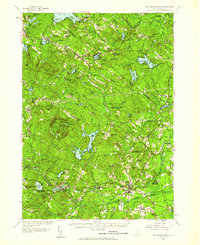
(40)- 1917 Map of Mt. Pawtuckaway, 1957 Print
 1917 Mt. Pawtuckaway1957 Print · USGSSoutheast New Hampshire in the early 1900s was a landscape of concentrated village centers and active rail lines. Genealogists can locate family landmarks like Rundlett Hills and Winkley School or trace the early paths of the Isinglass River and Pawtuckaway Pond.
 - 1919 Map of Mt. Pawtuckaway
 1919 Mt. Pawtuckaway1919 Print · USGSSoutheastern New Hampshire is captured just after the Great War, showing a landscape of upland farms and rural villages connected by the Boston and Maine Railroad. Genealogists can locate family-named landmarks and institutions like the Winkley School, Nottingham Square, and the County Farm.5 unique versions available
 - 1921 Map of Suncook
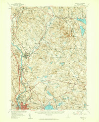
 1921 Suncook1921 Print · USGSMerrimack and Suncook River valleys thrive in the early 1920s as bustling centers of rail travel and local education. Genealogists can locate family homesteads near dozens of rural schoolhouses like Borough School or trace the old Boston and Maine Railroad through Suncook and Hooksett.5 unique versions available
 - 1939 Map of Mt. Pawtuckaway
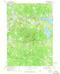
 1939 Mt. Pawtuckaway1939 Print · USGSSoutheastern New Hampshire is shown just before the mid-century as a land of granite hills, numerous ponds, and deep-rooted villages. Trace the path of the Boston and Maine Railroad or locate family sites like the Poore Farm School and Nottingham Square.
 - 1944 Map of Mt. Pawtuckaway
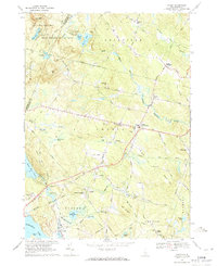
 1944 Mt. Pawtuckaway1944 Print · USGSMid-century Rockingham and Strafford counties are captured here at a time when rural schoolhouses and rail lines still defined the local landscape. Genealogists can trace family names across Winkley Sch and Philbrick Sch, or locate vanished industries like the Deer Mill and the Boston and Maine Railroad.
 - 1944 Map of Suncook
 1944 Suncook1944 Print · USGSSuncook and the surrounding New Hampshire hill towns are captured in the 1940s as industry met a rugged landscape. Trace ancestral homes and community hubs like Candia Station, the Sanitarium, and the Buck Street Sch during this era of transition.
 - 1949 Map of Portland
 1949 Portland1949 Print · USGSCoastal Maine and the New Hampshire interior are shown in detail during the late forties, from the bustling harbors to the lakeside villages. Researchers can trace historical rail networks like the Boston & Maine RR and locate coastal defenses such as Fort Preble.3 unique versions available
 - 1956 Map of Portland, 1963 Print
 1956 Portland1963 Print · USGSSouthern Maine and eastern New Hampshire are captured here in the mid-fifties, during a time of major highway expansion and military growth. You can trace the path of the Maine Turnpike and locate landmarks like the Portsmouth Naval Shipyard and Sebago Lake.4 unique versions available
 - 1957 Map of Mt. Pawtuckaway, 1959 Print
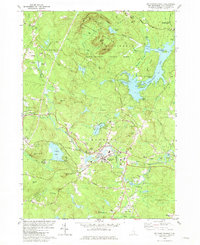
 1957 Mt. Pawtuckaway1959 Print · USGSRockingham and Strafford counties are shown in the late fifties, featuring a network of traditional villages and expanding recreational lakes. Researchers can trace historic sites like Nottingham Square, Deerfield Parade, and the Watson Academy.4 unique versions available
 - 1957 Map of Suncook, 1959 Print
 1957 Suncook1959 Print · USGSCentral New Hampshire comes into focus during the late fifties, capturing the growth of Manchester and the surrounding river valleys. Genealogists can trace family names at Pembroke Cem or locate historic schools like Pembroke Academy and Center Sch.4 unique versions available
 - 1959 Map of Portland
 1959 Portland1959 Print · USGSThe Maine and New Hampshire coastlines meet in this mid-century portrait of maritime commerce and inland rail networks. Researchers can trace the legacy of coastal defense at Fort Williams and follow the historic path of the Maine Central RR through the White Mountain National Forest.2 unique versions available
 - 1963 Map of Portland
 1963 Portland1963 Print · USGSCoastal Maine and New Hampshire thrived as maritime and industrial hubs during the mid-sixties, linked by a dense network of rail and river. Researchers can trace historic transit corridors like the Maine Central RR and locate key sites such as the Portsmouth Naval Shipyard or Pease Air Force Base.3 unique versions available
 - 1967 Map of Gossville, 1971 Print
 1967 Gossville1971 Print · USGSThe Suncook River valley and the highlands of Merrimack County are captured here in the late sixties as traditional village life met growing state parklands. Trace the route of the Suncook Valley RR and locate local landmarks like Epsom Central Sch or the McClary Cem.4 unique versions available
 - 1969 Map of Candia, 1971 Print
 1969 Candia1971 Print · USGSRockingham County in the late sixties shows a landscape of wooded state parks and quiet rail corridors. Genealogists can locate family landmarks like the Holbrook Cem, the Moore Sch, and the Boston and Maine Railroad grade.2 unique versions available
 - 1981 Map of Mt. Pawtuckaway
 1981 Mt. Pawtuckaway1981 Print · USGSRockingham County in the early eighties shows a landscape defined by the Pawtuckaway Mountains and the busy Lamprey River valley. Genealogists and hikers can trace the Boston and Maine Railroad corridor or locate family landmarks like Bartlett Cem and Gove Cem.3 unique versions available
 - 1981 Map of Northwood
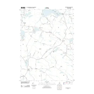
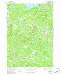 1981 Northwood1981 Print · USGSSoutheastern New Hampshire’s lake country is captured here in the early eighties, showcasing the historic village clusters of Northwood and Deerfield. Genealogists and historians can trace family landmarks like Bartlett Cem, find the old White Sch, or locate the radio tower on Saddleback Mountain.3 unique versions available
 - 1986 Map of Concord
 1986 Concord1986 Print · USGSCentral New Hampshire in the mid-eighties shows a landscape of river-valley cities and rural villages connected by the growing interstate system. Genealogists and historians can trace old community centers like Gilmanton Ironworks or follow the Boston and Maine Railroad through Concord and Tilton.
 - 1988 Map of Concord
 1988 Concord1988 Print · USGSCentral New Hampshire in the late eighties centers on the industrial and political hub of Concord. Researchers can trace the Boston and Maine RR along the Merrimack River or locate recreation landmarks like Bear Brook State Park and Massabesic Lake.
 - 1995 Map of Gossville, 1999 Print
 1995 Gossville1999 Print · USGSMerrimack and Rockingham County hills come into focus in the mid-nineties, showing the rural character of the Suncook River valley. Genealogists can locate family sites at McClary Cem, the Epsom Central Sch, and the old Suncook Valley Railroad corridor.
 - 1995 Map of Northwood, 2000 Print
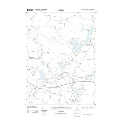
 1995 Northwood2000 Print · USGSNorthwood and Deerfield are shown here in the mid-nineties, a landscape of glacial lakes and historic village hamlets at the border of Rockingham and Strafford counties. Genealogists can locate family landmarks like Bartlett Cem and Stevens Cem, while local historians can trace the early layout of Northwood Narrows and Deerfield Parade.
 - 2012 Map of Candia, 2012 Print
 2012 Candia2012 Print · USGSCovers Deerfield, including Hooksett, Auburn, and other nearby areas
 - 2012 Map of Gossville, 2012 Print
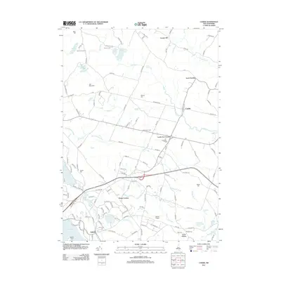
 2012 Gossville2012 Print · USGSCovers Deerfield, including Epsom, Allenstown, and other nearby areas
 - 2012 Map of Northwood, 2012 Print
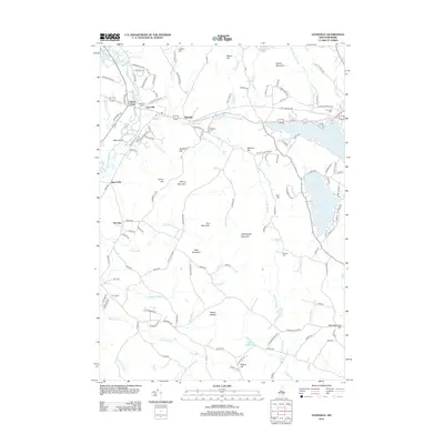
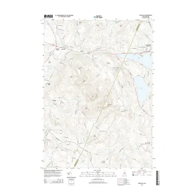
 2012 Northwood2012 Print · USGSCovers Deerfield, including Barrington, Nottingham, and other nearby areas
 - 2012 Map of Mount Pawtuckaway, 2012 Print
 2012 Mount Pawtuckaway2012 Print · USGSCovers Deerfield, including Nottingham, Fremont, and other nearby areas
 - 2015 Map of Gossville, 2015 Print
 2015 Gossville2015 Print · USGSCovers Deerfield, including Epsom, Allenstown, and other nearby areas
Showing maps 1-25 of 40
Top cities near Deerfield
- Manchester historical maps
- Concord historical maps
- Derry historical maps
- Rochester historical maps
- Londonderry historical maps
- Bedford historical maps
See more
Top neighborhoods of Deerfield
- Deerfield Center historical maps
- Leavitts Hill historical maps
- South Deerfield historical maps
- Deerfield Parade historical maps
- James City historical maps
Frequently asked questions
- What are the different types of historical maps available for Deerfield?
- What is the oldest map of Deerfield?
- Where can I purchase historical maps of Deerfield for my home or office?
- Where can I download high-res historical maps of Deerfield?
- Are there historical topographic maps available for Deerfield?
- Is there historical aerial imagery available for Deerfield?
- Where are historical maps of Deerfield sourced from?