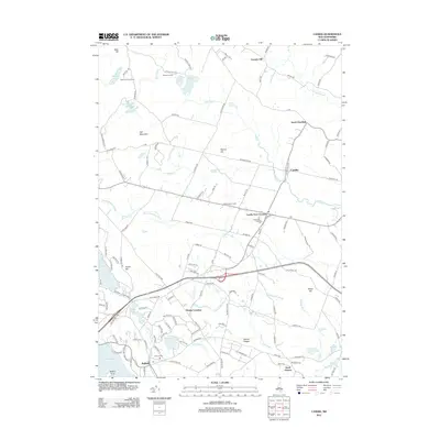
2012 Map of Candia
USGS Topo · Published 2012About this map
Candia and Candia Four Corners serve as the central hubs of this Rockingham County landscape, where small village centers are connected by a network of historic roads like New Boston Rd and Old Deerfield Rd. The geography is defined by a series of prominent elevations, including Hall Mountain, Walnut Hill, and Mount Pisgah, which rise above a complex watershed of ponds and brooks. Genealogists will find interest in sites like Holbrook Cem and Auburn Cem, while the presence of the Bear Hill Pond Camp and Childrens Camp near Bear Hill Pond reflects the area's long-standing tradition of seasonal recreation. The southern edge of the map transitions into the waters of Massabesic Lake near Auburn, where Battery Point marks the rugged shoreline of this vital local reservoir.
Find a feature on this map
137 named features on this map. Tap any name to fly to it.
Don’t see what you’re looking for? This feature index may not catch every label — zoom into the map to look around manually.
Map Details
Editions of this 2012 Candia Map
This is the sole edition of this map. No revisions or reprints were ever made.
Other maps of this area

1888 · Haverhill
USGS Topo · 1:62,500

1890 · Haverhill
USGS Topo · 1:62,500

1893 · Haverhill
USGS Topo · 1:62,500

1905 · Manchester
USGS Topo · 1:62,500

1917 · Mt. Pawtuckaway
USGS Topo · 1:62,500

1919 · Mt. Pawtuckaway
USGS Topo · 1:62,500

1921 · Suncook
USGS Topo · 1:62,500

1935 · Haverhill
USGS Topo · 1:62,500

1939 · Mt. Pawtuckaway
USGS Topo · 1:62,500

1941 · Manchester
USGS Topo · 1:62,500