1900s (20th Century) Maps of Stratham, New Hampshire
Explore 28 historic maps of Stratham from the 1900s (20th Century). These maps offer a rare glimpse into what life looked like during the 1900s — showing old roads, neighborhoods, homes, and landmarks that have changed or disappeared over time.
Whether you're researching your family's past, planning a metal detecting trip, or studying how Stratham's landscape evolved across the 1900s, these high-resolution maps are a powerful tool for exploring the history of this region.
- Focus on a specific era: All maps on this page are from the 1900s, giving you a focused view of this time period.
- See what’s changed: Compare century-old streets, trails, and buildings to today's modern landscape using overlays and satellite layers.
- Research with precision: Use these maps for genealogy, historical research, land use analysis, or educational projects.
- View, download, or print: Maps are fully viewable online in high resolution, and can be downloaded or printed for your own records.
Start exploring Stratham's history through authentic maps from the 1900s. This is your window into the past.
Stratham, NH maps
(28)- 1916 Map of Dover
 1916 Dover1916 Print · USGSCoastal New Hampshire and the Maine borderlands are captured here during the height of the rail era. Genealogists can locate dozens of district schools like Madbury School and trace the paths of the Boston and Maine Railroad through Portsmouth and Dover.2 unique versions available
 - 1918 Map of Dover
 1918 Dover1918 Print · USGSCoastal New Hampshire and the Maine borderlands are captured here during the First World War era, showing a landscape defined by tidal rivers and rail networks. Genealogists can trace family landmarks and early civic life through the State College in Durham, the Kittery Depot, and local schoolhouses like Marshwood.6 unique versions available
 - 1932 Map of Newburyport
 1932 Newburyport1932 Print · USGSThe New Hampshire seacoast and southern Rockingham County are shown here in the early thirties, just as coastal recreation and inland farming reached a mature balance. Genealogists can locate family-named landmarks like Nason Corner, Dearborn Academy, and various district schools.4 unique versions available
 - 1934 Map of Exeter
 1934 Exeter1934 Print · USGSThe New Hampshire seacoast and Merrimack Valley met the Atlantic in the mid-thirties as a network of rail and river commerce. Genealogists can trace family lines through Newbury Old Town or locate historic institutions like Phillips Exeter Academy and Dearborn Academy.5 unique versions available
 - 1941 Map of Dover
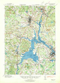 1941 Dover1941 Print · USGSCoastal New Hampshire and the Maine borderlands are captured here just before the mobilization of the early 1940s. Genealogists can trace family lands near Garrison Hill, old district schools like Witchtrot Sch, and the rail depots at Greenland Village Sta.
 - 1943 Map of Cape Ann
 1943 Cape Ann1943 Print · USGSCoastal Massachusetts and New Hampshire appear here during the wartime era, showing the maritime and rail infrastructure that defined the North Shore. Genealogists can trace family names across Asbury Grove, Merrimacport, and the Boston & Maine RR rail corridor.
 - 1944 Map of Hampton
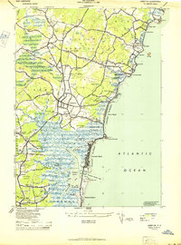 1944 Hampton1944 Print · USGSThe New Hampshire Seacoast during the mid-forties reveals a world of tidal marshes and emerging beach communities. Trace family roots and local history at Old Camp Ground, Dearborn Academy, and the crossroads at The Five Corners.2 unique versions available
 - 1948 Map of Boston
 1948 Boston1948 Print · USGSEastern Massachusetts and southern New Hampshire appear at an industrial peak in the late 1940s, just as suburban growth began to accelerate. Genealogists and historians can trace rail lines like the Boston and Albany RR or locate coastal landmarks like Graves Lighthouse and Fort Devens.2 unique versions available
 - 1949 Map of Portland
 1949 Portland1949 Print · USGSCoastal Maine and the New Hampshire interior are shown in detail during the late forties, from the bustling harbors to the lakeside villages. Researchers can trace historical rail networks like the Boston & Maine RR and locate coastal defenses such as Fort Preble.3 unique versions available
 - 1950 Map of Exeter, 1952 Print
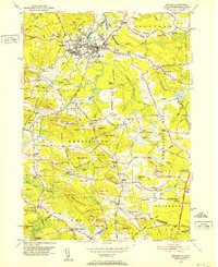 1950 Exeter1952 Print · USGSCoastal New Hampshire's rural character and established town centers are captured here at mid-century, just as local road networks began to expand. Researchers can trace ancestral roots through family-named landmarks like Gooch Corner, Dows Corner, and the Westview Cem.5 unique versions available
 - 1952 Map of Portsmouth
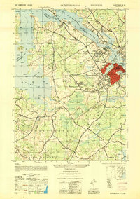 1952 Portsmouth1952 Print · USGSCoastal New Hampshire and Maine are shown in detail during the early fifties, centering on the harbor and the bustling city of Portsmouth. Trace the development of the Piscataqua River waterfront, find ancestral sites like Winnicut Mills, and locate old rail hubs at Greenland Station or Newington Station.
 - 1956 Map of Newmarket, 1958 Print
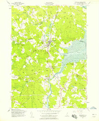 1956 Newmarket1958 Print · USGSCoastal New Hampshire's river-fed mill towns and rail junctions are caught in detail during the mid-1950s. Genealogists and historians can trace family plots at Riverside Cem or locate the vital rail hub at Rockingham Junction and the small settlement of Littlefield.5 unique versions available
 - 1956 Map of Dover, 1960 Print
 1956 Dover1960 Print · USGSCoastal New Hampshire and the Maine borderlands are captured here during a period of massive transition as modern infrastructure meets historic mill towns. Researchers can trace the development of Pease Air Force Base or locate family roots at Winnicut Mills and Packers Falls Cem.4 unique versions available
 - 1956 Map of Portland, 1963 Print
 1956 Portland1963 Print · USGSSouthern Maine and eastern New Hampshire are captured here in the mid-fifties, during a time of major highway expansion and military growth. You can trace the path of the Maine Turnpike and locate landmarks like the Portsmouth Naval Shipyard and Sebago Lake.4 unique versions available
 - 1956 Map of Portsmouth, 1963 Print
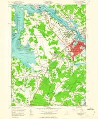 1956 Portsmouth1963 Print · USGSCoastal New Hampshire and Maine are shown here during the mid-fifties, just as the massive Pease Air Force Base was established. Researchers can trace family sites from Winnicut Mills to Atlantic Heights and find local landmarks like Breakfast Hill.4 unique versions available
 - 1956 Map of Boston, 1967 Print
 1956 Boston1967 Print · USGSThe Massachusetts coastline and industrial interior are seen here during the mid-century peak of suburban and highway expansion. Researchers can trace historic harbor defenses like Fort Revere, local landmarks such as Faneuil Hall, and the vast Parker River National Wildlife Refuge.6 unique versions available
 - 1957 Map of Hampton, 1959 Print
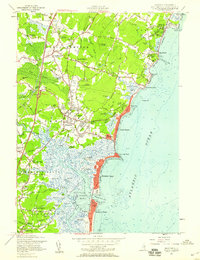 1957 Hampton1959 Print · USGSCoastal Rockingham County in the late fifties shows a landscape of tidal marshes and growing beach communities. Genealogists and local researchers can locate landmarks like Dearborn Academy, the Boston and Maine RR, and Ring Swamp Cem.5 unique versions available
 - 1958 Map of Boston
 1958 Boston1958 Print · USGSEastern Massachusetts and southern New Hampshire are shown at the height of the industrial era, before the full expansion of the interstate system. Trace coastal defenses at Fort Warren, historic rail lines like the Boston and Maine, and the development of the Mass. 128 corridor.2 unique versions available
 - 1959 Map of Portland
 1959 Portland1959 Print · USGSThe Maine and New Hampshire coastlines meet in this mid-century portrait of maritime commerce and inland rail networks. Researchers can trace the legacy of coastal defense at Fort Williams and follow the historic path of the Maine Central RR through the White Mountain National Forest.2 unique versions available
 - 1961 Map of Boston
 1961 Boston1961 Print · USGSThe Massachusetts coastline and its industrial interior are detailed here in the mid-twentieth century, from the Monadnock highlands to Cape Cod. Researchers can trace the rail routes of the Boston and Maine or locate landmarks like Fort Devens and the Wachusett Reservoir.2 unique versions available
 - 1963 Map of Portland
 1963 Portland1963 Print · USGSCoastal Maine and New Hampshire thrived as maritime and industrial hubs during the mid-sixties, linked by a dense network of rail and river. Researchers can trace historic transit corridors like the Maine Central RR and locate key sites such as the Portsmouth Naval Shipyard or Pease Air Force Base.3 unique versions available
 - 1977 Map of Hampton, 1981 Print
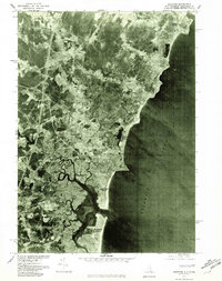 1977 Hampton1981 Print · USGSThe New Hampshire seacoast is captured in detail during the late seventies, showing the intricate tidal marshes and shoreline settlements. Genealogists and local historians can trace the development of Hampton Beach, Seabrook, and the winding Taylor River.
 - 1977 Map of Exeter, 1981 Print
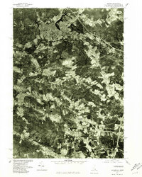 1977 Exeter1981 Print · USGSThe coastal New Hampshire landscape is captured here in the late 1970s, showcasing the transition from village centers to rural outskirts. Researchers can trace land use patterns near Exeter and locate family-named intersections like Eastman Corners and Parkman Corner.
 - 1984 Map of Gloucester
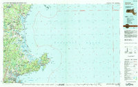 1984 Gloucester1984 Print · USGSCoastal Massachusetts and the New Hampshire borderlands are shown here in the mid-eighties, from the granite shores of Cape Ann to the Merrimack River. Researchers can trace the legacy of maritime trade and higher education at Salem State College or follow the Boston and Maine rail lines through Ipswich and Beverly.
 - 1985 Map of Exeter
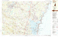 1985 Exeter1985 Print · USGSThe New Hampshire seacoast in the mid-eighties shows a landscape of colonial roots meeting modern energy infrastructure. Genealogists and historians can trace long-standing family corners and sites like Phillips Exeter Academy or Coffins Mill alongside the emerging Seabrook nuclear facility.
Showing maps 1-25 of 28
Top cities near Stratham
- Haverhill historical maps
- Methuen historical maps
- Dover historical maps
- Rochester historical maps
- Portsmouth historical maps
- Newburyport historical maps
See more
Top neighborhoods of Stratham
Frequently asked questions
- What are the different types of historical maps available for Stratham?
- What is the oldest map of Stratham?
- Where can I purchase historical maps of Stratham for my home or office?
- Where can I download high-res historical maps of Stratham?
- Are there historical topographic maps available for Stratham?
- Is there historical aerial imagery available for Stratham?
- Where are historical maps of Stratham sourced from?