
Loading...
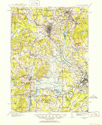
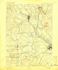
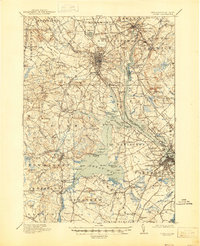
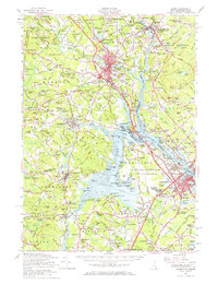
Loading map...1916 Map of Dover
USGS Topo · Published 1916About this map
The Cocheco River and Piscataqua River systems define this 1916 coastal landscape, where the tidal waters of Great Bay and Little Bay separate the inland settlements of New Hampshire from the Maine border. Dover stands as a primary hub of rail and water activity, connected to outlying villages like Rollinsford and South Berwick by the Boston and Maine Railroad. The map reveals a dense network of early 20th-century rural infrastructure, including localized landmarks like the County Farm and Garrison Hill.
Find a feature on this map
91 named features on this map. Tap any name to fly to it.
Don’t see what you’re looking for? This feature index may not catch every label — zoom into the map to look around manually.
Map Details
Date Portrayed1916
Date Published1916
PublisherU.S. Geological Survey
Map TypeTopographic
Scale1:62,500
Physical Dimensions16.9 x 20.9 inches
Editions of this 1916 Dover Map
2 editions found
Historical Maps of Dover Through Time
5 maps found

Featured Locations
Source Details
SourceU.S. Geological Survey
CopyrightPublic Domain