Old Maps of Squag City, Cornish for Academic Research
Study the evolution of Squag City with 14 high-resolution historic maps. Whether you're teaching, researching, or modeling changes in land use, these maps provide essential visual documentation of urban, environmental, and geographic change.
- Analyze long-term change: Track patterns in development, transportation, and natural features.
- Ideal for environmental or urban studies: Support academic projects with primary historical map data.
- Use in the classroom or lab: Educators and researchers rely on these maps to bring historical context to life.
These maps are a powerful tool for teaching, research, and visualizing how Squag City has changed over the decades.
Squag City, Cornish maps
(14)- 1906 Map of Hanover, 1956 Print
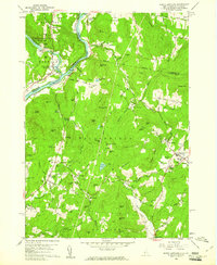
 1906 Hanover1956 Print · USGSThe Upper Connecticut River Valley at the turn of the century is a hub of rail activity and collegiate life. Researchers can trace the early footprints of Dartmouth College or locate vanished rail infrastructure at White River Junction and Deweys Mills.2 unique versions available
 - 1908 Map of Hanover
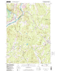
 1908 Hanover1908 Print · USGSThe Upper Valley at the dawn of the twentieth century was a vital junction of Vermont and New Hampshire rail lines and river commerce. Researchers can trace the early layout of Dartmouth College, the rail yards of White River Junction, and numerous rural schoolhouses like Podunk School.7 unique versions available
 - 1950 Map of Glens Falls
 1950 Glens Falls1950 Print · USGSThe Adirondacks and the Green Mountains meet in this mid-century survey of the New York and Vermont borderlands. Researchers can trace the industrial rail corridors of the Rutland RR and Delaware & Hudson RR connecting Glens Falls, Rutland, and the shores of Lake George.
 - 1956 Map of Glens Falls, 1968 Print
 1956 Glens Falls1968 Print · USGSUpper New York and the Vermont mountains are captured here in the mid-fifties, showing the rugged rail-and-river network of the Northeast. Researchers can trace the paths of the Delaware and Hudson RR and Rutland RR as they wind through valley towns like Poultney and Whitehall.3 unique versions available
 - 1959 Map of Glens Falls
 1959 Glens Falls1959 Print · USGSUpper New York and Vermont are captured here during the late 1950s, a period of transition for these mountain communities. Researchers can trace the legacy of the region's river-and-rail economy through landmarks like Lake George, Saratoga Springs, and Killington Peak.2 unique versions available
 - 1959 Map of North Hartland, 1961 Print
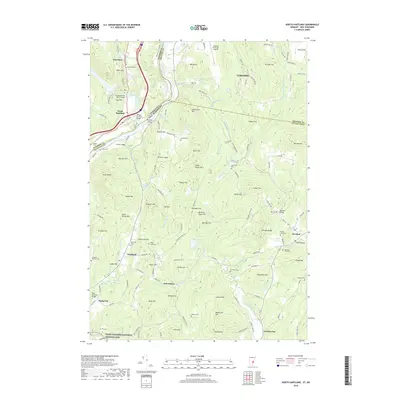
 1959 North Hartland1961 Print · USGSThe Upper Connecticut River Valley at the end of the 1950s shows a landscape of river-driven industry and academic tradition. Genealogists and historians can trace the foundations of Meriden, identify the location of the Kimball Union Academy, and locate dozens of family cemeteries such as Gallup Cem.4 unique versions available
 - 1964 Map of Glens Falls
 1964 Glens Falls1964 Print · USGSThe tri-state borderlands of New York, Vermont, and New Hampshire appear here in the mid-1960s. Researchers can trace the rail routes of the Rutland RR and find historic sites like Ticonderoga and Saratoga National Historical Park.
 - 1985 Map of Rutland, 1988 Print
 1985 Rutland1988 Print · USGSThe Upper Valley of the mid-1980s comes to life along the winding Connecticut River as it divides the Green Mountain and Granite states. Historians can trace the industrial rail hubs of White River Junction and the paths of the Appalachian Trail and Long Trail.
 - 1998 Map of North Hartland
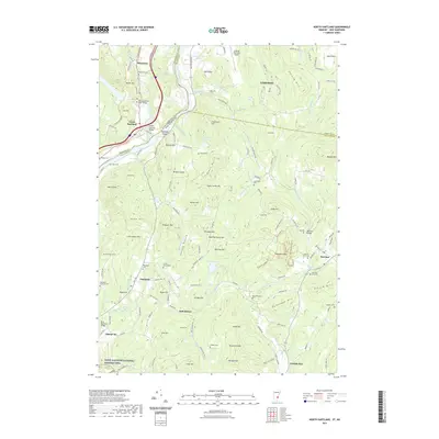
 1998 North Hartland1998 Print · USGSThe Connecticut River valley along the Vermont and New Hampshire border comes to life in this late-century survey. Researchers can trace family history through sites like Kimball Union Academy and numerous burial grounds such as Plainfield Cem and Raynes-Ford Cem.
 - 2012 Map of North Hartland, 2012 Print
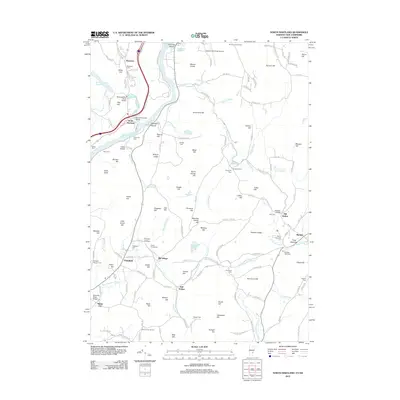 2012 North Hartland2012 Print · USGSCovers Squag City, including Lebanon, Hartford, and other nearby areas
 - 2015 Map of North Hartland, 2015 Print
 2015 North Hartland2015 Print · USGSCovers Squag City, including Lebanon, Hartford, and other nearby areas
 - 2018 Map of North Hartland, 2018 Print
 2018 North Hartland2018 Print · USGSCovers Squag City, including Lebanon, Hartford, and other nearby areas
 - 2021 Map of North Hartland, 2021 Print
 2021 North Hartland2021 Print · USGSCovers Squag City, including Lebanon, Hartford, and other nearby areas
 - 2024 Map of North Hartland, 2024 Print
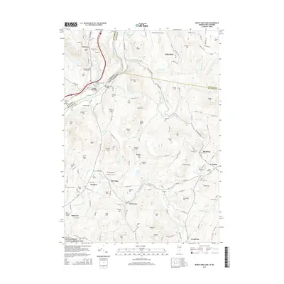
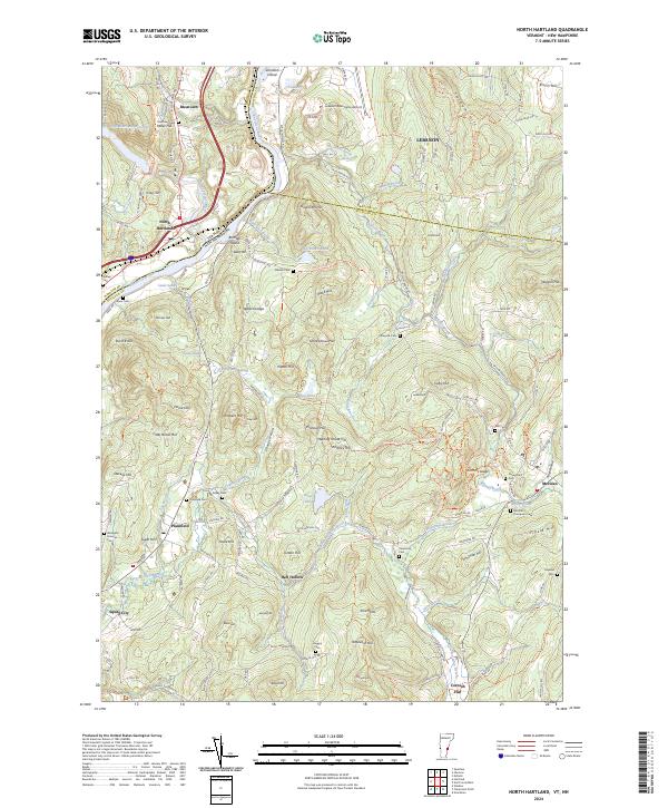 2024 North Hartland2024 Print · USGSThe Upper Valley straddling the Vermont and New Hampshire border is captured here in detail, showcasing the settlements of North Hartland and Plainfield. Researchers can trace early family lines through numerous burial sites like Russtown Cem and Raynesford Cem, or follow the winding path of Bloods Brook through the hills.
End of results
Showing maps 1-14 of 14
Top cities near Squag City
- Lebanon historical maps
- Claremont historical maps
- Hanover historical maps
- Hartford historical maps
- Newport historical maps
- Enfield historical maps
See more
Frequently asked questions
- What are the different types of historical maps available for Squag City?
- What is the oldest map of Squag City?
- Where can I purchase historical maps of Squag City for my home or office?
- Where can I download high-res historical maps of Squag City?
- Are there historical topographic maps available for Squag City?
- Is there historical aerial imagery available for Squag City?
- Where are historical maps of Squag City sourced from?