2020s Maps of Bergen County, New Jersey
Explore 12 historic maps of Bergen County from the 2020s. These maps offer a rare glimpse into what life looked like during the 2020s — showing old roads, neighborhoods, homes, and landmarks that have changed or disappeared over time.
Whether you're researching your family's past, planning a metal detecting trip, or studying how Bergen County's landscape evolved across the 2020s, these high-resolution maps are a powerful tool for exploring the history of this region.
- Focus on a specific era: All maps on this page are from the 2020s, giving you a focused view of this time period.
- See what’s changed: Compare century-old streets, trails, and buildings to today's modern landscape using overlays and satellite layers.
- Research with precision: Use these maps for genealogy, historical research, land use analysis, or educational projects.
- View, download, or print: Maps are fully viewable online in high resolution, and can be downloaded or printed for your own records.
Start exploring Bergen County's history through authentic maps from the 2020s. This is your window into the past.
Bergen County, NJ maps
(12)- 2023 Map of Wanaque, 2023 Print
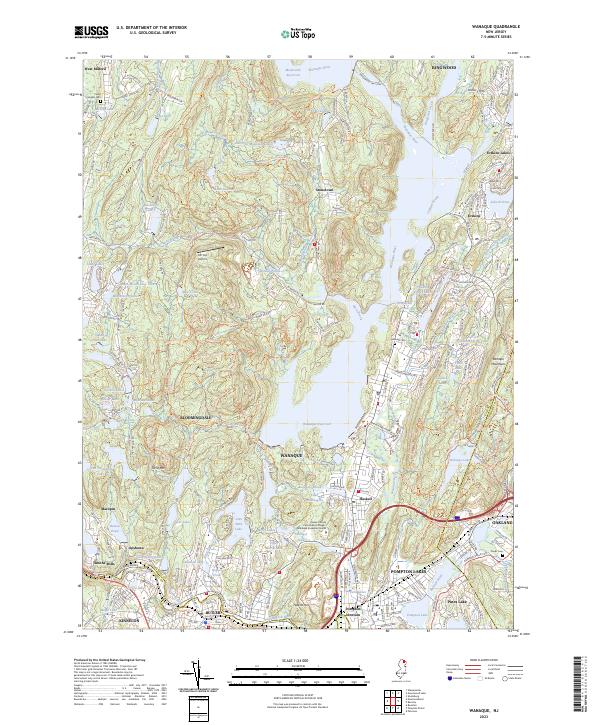 2023 Wanaque2023 Print · USGSThe Passaic County lake country and the Ramapo Mountains are captured here in a period of high suburban density. Researchers can trace historic cemeteries like Midvale Cem, the industrial site of Roomy Mine, and the rail connections at Pompton Junction.
 - 2023 Map of Park Ridge, 2023 Print
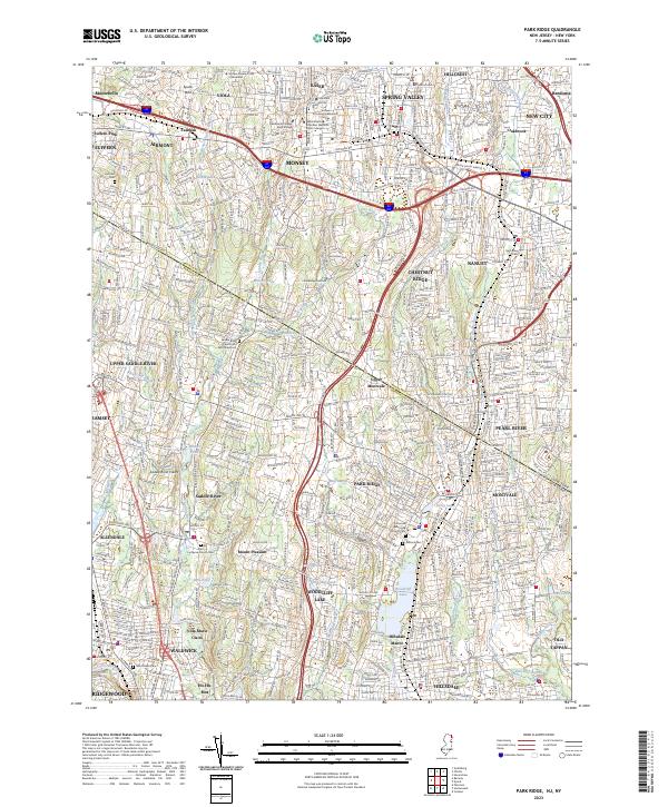 2023 Park Ridge2023 Print · USGSThe borderlands of Bergen and Rockland counties are captured here in the early twenty-first century, showing a landscape of established boroughs and winding waterways. Researchers can locate historic burial sites like the Low Dutch Reformed Cem and trace the shores of Woodcliff Lake and Monsey Lake.
 - 2023 Map of Nyack, 2023 Print
 2023 Nyack2023 Print · USGSThe Lower Hudson Valley and the New York-New Jersey borderlands come to life in this contemporary survey. Researchers can trace historic cemeteries like Oak Hill Cem and Mount Moor Cem or locate campuses such as Dominican College and Saint Thomas Aquinas College.
 - 2023 Map of Ramsey, 2023 Print
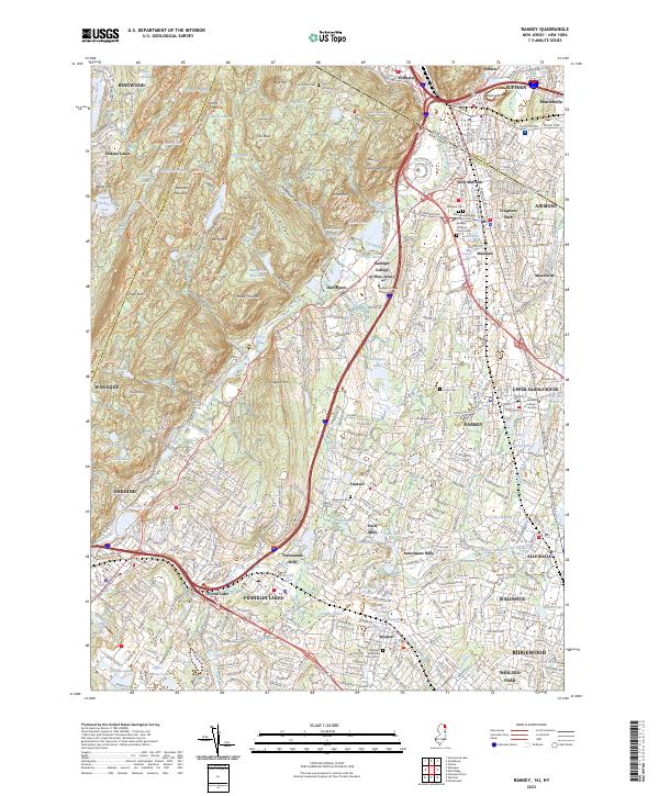 2023 Ramsey2023 Print · USGSThe northern Bergen County borderlands come into focus in this recent survey, where the rugged Ramapo Mountains meet the developed valleys of Ramsey and Mahwah. Researchers can trace local heritage through old burial sites like Redeemer Cem and historic locations like Ackermans Mills.
 - 2023 Map of Sloatsburg, 2023 Print
 2023 Sloatsburg2023 Print · USGSThe Ramapo River valley and the highlands of Rockland County come into focus during this modern era of development. Trace family-named landmarks and local history through Sloatsburg, the winding roads of Tuxedo Park, and the historic Saint Elizabeth Memorial Chapel.
 - 2023 Map of Central Park, 2023 Print
 2023 Central Park2023 Print · USGSThe heart of Manhattan and the western Bronx are captured here in the early twenty-first century, showing the dense intersection of culture and industry. Researchers can trace the grounds of Fordham University, the historic Saint Anns Cem, and the iconic Central Park.
 - 2023 Map of Yonkers, 2023 Print
 2023 Yonkers2023 Print · USGSThe Hudson River valley at the edge of New York City and New Jersey remains a complex corridor of steep terrain and deep-rooted settlements. Researchers can trace the modern layout of Yonkers and Englewood, identifying landmarks like Vault Hill and the New Croton Aqueduct.
 - 2023 Map of Hackensack, 2023 Print
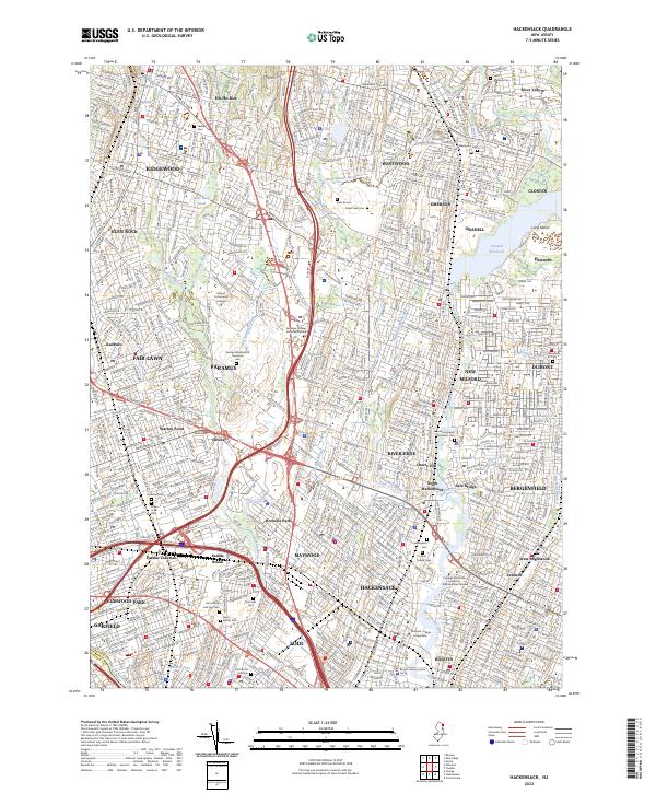 2023 Hackensack2023 Print · USGSBergen County's suburban heartland is shown in detail here during the early twenty-first century. Family historians can trace numerous landmarks including Lodi Burial Grounds, Cedar Park Cem, and the Bergen County Justice Center.
 - 2023 Map of Pompton Plains, 2023 Print
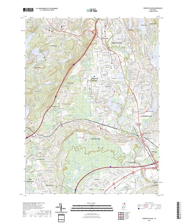 2023 Pompton Plains2023 Print · USGSThe confluence of the Pequannock, Ramapo, and Wanaque rivers defines this North Jersey landscape as it appears in the early twenty-first century. Genealogists and local historians can trace the path of the Morris Canal or locate family markers at Mount Rest Cem and Brown Cem.
 - 2023 Map of Paterson, 2023 Print
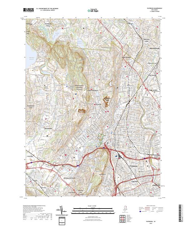 2023 Paterson2023 Print · USGSThe industrial heart of Passaic County meets the ridges of the Watchung Mountains in this contemporary survey of the North Jersey urban corridor. Trace local history through numerous burial grounds like Laurel Grove Cem or follow the Passaic River past the landmark Paterson Great Falls.
 - 2023 Map of Weehawken, 2023 Print
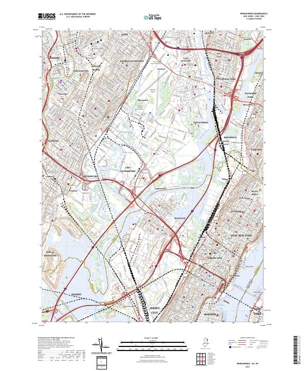 2023 Weehawken2023 Print · USGSThe Meadowlands and the urban corridor of North Jersey are captured here in the early twenty-first century. Researchers can trace historic cemeteries like Hoboken Cem and Saint Michael's Cem or locate institutional landmarks such as Felician University.
 - 2023 Map of Orange, 2023 Print
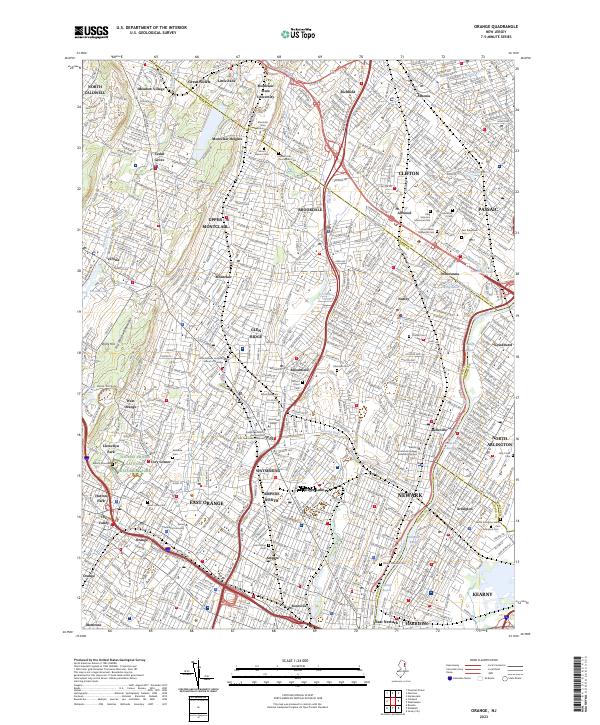 2023 Orange2023 Print · USGSThe industrial heart of Essex County is on full display in this recent survey, from the First Watchung Mountain ridges to the Passaic River banks. Genealogists and historians can trace Edison's legacy, explore Llewellyn Park, and locate numerous burial sites like Rosedale Cem.
End of results
Showing maps 1-12 of 12
Top cities of Bergen County
- Hackensack historical maps
- Teaneck Township historical maps
- Fort Lee historical maps
- Fair Lawn historical maps
- Garfield historical maps
- Englewood historical maps
See more
Frequently asked questions
- What are the different types of historical maps available for Bergen County?
- What is the oldest map of Bergen County?
- Where can I purchase historical maps of Bergen County for my home or office?
- Where can I download high-res historical maps of Bergen County?
- Are there historical topographic maps available for Bergen County?
- Is there historical aerial imagery available for Bergen County?
- Where are historical maps of Bergen County sourced from?