Old Maps of Arcola, Paramus for Academic Research
Study the evolution of Arcola with 25 high-resolution historic maps. Whether you're teaching, researching, or modeling changes in land use, these maps provide essential visual documentation of urban, environmental, and geographic change.
- Analyze long-term change: Track patterns in development, transportation, and natural features.
- Ideal for environmental or urban studies: Support academic projects with primary historical map data.
- Use in the classroom or lab: Educators and researchers rely on these maps to bring historical context to life.
These maps are a powerful tool for teaching, research, and visualizing how Arcola has changed over the decades.
Arcola, Paramus maps
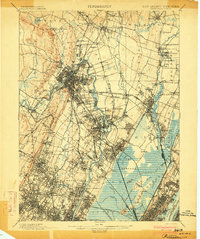
(25)- 1888 Map of Paterson
 1888 Paterson1888 Print · USGSNortheastern New Jersey in the late nineteenth century was a complex network of industrial canals and rising commuter towns. Genealogists and historians can trace the Morris Canal, the Jersey City Waterworks, and early rail lines through Hackensack and Paterson.
 - 1892 Map of Paterson
 1892 Paterson1892 Print · USGSNorthern New Jersey and the industrial core of Paterson are seen here in the late nineteenth century as rail and water infrastructure expanded. Trace the development of early utility systems like the Jersey City Waterworks or explore the rail lines of the Lodi Branch R.R. and West Shore Railroad.
 - 1898 Map of Paterson
 1898 Paterson1898 Print · USGSNorthern New Jersey's industrial and rail corridors are captured here in the late nineteenth century, from the silk mills of Paterson to the Hackensack marshes. Genealogists can locate family sites near Laurel Grove Cemetery, the Morris Canal, and early villages like Wortendyke.
 - 1900 Map of Passaic
 1900 Passaic1900 Print · USGSNorthern New Jersey and the New York Harbor are captured here at the close of the nineteenth century, showing a landscape defined by rail, river, and coastal defense. Researchers can trace the original path of the Morris Canal, locate Seton Hall College, and explore the batteries at Fort Wadsworth.
 - 1900 Map of Paterson
 1900 Paterson1900 Print · USGSNortheastern New Jersey at the turn of the century shows a landscape defined by the Morris Canal and a dense network of early railroads. Researchers can trace ancestral roots through vanished rail stops and sites like Laurel Grove Cemetery, Wortendyke, and Sicomac.
 - 1903 Map of Paterson
 1903 Paterson1903 Print · USGSNorthern New Jersey's transition from an industrial river valley to a dense rail-connected region is captured here just after the turn of the century. You can trace the path of the Morris Canal, locate the old Dundee Dam, or find early settlements like Peetzburg and Etna.8 unique versions available
 - 1905 Map of Passaic
 1905 Passaic1905 Print · USGSNorthern New Jersey and Staten Island appear here at a pivotal moment of early 20th-century growth and industrialization. Researchers can trace the development of transit hubs like Convent Sta. or locate legacy landmarks including Hillside Cemetery and the Moravian Cemetery.4 unique versions available
 - 1934 Map of Hackensack
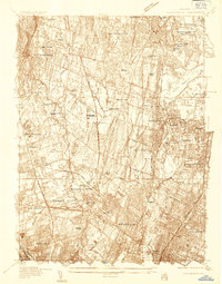 1934 Hackensack1934 Print · USGSBergen County suburban expansion is in full swing during the mid-thirties as rail lines and early state highways reshape the landscape. Trace family history through numerous burial grounds like Valleau Cemetery or locate landmarks such as the Radburn-Fairlawn Sta and Oradell Reservoir.
 - 1940 Map of Hackensack
 1940 Hackensack1940 Print · USGSBergen County suburban life comes into focus just before the mid-century boom, showing the transition from towns to dense residential grids. Genealogists can trace family plots at Riverside Cemetery or locate early schools like Steuben Sch and Willard Sch.3 unique versions available
 - 1942 Map of Passaic
 1942 Passaic1942 Print · USGSNorthern New Jersey and New York harbor appear in detail at the start of the war, showing a landscape of burgeoning suburbs and vital industry. Trace family roots and local history across the Passaic River valley, from Paterson to the Watchung Mountains.
 - 1944 Map of Newark, 1971 Print
 1944 Newark1971 Print · USGSThe industrial corridor from Philadelphia to New York was in a period of massive transition during the mid-forties. Genealogists and researchers can trace the rail lines of the Lehigh Valley RR, locate military installations like Picatinny Arsenal, and explore the early sprawl near Levittown.5 unique versions available
 - 1949 Map of Newark
 1949 Newark1949 Print · USGSThe industrial corridor between Philadelphia and New York comes alive in this post-war survey. Genealogists and historians can trace the massive rail networks of the Reading Railroad and locate major installations like Fort Dix or Picatinny Arsenal.2 unique versions available
 - 1955 Map of Hackensack, 1958 Print
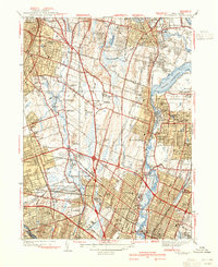
 1955 Hackensack1958 Print · USGSBergen County is captured during the mid-fifties expansion of the New York suburbs, showing the rise of the Garden State Parkway. Trace family history through Valleau Cemetery, Cedar Park Cemetery, and dozens of local schools and parish churches.5 unique versions available
 - 1956 Map of Newark
 1956 Newark1956 Print · USGSThe industrial heart of the Mid-Atlantic is captured here at the dawn of the highway era, tracing the dense corridors between Newark and Philadelphia. Genealogists and local historians can map the rail networks of the Reading RR or locate mid-century military life at Fort Dix Military Reservation.2 unique versions available
 - 1957 Map of Newark
 1957 Newark1957 Print · USGSThe industrial and military heart of the Mid-Atlantic is mapped during its post-war suburban boom. Genealogists and historians can trace the intricate rail corridors of the Reading Railroad and locate key landmarks from Princeton University to Fort Hancock.
 - 1960 Map of Newark
 1960 Newark1960 Print · USGSThe industrial heart of the Mid-Atlantic is shown at mid-century, stretching from the dense urban centers of Newark and Philadelphia to the Blue Mountain ridges. Researchers can trace historic rail lines, coastal defenses at Fort Hancock, and the riverfront growth of Trenton and Easton.3 unique versions available
 - 1964 Map of Newark
 1964 Newark1964 Print · USGSGreater New Jersey and eastern Pennsylvania appear at the peak of their industrial and rail-centered development in the mid-sixties. Genealogists and historians can trace the paths of the Pennsylvania RR, identify mid-century landmarks like CAMP KILMER, or follow the Schuylkill River through READING.2 unique versions available
 - 1984 Map of Newark, 1985 Print
 1984 Newark1985 Print · USGSNorthern New Jersey's massive industrial and transit network is on full display in the mid-eighties, showing the region just before modern redevelopment. Genealogists and historians can trace the dense urban grids of Newark, find historic landmarks like Ellis Island, and locate the sprawling Picatinny Arsenal in the western hills.
 - 1986 Map of Newark, 1987 Print
 1986 Newark1987 Print · USGSNorthern New Jersey during the mid-eighties shows an incredible transition from the industrial harbor to the wooded Highlands. Researchers can trace the massive footprints of Picatinny Arsenal and Newark International Airport or explore protected lands like the Great Swamp National Wildlife Refuge.
 - 1997 Map of Hackensack, 1998 Print
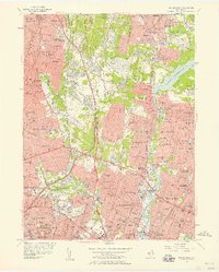
 1997 Hackensack1998 Print · USGSBergen County towns like Hackensack and Paramus are shown in high detail during the late nineties as the region's suburban and transit networks reached full maturity. Researchers can trace family sites among dozens of landmarks, including Old South Ch, Riverside Cemetery, and local landmarks like the Radio Tower (WABC).
 - 2011 Map of Hackensack, 2011 Print
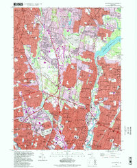
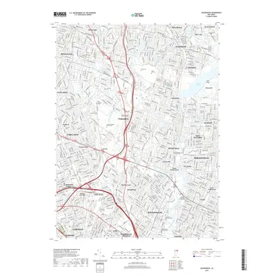
 2011 Hackensack2011 Print · USGSCovers Arcola, including Clifton, Passaic, and other nearby areas
 - 2014 Map of Hackensack, 2014 Print
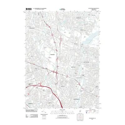
 2014 Hackensack2014 Print · USGSCovers Arcola, including Clifton, Passaic, and other nearby areas
 - 2016 Map of Hackensack, 2016 Print
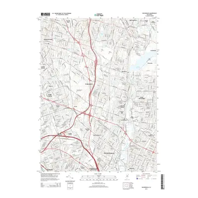
 2016 Hackensack2016 Print · USGSCovers Arcola, including Clifton, Passaic, and other nearby areas
 - 2019 Map of Hackensack, 2019 Print
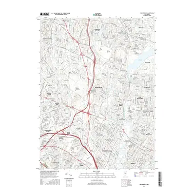
 2019 Hackensack2019 Print · USGSCovers Arcola, including Clifton, Passaic, and other nearby areas
 - 2023 Map of Hackensack, 2023 Print
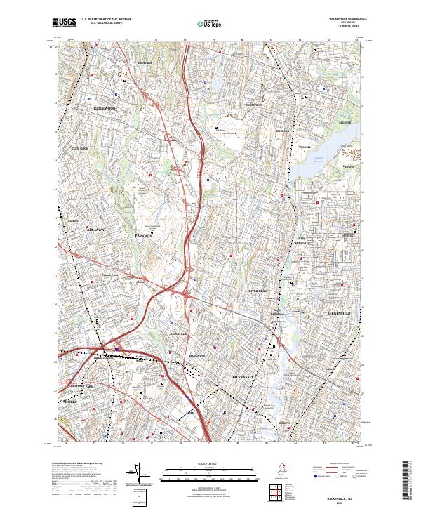 2023 Hackensack2023 Print · USGSBergen County's suburban heartland is shown in detail here during the early twenty-first century. Family historians can trace numerous landmarks including Lodi Burial Grounds, Cedar Park Cem, and the Bergen County Justice Center.
End of results
Showing maps 1-25 of 25
Frequently asked questions
- What are the different types of historical maps available for Arcola?
- What is the oldest map of Arcola?
- Where can I purchase historical maps of Arcola for my home or office?
- Where can I download high-res historical maps of Arcola?
- Are there historical topographic maps available for Arcola?
- Is there historical aerial imagery available for Arcola?
- Where are historical maps of Arcola sourced from?