Old Maps of Riverton, New Jersey for Genealogy
Trace your family roots with 37 historic maps of Riverton. These high-res maps reveal old neighborhoods, homesites, landmarks, and streets — helping you uncover where your ancestors lived and how the area evolved over time.
- Explore historic neighborhoods: Identify where your relatives may have lived in the 1800s or 1900s.
- Compare maps over time: Trace the changes in streets, buildings, and landmarks for multi-generational research.
- Perfect for genealogy & ancestry research: Used by family historians and researchers to map out lineage and migration.
These maps are an incredible resource for exploring your personal connection to Riverton's past.
Riverton, NJ maps
(37)- 1890 Map of Burlington
 1890 Burlington1890 Print · USGSThe Delaware River corridor was a thriving network of canal commerce and rail lines in the late nineteenth century. Genealogists and historians can trace family-named landings and early settlements like Dunks Ferry, Hulmeville, and the State Lunatic Asylum near Trenton.
 - 1893 Map of Germantown
 1893 Germantown1893 Print · USGSThe outskirts of Philadelphia and Montgomery County are shown in the late nineteenth century as rail lines transformed rural townships. Genealogists and historians can trace old property lines and depots from Warminster P.O. to the U.S. Arsenal.
 - 1893 Map of Burlington
 1893 Burlington1893 Print · USGSThe Delaware River valley thrived as a corridor of rail and river commerce in the late nineteenth century. Genealogists and historians can trace defunct transport hubs like Dunks Ferry, explore the grounds of the State Lunatic Asylum, and locate old stops along the Philadelphia and Newtown Railroad.3 unique versions available
 - 1894 Map of Germantown, 1961 Print
 1894 Germantown1961 Print · USGSThe northern Philadelphia suburbs and rural Montgomery County are captured here just as the railroad was transforming local life. Genealogists can trace family names and old property lines across Germantown, Hatboro, and the historic U.S. Arsenal.
 - 1896 Map of Germantown
 1896 Germantown1896 Print · USGSThe northern reaches of Philadelphia and lower Bucks County are shown in the late nineteenth century as rail lines transformed rural villages into bustling suburbs. Trace early transport routes along Street Road or locate family landmarks near Hatboro, Ambler, and the U. S. Arsenal.
 - 1899 Map of Germantown
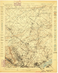 1899 Germantown1899 Print · USGSPhiladelphia and its northern townships are documented in the late nineteenth century as the suburban rail network expanded. Genealogists can trace family roots through historic settlements like Hatboro, Ambler, and the neighborhood of Chestnut Hill.9 unique versions available
 - 1904 Map of Burlington, 1958 Print
 1904 Burlington1958 Print · USGSThe Delaware River corridor thrives during the early twentieth century as a hub of rail, canal, and river commerce. Genealogists and local historians can trace family roots through riverside landings like Borton Landing or follow the legacy of institutions such as the George School and the State Lunatic Asylum.
 - 1906 Map of Burlington
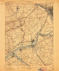 1906 Burlington1906 Print · USGSThe Delaware River corridor was a bustling hub of rail and water transport in the early 1900s. Genealogists and local historians can trace the development of riverside wharves like Andalusia Wharf and institutional landmarks such as the State Lunatic Asylum.6 unique versions available
 - 1907 Map of Trenton
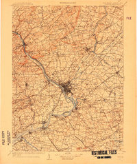 1907 Trenton1907 Print · USGSThe Delaware River valley hums with turn-of-the-century industry and transport as river canals and railroads converge between New Jersey and Pennsylvania. Genealogists and local historians can trace the footprint of the George School, find early post offices like Holland PO, or locate old mill sites such as Blackwells Mills.4 unique versions available
 - 1942 Map of Norristown
 1942 Norristown1942 Print · USGSSoutheastern Pennsylvania at the onset of World War II shows a landscape of busy industrial river towns and expanding rail suburbs. Genealogists and historians can trace the early transit networks connecting Norristown, Doylestown, and the riverfront at New Hope.
 - 1942 Map of Burlington
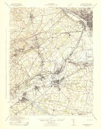 1942 Burlington1942 Print · USGSThe Delaware River valley thrived at the start of the 1940s as a hub of heavy rail and river commerce. Genealogists and local historians can trace family-named sites and old transit points like Dunks Ferry, Borton Landing, and Neshaminy Falls.
 - 1944 Map of Newark, 1971 Print
 1944 Newark1971 Print · USGSThe industrial corridor from Philadelphia to New York was in a period of massive transition during the mid-forties. Genealogists and researchers can trace the rail lines of the Lehigh Valley RR, locate military installations like Picatinny Arsenal, and explore the early sprawl near Levittown.5 unique versions available
 - 1947 Map of Beverly
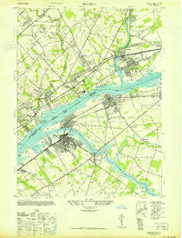 1947 Beverly1947 Print · USGSThe Delaware River corridor was a hub of transit and industry in the late forties, connecting Pennsylvania and New Jersey via the Pennsylvania RR. Researchers can trace the footprints of institutional sites like the Philadelphia State Hospital or the St Elizabeth Convent.
 - 1949 Map of Newark
 1949 Newark1949 Print · USGSThe industrial corridor between Philadelphia and New York comes alive in this post-war survey. Genealogists and historians can trace the massive rail networks of the Reading Railroad and locate major installations like Fort Dix or Picatinny Arsenal.2 unique versions available
 - 1950 Map of Frankford, 1953 Print
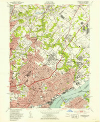 1950 Frankford1953 Print · USGSPhiladelphia in the mid-twentieth century shows a bustling industrial and institutional corridor along the Delaware River. Genealogists and historians can trace neighborhood growth through local landmarks like Montefiore Cemetery, Frankford High Sch, and the historic Frankford Arsenal.2 unique versions available
 - 1955 Map of Beverly, 1957 Print
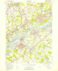 1955 Beverly1957 Print · USGSThe Delaware River corridor hums with mid-century activity in this detailed survey of the Pennsylvania-New Jersey border. Genealogists and researchers can trace the developed neighborhoods of Beverly and Riverside or locate ancestors at the Beverly National Cemetery and Monument Cem.3 unique versions available
 - 1956 Map of Newark
 1956 Newark1956 Print · USGSThe industrial heart of the Mid-Atlantic is captured here at the dawn of the highway era, tracing the dense corridors between Newark and Philadelphia. Genealogists and local historians can map the rail networks of the Reading RR or locate mid-century military life at Fort Dix Military Reservation.2 unique versions available
 - 1957 Map of Newark
 1957 Newark1957 Print · USGSThe industrial and military heart of the Mid-Atlantic is mapped during its post-war suburban boom. Genealogists and historians can trace the intricate rail corridors of the Reading Railroad and locate key landmarks from Princeton University to Fort Hancock.
 - 1960 Map of Newark
 1960 Newark1960 Print · USGSThe industrial heart of the Mid-Atlantic is shown at mid-century, stretching from the dense urban centers of Newark and Philadelphia to the Blue Mountain ridges. Researchers can trace historic rail lines, coastal defenses at Fort Hancock, and the riverfront growth of Trenton and Easton.3 unique versions available
 - 1964 Map of Newark
 1964 Newark1964 Print · USGSGreater New Jersey and eastern Pennsylvania appear at the peak of their industrial and rail-centered development in the mid-sixties. Genealogists and historians can trace the paths of the Pennsylvania RR, identify mid-century landmarks like CAMP KILMER, or follow the Schuylkill River through READING.2 unique versions available
 - 1966 Map of Beverly, 1969 Print
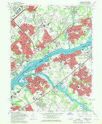 1966 Beverly1969 Print · USGSThe Delaware River corridor hums with mid-century development during the 1960s, linking the established neighborhoods of Northeast Philly with burgeoning New Jersey suburbs. Researchers can trace family roots through numerous sites like Beverly National Cemetery, Liberty Bell Park, and Holy Family College.5 unique versions available
 - 1967 Map of Frankford, 1970 Print
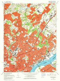 1967 Frankford1970 Print · USGSPhiladelphia's northeast reaches and the riverfront are captured here in the late sixties as urban density met heavy industry. Researchers can trace the massive Frankford Arsenal site, family plots in William Penn Cemetery, and the busy Reading Railroad corridor.5 unique versions available
 - 1982 Map of Trenton, 1983 Print
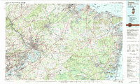 1982 Trenton1983 Print · USGSCentral New Jersey and the Delaware River valley are captured in the early eighties during a time of major highway expansion and suburban maturation. Researchers can trace the grounds of Princeton University, the historic Monmouth Battlefield, and the sprawling Fort Dix.
 - 1984 Map of Reading, 1986 Print
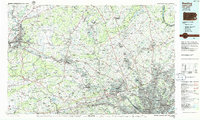 1984 Reading1986 Print · USGSSoutheastern Pennsylvania in the mid-eighties shows a landscape of established industrial hubs and rapid suburban expansion. Trace local history through landmarks like Valley Forge National Historical Park, the Willow Grove Naval Air Station, and Kutztown University.2 unique versions available
 - 1986 Map of Trenton, 1987 Print
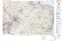 1986 Trenton1987 Print · USGSCentral New Jersey and the Delaware River valley are shown here during the mid-eighties, a period of dense suburban growth and military activity. Researchers can trace the sprawling grounds of the Fort Dix Military Reservation and the historic corridors of the Delaware & Raritan Canal State Park.
Showing maps 1-25 of 37
Top cities near Riverton
- Philadelphia historical maps
- Trenton historical maps
- Camden historical maps
- Cherry Hill Township historical maps
- Bensalem Township historical maps
- Abington Township historical maps
See more
Frequently asked questions
- What are the different types of historical maps available for Riverton?
- What is the oldest map of Riverton?
- Where can I purchase historical maps of Riverton for my home or office?
- Where can I download high-res historical maps of Riverton?
- Are there historical topographic maps available for Riverton?
- Is there historical aerial imagery available for Riverton?
- Where are historical maps of Riverton sourced from?