2020s Maps of Willingboro Township, New Jersey
Explore 4 historic maps of Willingboro Township from the 2020s. These maps offer a rare glimpse into what life looked like during the 2020s — showing old roads, neighborhoods, homes, and landmarks that have changed or disappeared over time.
Whether you're researching your family's past, planning a metal detecting trip, or studying how Willingboro Township's landscape evolved across the 2020s, these high-resolution maps are a powerful tool for exploring the history of this region.
- Focus on a specific era: All maps on this page are from the 2020s, giving you a focused view of this time period.
- See what’s changed: Compare century-old streets, trails, and buildings to today's modern landscape using overlays and satellite layers.
- Research with precision: Use these maps for genealogy, historical research, land use analysis, or educational projects.
- View, download, or print: Maps are fully viewable online in high resolution, and can be downloaded or printed for your own records.
Start exploring Willingboro Township's history through authentic maps from the 2020s. This is your window into the past.
Willingboro Township, NJ maps
(4)- 2023 Map of Bristol, 2023 Print
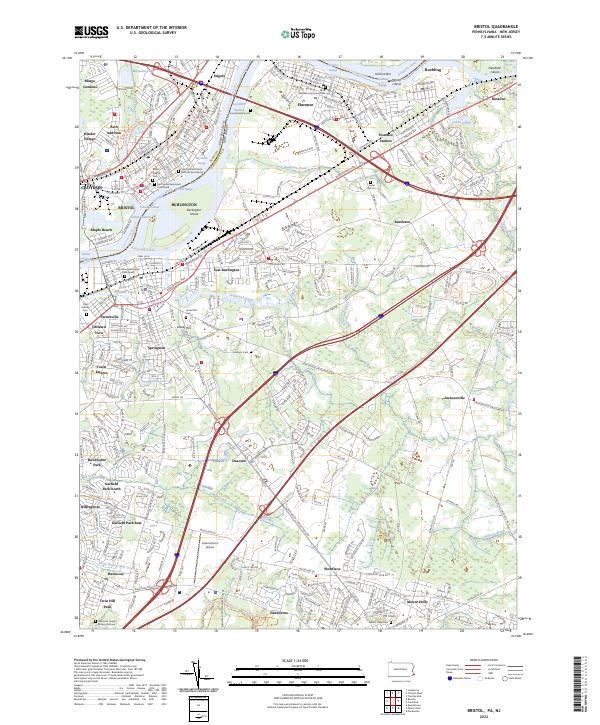 2023 Bristol2023 Print · USGSThe Delaware River corridor near the Bucks and Burlington county line remains a landscape of deep historical layers in the early twenty-first century. Researchers can trace centuries of local heritage at sites like Timbuctoo, the Bristol Friends Cem, and the Pennsylvania Canal.
 - 2023 Map of Mount Holly, 2023 Print
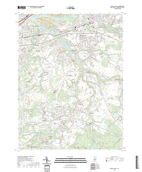 2023 Mount Holly2023 Print · USGSMount Holly and its surrounding mill towns are captured here in the 2020s, revealing a landscape where colonial history meets modern growth. Researchers can trace ancestral sites at the Mount Moriah Timbuctoo Graveyard, Kirbys Mill, and Easton Union Cem.
 - 2023 Map of Moorestown, 2023 Print
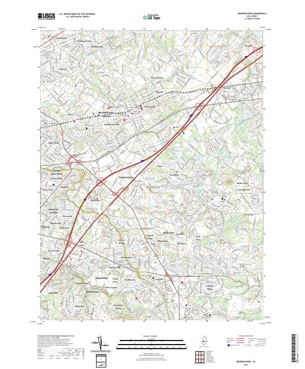 2023 Moorestown2023 Print · USGSGreater Moorestown and Cherry Hill are shown in high detail during this recent period of suburban density near the county line. Genealogists can locate family sites at the Moorestown Friends Cem and Colestown Cem, or trace the legacy of Maple Shade and Hartford.
 - 2023 Map of Beverly, 2023 Print
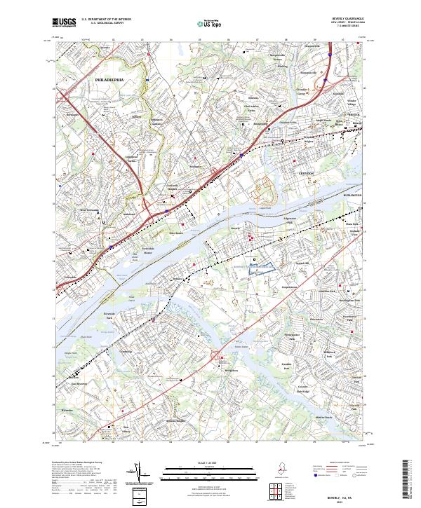 2023 Beverly2023 Print · USGSThe Delaware River corridor near the Burlington and Bucks county line shows a landscape of deep-rooted settlements and river-side industry. Genealogists can trace family names at the Beverly National Cem, Bridgeboro Methodist Cem, and several historic burial grounds.
End of results
Showing maps 1-4 of 4
Top cities near Willingboro Township
- Philadelphia historical maps
- Hamilton Township historical maps
- Trenton historical maps
- Camden historical maps
- Cherry Hill Township historical maps
- Bensalem Township historical maps
See more
Top neighborhoods of Willingboro Township
- Charleston historical maps
- Hawthorne Park historical maps
- Buckingham Park historical maps
- Sharper historical maps
- Martins Beach historical maps
- Franklin Park historical maps
See more
Frequently asked questions
- What are the different types of historical maps available for Willingboro Township?
- What is the oldest map of Willingboro Township?
- Where can I purchase historical maps of Willingboro Township for my home or office?
- Where can I download high-res historical maps of Willingboro Township?
- Are there historical topographic maps available for Willingboro Township?
- Is there historical aerial imagery available for Willingboro Township?
- Where are historical maps of Willingboro Township sourced from?