2020s Maps of Camden, New Jersey
Explore 2 historic maps of Camden from the 2020s. These maps offer a rare glimpse into what life looked like during the 2020s — showing old roads, neighborhoods, homes, and landmarks that have changed or disappeared over time.
Whether you're researching your family's past, planning a metal detecting trip, or studying how Camden's landscape evolved across the 2020s, these high-resolution maps are a powerful tool for exploring the history of this region.
- Focus on a specific era: All maps on this page are from the 2020s, giving you a focused view of this time period.
- See what’s changed: Compare century-old streets, trails, and buildings to today's modern landscape using overlays and satellite layers.
- Research with precision: Use these maps for genealogy, historical research, land use analysis, or educational projects.
- View, download, or print: Maps are fully viewable online in high resolution, and can be downloaded or printed for your own records.
Start exploring Camden's history through authentic maps from the 2020s. This is your window into the past.
Camden, NJ maps
(2)- 2023 Map of Philadelphia, 2023 Print
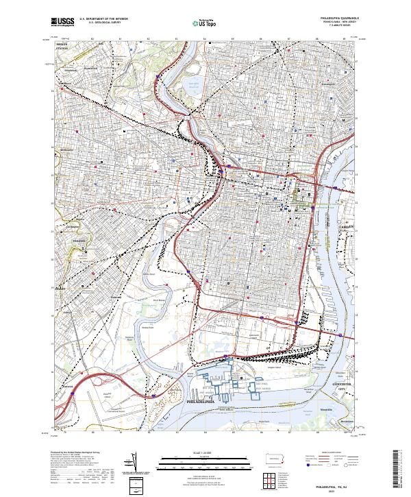 2023 Philadelphia2023 Print · USGSModern Philadelphia reveals its deep history along the Schuylkill River and Delaware River. Genealogists and historians can trace the city's past through Mount Moriah Cem, Mikveh Israel Cem, and the Edgar Allan Poe National Historic Site.
 - 2023 Map of Camden, 2023 Print
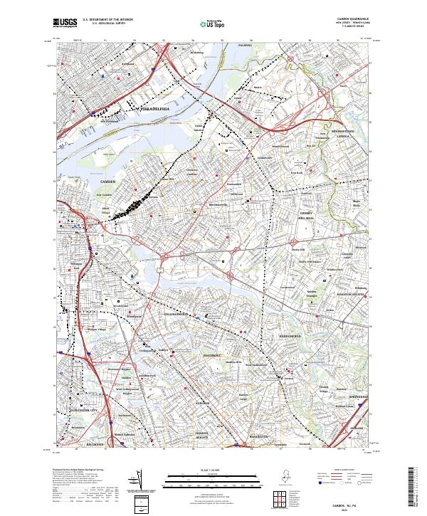 2023 Camden2023 Print · USGSThe Delaware River corridor and its surrounding New Jersey townships are shown here in modern detail. Trace local family history through numerous historic sites like Harleigh Cem, New Camden Cem, and Newton Union Burying Ground.
End of results
Showing maps 1-2 of 2
Top cities near Camden
- Philadelphia historical maps
- Upper Darby historical maps
- Cherry Hill Township historical maps
- Bensalem Township historical maps
- Abington Township historical maps
- Washington Township historical maps
See more
Top neighborhoods of Camden
- Whitman Park historical maps
- Fairview historical maps
- Ablett Village historical maps
- Morgan Village historical maps
- East Camden historical maps
- Cramer Hill historical maps
See more
Frequently asked questions
- What are the different types of historical maps available for Camden?
- What is the oldest map of Camden?
- Where can I purchase historical maps of Camden for my home or office?
- Where can I download high-res historical maps of Camden?
- Are there historical topographic maps available for Camden?
- Is there historical aerial imagery available for Camden?
- Where are historical maps of Camden sourced from?