Old Maps of Old Bridge, Old Bridge Township for Academic Research
Study the evolution of Old Bridge with 31 high-resolution historic maps. Whether you're teaching, researching, or modeling changes in land use, these maps provide essential visual documentation of urban, environmental, and geographic change.
- Analyze long-term change: Track patterns in development, transportation, and natural features.
- Ideal for environmental or urban studies: Support academic projects with primary historical map data.
- Use in the classroom or lab: Educators and researchers rely on these maps to bring historical context to life.
These maps are a powerful tool for teaching, research, and visualizing how Old Bridge has changed over the decades.
Old Bridge, Old Bridge Township maps
(31)- 1888 Map of New Brunswick
 1888 New Brunswick1888 Print · USGSMiddlesex County in the 1880s is shown here as a bustling hub of early rail and river industry. Genealogists and local historians can trace family roots through historic settlements like Old Bridge, Jamesburgh, and the preserved Monmouth Battle Ground.
 - 1893 Map of New Brunswick
 1893 New Brunswick1893 Print · USGSMiddlesex and Monmouth counties were thriving rail hubs in the 1890s, where heavy industry met Revolutionary history. Genealogists and collectors can trace family roots through small settlements like Texas and Spotswood or locate the State Reform School and Monmouth Battle Ground.2 unique versions available
 - 1901 Map of New Brunswick
 1901 New Brunswick1901 Print · USGSMiddlesex and Monmouth counties are depicted here at the height of the railroad era, as industrial centers like New Brunswick grew alongside rural farmlands. Genealogists and historians can trace family-named landmarks and old hamlets from Old Church and Matchaponix to the site of the Monmouth Battle Ground.5 unique versions available
 - 1902 Map of Navesink
 1902 Navesink1902 Print · USGSCoastal New Jersey and the Raritan valley are shown here at the turn of the century, when industrial hubs and maritime defenses defined the shoreline. Genealogists can trace family roots through settlements like Old Bridge and Milltown, or locate local landmarks like the State Reform School.3 unique versions available
 - 1919 Map of New Brunswick, 1921 Print
 1919 New Brunswick1921 Print · USGSMiddlesex and Monmouth counties are depicted here in the years following the Great War, when rail lines and river commerce still drove the region’s growth. Researchers can trace the sprawling Pennsylvania Railroad network through industrial hubs like Jamesburg or visit the hallowed Monmouth Battle Ground.
 - 1940 Map of South Amboy
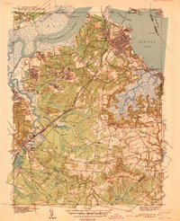 1940 South Amboy1940 Print · USGSCoastal Middlesex County at the dawn of the 1940s reveals a landscape of heavy rail, maritime commerce, and emerging state parks. Local historians can trace the paths of the Raritan River RR, find the Polish Cem, or locate the Great Beds LH off the shore.2 unique versions available
 - 1941 Map of South Amboy
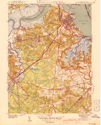 1941 South Amboy1941 Print · USGSCoastal Middlesex County comes alive in this pre-war survey, showing the busy maritime and rail corridors between the Raritan River and the bay. Researchers can trace the layout of South Amboy, locate the Polish Cem, and find the U S Military Reservation.2 unique versions available
 - 1942 Map of New Brunswick
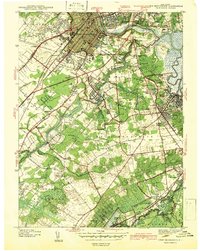 1942 New Brunswick1942 Print · USGSNew Brunswick and its surrounding Middlesex County townships are shown just before the war, when rail lines and early highways defined the region. Genealogists can trace family names at local crossroads like Berdines Cor or locate the McGinnis Sch and Sejeh Yehudo Cemetery.2 unique versions available
 - 1943 Map of South Amboy
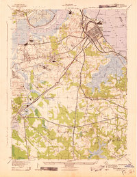 1943 South Amboy1943 Print · USGSThe industrial corridor of the Raritan valley thrives in the 1940s, balancing wartime military installations with a massive brick and clay industry. Researchers can trace the sprawling Raritan Arsenal, family farms like the J R Cotrell Farm, and local landmarks like the Beth Israel Cem.
 - 1944 Map of Newark, 1971 Print
 1944 Newark1971 Print · USGSThe industrial corridor from Philadelphia to New York was in a period of massive transition during the mid-forties. Genealogists and researchers can trace the rail lines of the Lehigh Valley RR, locate military installations like Picatinny Arsenal, and explore the early sprawl near Levittown.5 unique versions available
 - 1949 Map of Newark
 1949 Newark1949 Print · USGSThe industrial corridor between Philadelphia and New York comes alive in this post-war survey. Genealogists and historians can trace the massive rail networks of the Reading Railroad and locate major installations like Fort Dix or Picatinny Arsenal.2 unique versions available
 - 1954 Map of New Brunswick, 1956 Print
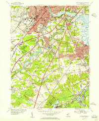 1954 New Brunswick1956 Print · USGSMid-century Middlesex County is captured during a transformative era of suburban growth and institutional expansion. Genealogists and local historians can trace family plots in Elmwood Cemetery or locate old schoolhouses like Weber Sch and McGinnis Sch.5 unique versions available
 - 1954 Map of South Amboy, 1957 Print
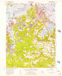 1954 South Amboy1957 Print · USGSMid-century Middlesex County is captured here during a period of rapid suburban and industrial expansion along the Raritan Bay. Researchers can trace family sites from Sayreville to Old Bridge, finding local landmarks like the Sacred Heart Sch and the Auto Race Track.6 unique versions available
 - 1956 Map of Newark
 1956 Newark1956 Print · USGSThe industrial heart of the Mid-Atlantic is captured here at the dawn of the highway era, tracing the dense corridors between Newark and Philadelphia. Genealogists and local historians can map the rail networks of the Reading RR or locate mid-century military life at Fort Dix Military Reservation.2 unique versions available
 - 1957 Map of Newark
 1957 Newark1957 Print · USGSThe industrial and military heart of the Mid-Atlantic is mapped during its post-war suburban boom. Genealogists and historians can trace the intricate rail corridors of the Reading Railroad and locate key landmarks from Princeton University to Fort Hancock.
 - 1960 Map of Newark
 1960 Newark1960 Print · USGSThe industrial heart of the Mid-Atlantic is shown at mid-century, stretching from the dense urban centers of Newark and Philadelphia to the Blue Mountain ridges. Researchers can trace historic rail lines, coastal defenses at Fort Hancock, and the riverfront growth of Trenton and Easton.3 unique versions available
 - 1964 Map of Newark
 1964 Newark1964 Print · USGSGreater New Jersey and eastern Pennsylvania appear at the peak of their industrial and rail-centered development in the mid-sixties. Genealogists and historians can trace the paths of the Pennsylvania RR, identify mid-century landmarks like CAMP KILMER, or follow the Schuylkill River through READING.2 unique versions available
 - 1982 Map of Trenton, 1983 Print
 1982 Trenton1983 Print · USGSCentral New Jersey and the Delaware River valley are captured in the early eighties during a time of major highway expansion and suburban maturation. Researchers can trace the grounds of Princeton University, the historic Monmouth Battlefield, and the sprawling Fort Dix.
 - 1986 Map of Trenton, 1987 Print
 1986 Trenton1987 Print · USGSCentral New Jersey and the Delaware River valley are shown here during the mid-eighties, a period of dense suburban growth and military activity. Researchers can trace the sprawling grounds of the Fort Dix Military Reservation and the historic corridors of the Delaware & Raritan Canal State Park.
 - 1995 Map of New Brunswick, 2000 Print
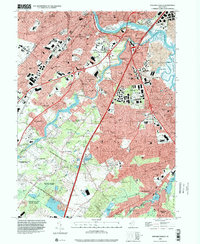 1995 New Brunswick2000 Print · USGSMiddlesex County in the mid-nineties shows a landscape defined by the convergence of major highways, historic canal routes, and growing residential suburbs. Genealogists and local historians can locate dozens of schools, cemeteries like Elmwood Cemetery, and long-standing neighborhoods from Westons Mills to Berdines Corners.
 - 1995 Map of South Amboy, 2000 Print
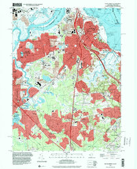 1995 South Amboy2000 Print · USGSThe Raritan Bay waterfront and industrial hubs of Middlesex County are on full display in the mid-1990s. Researchers can locate numerous family landmarks, from St Marys Cem and Sacred Heart Sch to the grounds of DeVitte Military Academy.
 - 2011 Map of New Brunswick, 2011 Print
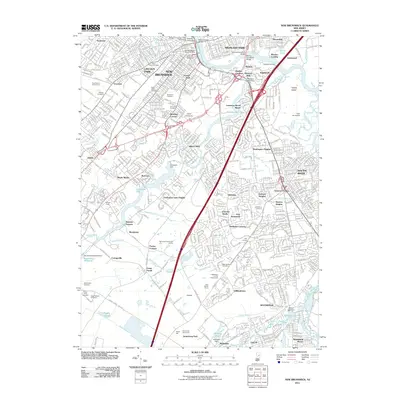 2011 New Brunswick2011 Print · USGSCovers Old Bridge, including Edison, Franklin Township, and other nearby areas
 - 2011 Map of South Amboy, 2011 Print
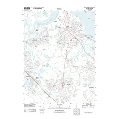 2011 South Amboy2011 Print · USGSCovers Old Bridge, including New York, Edison, and other nearby areas
 - 2014 Map of South Amboy, 2014 Print
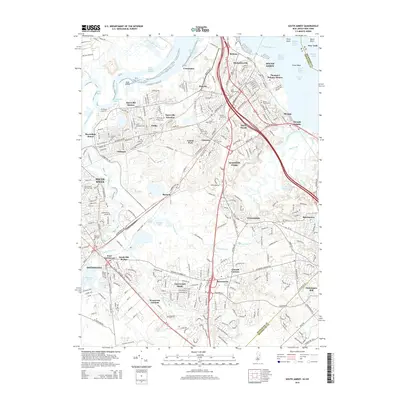 2014 South Amboy2014 Print · USGSCovers Old Bridge, including New York, Edison, and other nearby areas
 - 2014 Map of New Brunswick, 2014 Print
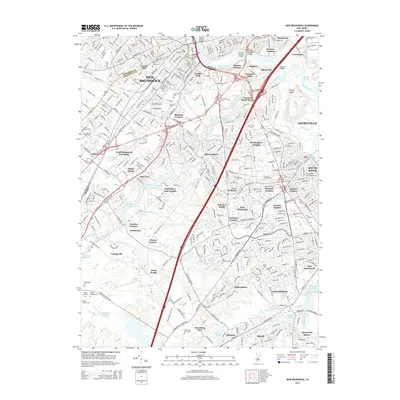 2014 New Brunswick2014 Print · USGSCovers Old Bridge, including Edison, Franklin Township, and other nearby areas
Showing maps 1-25 of 31
Top cities near Old Bridge
- New York historical maps
- Edison historical maps
- Woodbridge Township historical maps
- Franklin Township historical maps
- Middletown Township historical maps
- Old Bridge Township historical maps
See more
Top neighborhoods of Old Bridge
- East Spotswood historical maps
- South Old Bridge historical maps
- Brunswick Gardens historical maps
- Rolling Meadows Estates historical maps
- Sayerwood South historical maps
- Southwood historical maps
See more
Frequently asked questions
- What are the different types of historical maps available for Old Bridge?
- What is the oldest map of Old Bridge?
- Where can I purchase historical maps of Old Bridge for my home or office?
- Where can I download high-res historical maps of Old Bridge?
- Are there historical topographic maps available for Old Bridge?
- Is there historical aerial imagery available for Old Bridge?
- Where are historical maps of Old Bridge sourced from?