Old Maps of Woodbridge Township, New Jersey
Explore 36 old maps of Woodbridge Township, spanning from 1888 to today. These high-resolution historic maps reveal how streets, neighborhoods, landmarks, and natural features evolved over time — perfect for genealogy, metal detecting, research, and local history exploration.
What you can do with these maps:
- See how Woodbridge Township changed over time: Compare historical maps to modern-day views to trace roads, homesites, rail lines & more.
- View detailed metadata: Each map includes creators, publishers, year, scale, and archive source.
- Overlay maps with satellite & LiDAR: Visualize the past alongside modern tools to explore terrain & human change.
- Trusted historical sources: Maps sourced from the USGS, Library of Congress, and other archives.
- Access maps your way: View online, download high-res files, or order prints for personal or research use.
Start exploring old maps of Woodbridge Township to uncover forgotten places, hidden landmarks, and the deep history beneath your feet.
Woodbridge Township, NJ maps
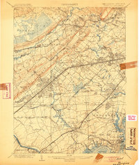
(36)- 1888 Map of Plainfield
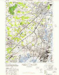
 1888 Plainfield1888 Print · USGSCovers Woodbridge Township, including New York, Newark, and other nearby areas
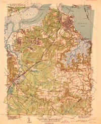
 - 1888 Map of New Brunswick
 1888 New Brunswick1888 Print · USGSCovers Woodbridge Township, including New York, Edison, and other nearby areas
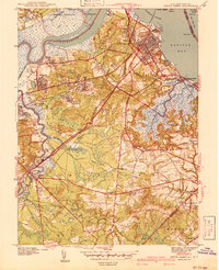
 - 1893 Map of New Brunswick
 1893 New Brunswick1893 Print · USGSCovers Woodbridge Township, including New York, Edison, and other nearby areas2 unique versions available
 - 1893 Map of Plainfield
 1893 Plainfield1893 Print · USGSCovers Woodbridge Township, including New York, Newark, and other nearby areas2 unique versions available
 - 1898 Map of Plainfield
 1898 Plainfield1898 Print · USGSCovers Woodbridge Township, including New York, Newark, and other nearby areas2 unique versions available
 - 1898 Map of Staten Island
 1898 Staten Island1898 Print · USGSCovers Woodbridge Township, including New York, Newark, and other nearby areas
 - 1900 Map of Passaic
 1900 Passaic1900 Print · USGSCovers Woodbridge Township, including New York, Newark, and other nearby areas
 - 1900 Map of Staten Island
 1900 Staten Island1900 Print · USGSCovers Woodbridge Township, including New York, Newark, and other nearby areas10 unique versions available
 - 1901 Map of New Brunswick
 1901 New Brunswick1901 Print · USGSCovers Woodbridge Township, including New York, Edison, and other nearby areas6 unique versions available
 - 1902 Map of Navesink
 1902 Navesink1902 Print · USGSCovers Woodbridge Township, including New York, Edison, and other nearby areas3 unique versions available
 - 1905 Map of Plainfield
 1905 Plainfield1905 Print · USGSCovers Woodbridge Township, including New York, Newark, and other nearby areas6 unique versions available
 - 1905 Map of Passaic
 1905 Passaic1905 Print · USGSCovers Woodbridge Township, including New York, Newark, and other nearby areas4 unique versions available
 - 1919 Map of New Brunswick, 1921 Print
 1919 New Brunswick1921 Print · USGSCovers Woodbridge Township, including New York, Edison, and other nearby areas
 - 1921 Map of Plainfield
 1921 Plainfield1921 Print · USGSCovers Woodbridge Township, including New York, Newark, and other nearby areas
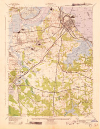
 - 1940 Map of South Amboy
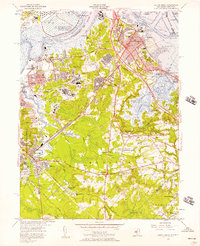
 1940 South Amboy1940 Print · USGSCovers Woodbridge Township, including New York, Edison, and other nearby areas2 unique versions available
 - 1941 Map of South Amboy
 1941 South Amboy1941 Print · USGSCovers Woodbridge Township, including New York, Edison, and other nearby areas2 unique versions available
 - 1942 Map of Passaic
 1942 Passaic1942 Print · USGSCovers Woodbridge Township, including New York, Newark, and other nearby areas
 - 1943 Map of South Amboy
 1943 South Amboy1943 Print · USGSCovers Woodbridge Township, including New York, Edison, and other nearby areas
 - 1944 Map of Newark, 1971 Print
 1944 Newark1971 Print · USGSCovers Woodbridge Township, including New York, Philadelphia, and other nearby areas5 unique versions available
 - 1947 Map of Perth Amboy
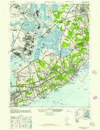
 1947 Perth Amboy1947 Print · USGSCovers Woodbridge Township, including New York, Edison, and other nearby areas
 - 1947 Map of Arthur Kill
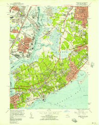
 1947 Arthur Kill1947 Print · USGSCovers Woodbridge Township, including New York, Perth Amboy, and other nearby areas
 - 1949 Map of Newark
 1949 Newark1949 Print · USGSCovers Woodbridge Township, including New York, Philadelphia, and other nearby areas3 unique versions available
 - 1954 Map of South Amboy, 1957 Print
 1954 South Amboy1957 Print · USGSCovers Woodbridge Township, including New York, Edison, and other nearby areas6 unique versions available
 - 1955 Map of Arthur Kill, 1957 Print
 1955 Arthur Kill1957 Print · USGSCovers Woodbridge Township, including New York, Perth Amboy, and other nearby areas2 unique versions available
 - 1956 Map of Newark
 1956 Newark1956 Print · USGSCovers Woodbridge Township, including New York, Philadelphia, and other nearby areas2 unique versions available
Showing maps 1-25 of 36
Top cities near Woodbridge Township
- New York historical maps
- Newark historical maps
- Jersey City historical maps
- Elizabeth historical maps
- Edison historical maps
- Franklin Township historical maps
See more
Top neighborhoods of Woodbridge Township
- Lynn Woodoaks historical maps
- Edgars historical maps
- Hazelton historical maps
- Hopelawn historical maps
- Menlo Park Terrace historical maps
- Sand Hills historical maps
See more
Frequently asked questions
- What are the different types of historical maps available for Woodbridge Township?
- What is the oldest map of Woodbridge Township?
- Where can I purchase historical maps of Woodbridge Township for my home or office?
- Where can I download high-res historical maps of Woodbridge Township?
- Are there historical topographic maps available for Woodbridge Township?
- Is there historical aerial imagery available for Woodbridge Township?
- Where are historical maps of Woodbridge Township sourced from?