Old Maps of Rockaway Township, New Jersey for Hiking & Exploration
Hike through history with 66 historic maps of Rockaway Township. Explore old trails, ghost towns, and forgotten backroads — perfect for outdoor adventurers and local explorers.
- Rediscover forgotten places: Map out old mining camps, roads, and footpaths that no longer exist on modern maps.
- Layer with modern tools: Combine with LiDAR or satellite views to plan hikes through historical terrain.
- Made for exploration: Popular among hikers, overlanders, and local history lovers.
Use these maps to find adventure and explore the hidden past of Rockaway Township.
Rockaway Township, NJ maps
(66)- 1888 Map of Franklin
 1888 Franklin1888 Print · USGSSussex County was a thriving hub of iron mining and rail commerce in the late nineteenth century. Genealogists and historians can trace the early industrial layout of Franklin Furnace, the remote Ogden Mine, and rural junctions like Branchville Junction.
 - 1888 Map of Morristown
 1888 Morristown1888 Print · USGSNorthern New Jersey's transition from an industrial mining hub to a rail-connected suburb is evident in the late 1880s. Genealogists and historians can locate the Hibernia Mine, trace the Morris Canal Feeder, and find old river crossings like Columbia Bridge.
 - 1888 Map of Lake Hopatcong
 1888 Lake Hopatcong1888 Print · USGSThe iron and water-power corridors of northern New Jersey are captured here in the late nineteenth century. Trace the industrial footprint of the Morris Canal and major rail lines through early centers like Port Oram, Stanhope, and Dover.
 - 1891 Map of Greenwood Lake
 1891 Greenwood Lake1891 Print · USGSThe Highlands of New York and New Jersey are captured here in the late nineteenth century during a peak era of iron mining and rail expansion. Researchers can trace the industrial footprint of the Sterling Furnace, locate family-named mines like Carey Mine, and follow the historic routes of the New York Susquehanna and Western Railroad.
 - 1893 Map of Greenwood Lake
 1893 Greenwood Lake1893 Print · USGSThe iron-rich highlands of the New York-New Jersey border come to life in this late-century survey of the lakes and ridges between Passaic and Orange counties. Genealogists and industrial historians can trace the paths of the Sterling Mountain Railroad and find long-established sites like Sterling Furnace or the Layton Mines.6 unique versions available
 - 1894 Map of Morristown
 1894 Morristown1894 Print · USGSNorthern New Jersey was a landscape of iron and water in the late nineteenth century, as the canal era gave way to steam power. Trace the winding Morris Canal, the mining works at Hibernia, and historic river crossings like Horse Neck Bridge.
 - 1894 Map of Lake Hopatcong
 1894 Lake Hopatcong1894 Print · USGSThe New Jersey Highlands are captured here in the 1890s, when the iron-rich hills were still crisscrossed by canal boats and steam locomotives. Researchers can trace the early layout of Lake Hopatcong or locate lost industrial sites near Shippenport and Hacklebarney.
 - 1894 Map of Franklin
 1894 Franklin1894 Print · USGSSussex County was a thriving industrial hub in the late nineteenth century, driven by the iron and zinc deposits of the Highlands. Genealogists and historians can trace the rail-to-mine connections between Franklin Furnace, Ogden Mine, and Deckertown.
 - 1897 Map of Franklin
 1897 Franklin1897 Print · USGSSussex County’s industrial and agricultural heartlands are captured in the late 1890s, centered on the vital mining district and its complex rail network. Genealogists and historians can trace the footprint of early iron and zinc works at Franklin Furnace or locate family homesteads near Branchville and Papakating.
 - 1898 Map of Lake Hopatcong
 1898 Lake Hopatcong1898 Print · USGSNorthwest New Jersey's highland lake country is captured here during a period of intense industrial and resort development. Researchers can trace the path of the Morris Canal, locate historical mining operations at Mine Hill, and explore early lakeside settlements like Mt. Arlington and Landing.2 unique versions available
 - 1898 Map of Morristown
 1898 Morristown1898 Print · USGSMorris and Essex counties at the turn of the century show a complex landscape of early industrial rail lines and historic water routes. Researchers can trace the path of the Morris Canal and find vanished local landmarks like Malapardis, Beach Glen, and Swinefield Bridge.2 unique versions available
 - 1900 Map of Passaic
 1900 Passaic1900 Print · USGSNorthern New Jersey and the New York Harbor are captured here at the close of the nineteenth century, showing a landscape defined by rail, river, and coastal defense. Researchers can trace the original path of the Morris Canal, locate Seton Hall College, and explore the batteries at Fort Wadsworth.
 - 1900 Map of Raritan
 1900 Raritan1900 Print · USGSNorth Jersey in the late nineteenth century was a complex web of mountain ridges and vital rail corridors. Researchers can trace ancestral routes through old junctions like High Bridge, industrial sites at Mine Hill, and the shores of Lake Hopatcong.
 - 1903 Map of Franklin Furnace
 1903 Franklin Furnace1903 Print · USGSSussex County at the turn of the century is a landscape shaped by iron mining and a bustling rail network. Genealogists and historians can trace the early industrial roots of Franklin Furnace, locate rural landmarks like North Church, and follow the path of the Lehigh and Hudson River Railroad.4 unique versions available
 - 1903 Map of Greenwood Lake, 1909 Print
 1903 Greenwood Lake1909 Print · USGSThe Highlands of New York and New Jersey are captured here at the height of their industrial era, showing a landscape of iron mines and mountain railroads. Genealogists and historians can locate heritage sites like Sterling Furnace, Dayton Mines, and the rural community of New Newfoundland.
 - 1905 Map of Lake Hopatcong
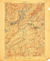 1905 Lake Hopatcong1905 Print · USGSNorthern New Jersey during the early twentieth century shows a landscape shaped by iron mining, railroads, and the growing resort culture around Lake Hopatcong. Genealogists and historians can trace family roots through old settlements like Succasunna, the industrial sites at Mine Hill, and the U.S. Navy Powder Depot.3 unique versions available
 - 1905 Map of Raritan
 1905 Raritan1905 Print · USGSNorthern New Jersey's ridges and valleys are meticulously detailed here at the turn of the century. You can trace the complex rail networks of the Lehigh Valley R.R. and locate family landmarks from Swayze Mills to the Powder Depot near Picatinny Peak.2 unique versions available
 - 1905 Map of Passaic
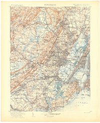 1905 Passaic1905 Print · USGSNorthern New Jersey and Staten Island appear here at a pivotal moment of early 20th-century growth and industrialization. Researchers can trace the development of transit hubs like Convent Sta. or locate legacy landmarks including Hillside Cemetery and the Moravian Cemetery.4 unique versions available
 - 1906 Map of Morristown
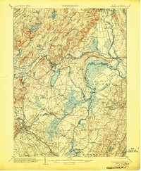 1906 Morristown1906 Print · USGSNorthern New Jersey's transition from industrial highlands to riverine lowlands is captured here just after the turn of the century. Genealogists can trace family roots in Hibernia or Boonton and locate historic crossings like Columbia Bridge and the Morris Canal.6 unique versions available
 - 1910 Map of Greenwood Lake
 1910 Greenwood Lake1910 Print · USGSThe Highlands of northern New Jersey and southern New York are shown here during a peak era of iron mining and rail expansion. Genealogists and industrial historians can trace the foundations of Sterling Furnace, Charlotteburg Mine, and the New Milford Sta. along the Erie Railroad.9 unique versions available
 - 1942 Map of Passaic
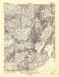 1942 Passaic1942 Print · USGSNorthern New Jersey and New York harbor appear in detail at the start of the war, showing a landscape of burgeoning suburbs and vital industry. Trace family roots and local history across the Passaic River valley, from Paterson to the Watchung Mountains.
 - 1943 Map of Franklin Furnace
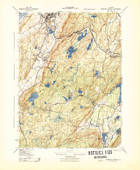 1943 Franklin Furnace1943 Print · USGSMid-century Sussex County is defined here by its deep mining roots and mountain reservoirs. Trace the industrial landscape of Franklin and Ogdensburg through landmarks like the N J Zinc Co, the Stockholm School, and the Lehigh and Hudson River.
 - 1943 Map of Newfoundland
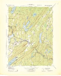 1943 Newfoundland1943 Print · USGSThe Pequannock River valley and its surrounding ridges are captured here during the Second World War. Researchers can trace the New York Susquehanna and Western rail line through Newfoundland or locate landmarks like the Fire House and West Milford School.
 - 1944 Map of Newark, 1971 Print
 1944 Newark1971 Print · USGSThe industrial corridor from Philadelphia to New York was in a period of massive transition during the mid-forties. Genealogists and researchers can trace the rail lines of the Lehigh Valley RR, locate military installations like Picatinny Arsenal, and explore the early sprawl near Levittown.5 unique versions available
 - 1947 Map of Dover
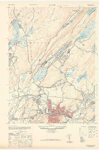 1947 Dover1947 Print · USGSDover and the Rockaway River valley are captured in the late 1940s, showing a landscape defined by industrial centers and lakeside retreats. Trace local history along the Morris Canal or find landmarks like the Star of the Sea Church and Wharton.
Showing maps 1-25 of 66
Top cities near Rockaway Township
- Wayne historical maps
- Parsippany-Troy Hills historical maps
- West Orange historical maps
- Warwick historical maps
- Mount Olive historical maps
- Livingston historical maps
See more
Top neighborhoods of Rockaway Township
- Lyonsville historical maps
- Marcella historical maps
- Meriden historical maps
- Hilltown historical maps
- Beach Glen historical maps
- Kitchell historical maps
See more
Frequently asked questions
- What are the different types of historical maps available for Rockaway Township?
- What is the oldest map of Rockaway Township?
- Where can I purchase historical maps of Rockaway Township for my home or office?
- Where can I download high-res historical maps of Rockaway Township?
- Are there historical topographic maps available for Rockaway Township?
- Is there historical aerial imagery available for Rockaway Township?
- Where are historical maps of Rockaway Township sourced from?