Old Maps of Carneys Point Township, New Jersey for Metal Detecting
Plan your next treasure hunt with 48 historic maps of Carneys Point Township. Find old homesites, ghost towns, trails, and gathering spots that may be lost to time — perfect for identifying promising metal detecting locations.
- Locate forgotten sites: Uncover places like long-lost settlements, abandoned rail lines, or gathering spots.
- Plan better hunts: Use map overlays combined with LiDAR or satellite views to narrow in on historically rich areas.
- Made for detectorists: Thousands of hobbyists use these maps to discover relics, coins, and hidden history.
Use these historic maps to boost your research and find new opportunities beneath the surface of Carneys Point Township.
Carneys Point Township, NJ maps
(48)- 1890 Map of Salem
 1890 Salem1890 Print · USGSSouth Jersey at the height of the Victorian era is captured here, showing the dense network of rail lines and creek-side landings. Genealogists and historians can trace family-named sites like Avis Mills, Hancock's Bridge, and Sharptown.2 unique versions available
 - 1894 Map of Chester, 1954 Print
 1894 Chester1954 Print · USGSThe Delaware River corridor near Chester was a hive of rail activity and water-powered industry at the close of the century. Genealogists and historians can trace family-named mills such as Llewellyn Mills or visit the campus of the Williamson School and the borough of Media.2 unique versions available
 - 1896 Map of Chester
 1896 Chester1896 Print · USGSThe industrial corridor along the Delaware River thrives at the close of the nineteenth century as railroads and mills reshape the landscape. Genealogists can trace early homesteads and institutions like the Williamson School, Sharon Academy, and Sycamore Mills.
 - 1898 Map of Salem
 1898 Salem1898 Print · USGSSouthwestern New Jersey at the close of the nineteenth century shows a complex web of rural river settlements and early rail junctions. Trace the paths of the West Jersey and Seashore railroad and locate historical sites like Berry Chapel or Avis Mills.4 unique versions available
 - 1898 Map of Chester
 1898 Chester1898 Print · USGSThe Delaware River shoreline at the end of the nineteenth century reveals a landscape of industrial riverfronts and emerging mill towns. Genealogists and historians can trace family roots through numerous small settlements and institutions like Village Green, Booth Corner, and the Williamson School.10 unique versions available
 - 1901 Map of Camden
 1901 Camden1901 Print · USGSThe Delaware River valley at the turn of the century shows a bustling corridor of early industrial growth and established mill towns. Researchers can trace the heritage of local industry at Sycamore Mills or locate early settlements like Penns Grove and Village Green.3 unique versions available
 - 1904 Map of Wilmington, 1961 Print
 1904 Wilmington1961 Print · USGSDelaware’s coastal industrial corridor and river defenses are captured here at the turn of the century. Genealogists and historians can trace old transit lines like the Maryland and Delaware Electric RR or locate landmarks such as Fort Delaware and Coochs Bridge.
 - 1906 Map of Wilmington
 1906 Wilmington1906 Print · USGSThe industrial waterfronts and rail hubs of northern Delaware thrive in the early twentieth century. Researchers can trace the path of the Chesapeake and Delaware Canal, find the strategic Fort Delaware, and locate old settlements like Coochs Bridge and St Georges.7 unique versions available
 - 1919 Map of Wilmington
 1919 Wilmington1919 Print · USGSNorthern Delaware and the river corridor are mapped at the close of the Great War, highlighting strategic coastal defenses and rail hubs. Genealogists can trace early landmarks like Coochs Bridge, Corner Ketch, and the defensive works at Fort Delaware.2 unique versions available
 - 1941 Map of Marcus Hook
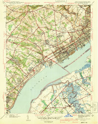 1941 Marcus Hook1941 Print · USGSThe industrial and maritime riverfront at the start of the 1940s is captured here, showing the dense rail networks of the Marcus Hook area. Researchers can trace ancestral property near Hambys Corner, Siloam Ch, or the U S Military Reservation.
 - 1941 Map of Salem
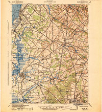 1941 Salem1941 Print · USGSSalem County and the Delaware River waterfront appear here in the early 1940s, just as industrial and wartime infrastructure began to reshape the landscape. Genealogists and local historians can trace family roots through old landmarks like Porches Mill, Yorktown PO, and the Wilmington Ferry route.
 - 1942 Map of Camden
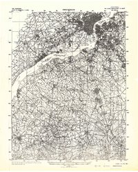 1942 Camden1942 Print · USGSThe Philadelphia and Camden metropolitan corridor is captured here at the height of the Second World War. Genealogists and historians can trace rail networks like the Reading R.R. and locate communities from Swedesboro to Merchantville.
 - 1946 Map of Wilmington, 1948 Print
 1946 Wilmington1948 Print · USGSThe Delaware Valley and Jersey Shore emerge in this mid-century portrait of a region defined by river commerce and seaside growth. Genealogists and historians can trace the rail networks of the Pennsylvania Railroad, locate early airfields like Dover Airpark, and find river defenses at Fort Delaware.2 unique versions available
 - 1948 Map of Salem
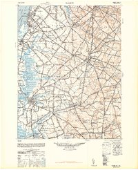 1948 Salem1948 Print · USGSSouth Jersey at the dawn of the atomic age is a landscape of thriving mill towns and vital river commerce. Genealogists and historians can trace the rail corridors of the Pennsylvania Reading Seashore Lines or locate family sites near Russels Mill and Hancocks Bridge.3 unique versions available
 - 1948 Map of Marcus Hook
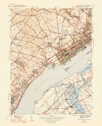 1948 Marcus Hook1948 Print · USGSThe industrial corridor along the Delaware River thrives in the late 1940s as rail and river trade intersect. Genealogists can locate family landmarks like Mt Hope Ch Cem, the U S Quarantine Sta, and the busy junction at Marcus Hook.2 unique versions available
 - 1948 Map of Wilmington South, 1952 Print
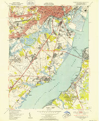 1948 Wilmington South1952 Print · USGSWilmington and New Castle were thriving centers of industry and aviation just after the war as suburban neighborhoods rapidly expanded. Genealogists and researchers can trace local landmarks like Silverbrook Cemetery, the New Castle County Airport, and the Marine Terminal along the Christina River.2 unique versions available
 - 1951 Map of Penns Grove
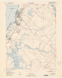 1951 Penns Grove1951 Print · USGSCoastal Salem County is seen here in the early fifties, showing a bustling riverfront economy and deep-rooted rural interior. Trace the Reading Seashore Lines to Friendship Sta or locate family sites near Haines Neck Ch and Biddles Landing.2 unique versions available
 - 1953 Map of Marcus Hook, 1956 Print
 1953 Marcus Hook1956 Print · USGSThe industrial waterfront of the Delaware River comes alive in the early fifties, from the refineries of Marcus Hook to the busy streets of Chester. Trace family roots at Mt Hope Ch Cem or locate vanished landmarks like the U S Quarantine Sta and Tank Farm.2 unique versions available
 - 1955 Map of Wilmington
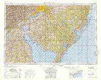 1955 Wilmington1955 Print · USGSThe Delaware Valley and Jersey Shore are seen here during the mid-fifties era of rapid suburban expansion and highway development. You can trace the path of the New Jersey Turnpike, locate the Fort Dix Military Reservation, or explore the rail networks of the Pennsylvania Railroad.
 - 1957 Map of Wilmington
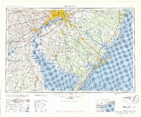 1957 Wilmington1957 Print · USGSThe mid-Atlantic coastal plain comes alive in the mid-fifties as the New Jersey Turnpike and Garden State Parkway redefine travel. Researchers can trace the rail-to-road transition and find landmarks like Ship John Shoal Light and the Fort Dix Military Reservation.2 unique versions available
 - 1959 Map of Wilmington
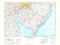 1959 Wilmington1959 Print · USGSThe Delaware Valley and Jersey Shore are seen here in the late fifties, during a period of massive suburban and highway expansion. Researchers can trace mid-century infrastructure like the N J Turnpike or locate coastal landmarks from Barnegat Bay to the Maurice River.3 unique versions available
 - 1966 Map of Wilmington, 1968 Print
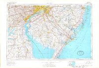 1966 Wilmington1968 Print · USGSThe Delaware Valley and Jersey Shore are seen here in the mid-1960s, documenting a landscape of dense industrial cities and emerging coastal resorts. Researchers can trace the sprawling rail networks of the Pennsylvania Railroad or locate landmarks like Fort Dix Military Reservation and Elk Neck State Park.4 unique versions available
 - 1967 Map of Penns Grove, 1969 Print
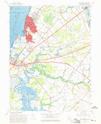 1967 Penns Grove1969 Print · USGSThe riverfront of Salem County is captured here in the late sixties as industrial hubs and suburban manors expanded alongside the historic Delaware. Trace family roots at Perkintown Cem, the St James Ch, or the small settlement of Marshalltown.2 unique versions available
 - 1967 Map of Wilmington South, 1969 Print
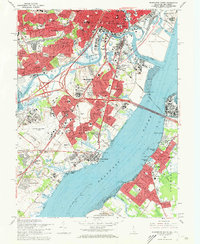 1967 Wilmington South1969 Print · USGSThe industrial corridor between Wilmington and New Castle is captured here during a period of intense suburban growth. Researchers can trace family roots through numerous sites like Gracelawn Mem Park (Cemetery), Wm Penn High Sch, and the Air National Guard base.3 unique versions available
 - 1967 Map of Marcus Hook, 1970 Print
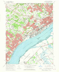 1967 Marcus Hook1970 Print · USGSThe industrial corridor of the Delaware River transitions into the established suburbs of Pennsylvania and Delaware during the late sixties. Researchers can trace historic landmarks like the St Patricks Monastery, the grounds of Archmere Prep Sch, and the rail junctions of the Baltimore and Ohio.3 unique versions available
Showing maps 1-25 of 48
Top cities near Carneys Point Township
- Philadelphia historical maps
- Upper Darby historical maps
- Wilmington historical maps
- Chester historical maps
- Marple Township historical maps
- Springfield Township historical maps
See more
Top neighborhoods of Carneys Point Township
- Cedar Crest Manor historical maps
- Danceys Corner historical maps
- Golf Manor historical maps
- Golf View historical maps
- Ordmont historical maps
- Biddles Landing historical maps
See more
Frequently asked questions
- What are the different types of historical maps available for Carneys Point Township?
- What is the oldest map of Carneys Point Township?
- Where can I purchase historical maps of Carneys Point Township for my home or office?
- Where can I download high-res historical maps of Carneys Point Township?
- Are there historical topographic maps available for Carneys Point Township?
- Is there historical aerial imagery available for Carneys Point Township?
- Where are historical maps of Carneys Point Township sourced from?