1930s Maps of Lower Alloways Creek Township, New Jersey
Explore 2 historic maps of Lower Alloways Creek Township from the 1930s. These maps offer a rare glimpse into what life looked like during the 1930s — showing old roads, neighborhoods, homes, and landmarks that have changed or disappeared over time.
Whether you're researching your family's past, planning a metal detecting trip, or studying how Lower Alloways Creek Township's landscape evolved across the 1930s, these high-resolution maps are a powerful tool for exploring the history of this region.
- Focus on a specific era: All maps on this page are from the 1930s, giving you a focused view of this time period.
- See what’s changed: Compare century-old streets, trails, and buildings to today's modern landscape using overlays and satellite layers.
- Research with precision: Use these maps for genealogy, historical research, land use analysis, or educational projects.
- View, download, or print: Maps are fully viewable online in high resolution, and can be downloaded or printed for your own records.
Start exploring Lower Alloways Creek Township's history through authentic maps from the 1930s. This is your window into the past.
Lower Alloways Creek Township, NJ maps
(2)- 1931 Map of Bay Side
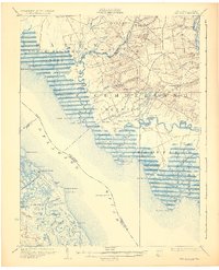 1931 Bay Side1931 Print · USGSThe tidal marshes of the lower Delaware River come alive in the early thirties, showcasing the maritime and agricultural roots of South Jersey. Genealogists and historians can trace family-named sites like Maskell Mill, the rail path of the Southern Jersey R R, and old bayfront landings at Sea Breeze.2 unique versions available
 - 1931 Map of Smyrna
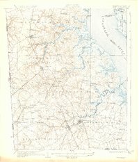 1931 Smyrna1931 Print · USGSCoastal Delaware in the late twenties and early thirties was a landscape of tidal landings and crossroads settlements linked by the new Dupont Highway. Genealogists can trace family names across Gums Corners, identify sites like St Anns Church, or locate the many landings along Blackbird Creek, including Blackbird Landing and Stave Landing.5 unique versions available
End of results
Showing maps 1-2 of 2
Top cities near Lower Alloways Creek Township
- Wilmington historical maps
- Bridgeton historical maps
- Pennsville Township historical maps
- Smyrna historical maps
- Middletown historical maps
- Wilmington Manor historical maps
See more
Top neighborhoods of Lower Alloways Creek Township
- Maskells Mill historical maps
- Hancocks Bridge historical maps
- Canton historical maps
- Hagerville historical maps
- Harmersville historical maps
Frequently asked questions
- What are the different types of historical maps available for Lower Alloways Creek Township?
- What is the oldest map of Lower Alloways Creek Township?
- Where can I purchase historical maps of Lower Alloways Creek Township for my home or office?
- Where can I download high-res historical maps of Lower Alloways Creek Township?
- Are there historical topographic maps available for Lower Alloways Creek Township?
- Is there historical aerial imagery available for Lower Alloways Creek Township?
- Where are historical maps of Lower Alloways Creek Township sourced from?