2020s Maps of Bernards Township, New Jersey
Explore 3 historic maps of Bernards Township from the 2020s. These maps offer a rare glimpse into what life looked like during the 2020s — showing old roads, neighborhoods, homes, and landmarks that have changed or disappeared over time.
Whether you're researching your family's past, planning a metal detecting trip, or studying how Bernards Township's landscape evolved across the 2020s, these high-resolution maps are a powerful tool for exploring the history of this region.
- Focus on a specific era: All maps on this page are from the 2020s, giving you a focused view of this time period.
- See what’s changed: Compare century-old streets, trails, and buildings to today's modern landscape using overlays and satellite layers.
- Research with precision: Use these maps for genealogy, historical research, land use analysis, or educational projects.
- View, download, or print: Maps are fully viewable online in high resolution, and can be downloaded or printed for your own records.
Start exploring Bernards Township's history through authentic maps from the 2020s. This is your window into the past.
Bernards Township, NJ maps
(3)- 2023 Map of Bound Brook, 2023 Print
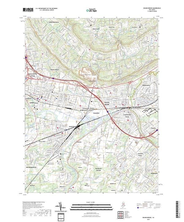 2023 Bound Brook2023 Print · USGSThe Raritan River valley and Watchung Mountains define this New Jersey landscape as it appeared in the early 2020s. Genealogists and local historians can locate numerous burial sites like Saint Joseph Cem and trace the path of the Delaware and Raritan Canal through South Bound Brook.
 - 2023 Map of Bernardsville, 2023 Print
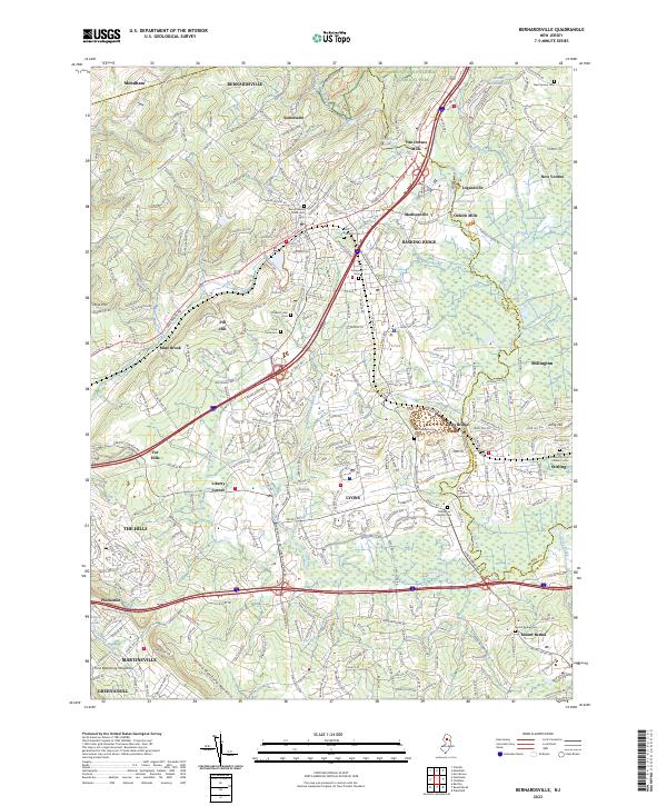 2023 Bernardsville2023 Print · USGSSomerset and Morris counties appear here in the early twenty-first century, showing the established rail-and-road network of north-central New Jersey. Researchers can trace local lineage through the Vail Family Burial Ground or locate historic milling sites like Osborn Mills and Van Dorans Mills.
 - 2023 Map of Gladstone, 2023 Print
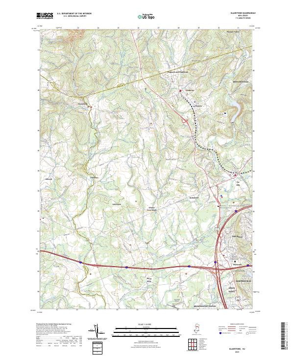 2023 Gladstone2023 Print · USGSThe North Jersey hills and the Raritan valley are shown in contemporary detail in this recent survey. Local researchers can trace old routes and landmarks through Pottersville, Oldwick, and the historic Pluckemin Presbyterian Church Cem.
End of results
Showing maps 1-3 of 3
Top cities near Bernards Township
- Edison historical maps
- Franklin Township historical maps
- Old Bridge Township historical maps
- Parsippany-Troy Hills historical maps
- Piscataway Township historical maps
- New Brunswick historical maps
See more
Top neighborhoods of Bernards Township
- Madisonville historical maps
- Van Dorans Mills historical maps
- The Hills Development historical maps
- Davis Bridge historical maps
- Mine Brook historical maps
- Basking Ridge historical maps
See more
Frequently asked questions
- What are the different types of historical maps available for Bernards Township?
- What is the oldest map of Bernards Township?
- Where can I purchase historical maps of Bernards Township for my home or office?
- Where can I download high-res historical maps of Bernards Township?
- Are there historical topographic maps available for Bernards Township?
- Is there historical aerial imagery available for Bernards Township?
- Where are historical maps of Bernards Township sourced from?