1960s Maps of Cruzville, New Mexico
Explore 2 historic maps of Cruzville from the 1960s. These maps offer a rare glimpse into what life looked like during the 1960s — showing old roads, neighborhoods, homes, and landmarks that have changed or disappeared over time.
Whether you're researching your family's past, planning a metal detecting trip, or studying how Cruzville's landscape evolved across the 1960s, these high-resolution maps are a powerful tool for exploring the history of this region.
- Focus on a specific era: All maps on this page are from the 1960s, giving you a focused view of this time period.
- See what’s changed: Compare century-old streets, trails, and buildings to today's modern landscape using overlays and satellite layers.
- Research with precision: Use these maps for genealogy, historical research, land use analysis, or educational projects.
- View, download, or print: Maps are fully viewable online in high resolution, and can be downloaded or printed for your own records.
Start exploring Cruzville's history through authentic maps from the 1960s. This is your window into the past.
Cruzville, NM maps
(2)- 1962 Map of Clifton
 1962 Clifton1962 Print · USGSThe copper-rich Arizona-New Mexico borderlands come into focus in the early sixties, centered on the mining complexes of Morenci and Clifton. Researchers can trace the Southern Pacific rail lines and locate remote outposts like Honeymoon and the Double Circle Ranch.
 - 1965 Map of Cruzville, 1968 Print
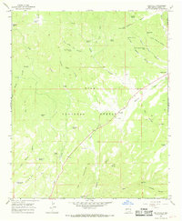 1965 Cruzville1968 Print · USGSCruzville and the upper Tularosa River are captured here in the mid-1960s, showing a landscape of high-elevation ranches and canyons. Researchers can trace family-named landmarks like Jon S Mountain and isolated sites such as the Cross V Ranch and a lone Grave.
End of results
Showing maps 1-2 of 2
Top cities near Cruzville
Frequently asked questions
- What are the different types of historical maps available for Cruzville?
- What is the oldest map of Cruzville?
- Where can I purchase historical maps of Cruzville for my home or office?
- Where can I download high-res historical maps of Cruzville?
- Are there historical topographic maps available for Cruzville?
- Is there historical aerial imagery available for Cruzville?
- Where are historical maps of Cruzville sourced from?