Old Maps of Ed, Edd n Eddy's Backyard, New Mexico for Academic Research
Study the evolution of Ed, Edd n Eddy's Backyard with 10 high-resolution historic maps. Whether you're teaching, researching, or modeling changes in land use, these maps provide essential visual documentation of urban, environmental, and geographic change.
- Analyze long-term change: Track patterns in development, transportation, and natural features.
- Ideal for environmental or urban studies: Support academic projects with primary historical map data.
- Use in the classroom or lab: Educators and researchers rely on these maps to bring historical context to life.
These maps are a powerful tool for teaching, research, and visualizing how Ed, Edd n Eddy's Backyard has changed over the decades.
Ed, Edd n Eddy's Backyard, NM maps
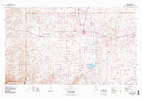
(10)- 1954 Map of Carlsbad, 1963 Print
 1954 Carlsbad1963 Print · USGSSoutheastern New Mexico's desert peaks and river valleys appear in this mid-century study of the borderlands. Researchers can locate vanished sites like Sacramento City, trace the Pecos River reservoirs, and explore Carlsbad Caverns.3 unique versions available
 - 1958 Map of Carlsbad
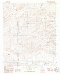
 1958 Carlsbad1958 Print · USGSSoutheastern New Mexico in the mid-1950s shows a landscape of deep desert basins and high forest ranges during a period of steady ranching and early tourism. Researchers can trace the path of the Atchison Topeka and Santa Fe railroad or find vanished locales like Sacramento City (abandoned) and Whites City.2 unique versions available
 - 1960 Map of Teel Ranch, 1964 Print
 1960 Teel Ranch1964 Print · USGSThe Chaves and Eddy county borderlands in the early sixties reveal a landscape of resilient family ranching and vital water infrastructure. Genealogists and historians can trace holdings like Teel Ranch, Harris Ranch, and the Schauer Landing Strip along the winding Rio Peñasco.
 - 1978 Map of Artesia, 1979 Print
 1978 Artesia1979 Print · USGSThe Pecos River valley in southeastern New Mexico comes alive in the late seventies, showing the intersection of rail-line agriculture and oil-field growth. Trace the path of the Atchison Topeka and Santa Fe through settlements like Dayton, Espuela, and Lakewood near Lake McMillan.
 - 1989 Map of Sagebrush Valley East
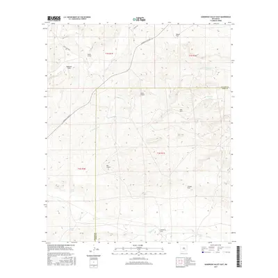
 1989 Sagebrush Valley East1989 Print · USGSSoutheastern New Mexico ranching lands are mapped here in the late eighties at the intersection of Chaves and Eddy Counties. Local history researchers can trace old water sources and canyon trails like CCC Tank, Goaty Canyon, and Eagle Creek.
 - 2010 Map of Sagebrush Valley East, 2010 Print
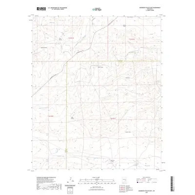
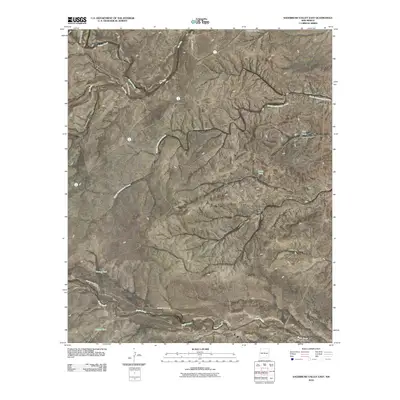 2010 Sagebrush Valley East2010 Print · USGSCovers Ed, Edd n Eddy's Backyard, including Chaves County, Eddy County, and other nearby areas
 - 2013 Map of Sagebrush Valley East, 2013 Print
 2013 Sagebrush Valley East2013 Print · USGSCovers Ed, Edd n Eddy's Backyard, including Chaves County, Eddy County, and other nearby areas
 - 2017 Map of Sagebrush Valley East, 2017 Print
 2017 Sagebrush Valley East2017 Print · USGSCovers Ed, Edd n Eddy's Backyard, including Chaves County, Eddy County, and other nearby areas
 - 2020 Map of Sagebrush Valley East, 2020 Print
 2020 Sagebrush Valley East2020 Print · USGSCovers Ed, Edd n Eddy's Backyard, including Chaves County, Eddy County, and other nearby areas
 - 2023 Map of Sagebrush Valley East, 2023 Print
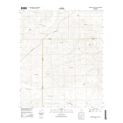
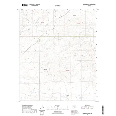
 2023 Sagebrush Valley East2023 Print · USGSSoutheast New Mexico in 2023 remains a landscape of remote draws and seasonal creeks along the Chaves and Eddy county line. Researchers can trace the drainage of Rio Felix and locate water management sites like CCC Tank and Eagle Tanks across the desert floor.
End of results
Showing maps 1-10 of 10
Top cities near Ed, Edd n Eddy's Backyard
Frequently asked questions
- What are the different types of historical maps available for Ed, Edd n Eddy's Backyard?
- What is the oldest map of Ed, Edd n Eddy's Backyard?
- Where can I purchase historical maps of Ed, Edd n Eddy's Backyard for my home or office?
- Where can I download high-res historical maps of Ed, Edd n Eddy's Backyard?
- Are there historical topographic maps available for Ed, Edd n Eddy's Backyard?
- Is there historical aerial imagery available for Ed, Edd n Eddy's Backyard?
- Where are historical maps of Ed, Edd n Eddy's Backyard sourced from?