Old Maps of Elkins, New Mexico for Genealogy
Trace your family roots with 10 historic maps of Elkins. These high-res maps reveal old neighborhoods, homesites, landmarks, and streets — helping you uncover where your ancestors lived and how the area evolved over time.
- Explore historic neighborhoods: Identify where your relatives may have lived in the 1800s or 1900s.
- Compare maps over time: Trace the changes in streets, buildings, and landmarks for multi-generational research.
- Perfect for genealogy & ancestry research: Used by family historians and researchers to map out lineage and migration.
These maps are an incredible resource for exploring your personal connection to Elkins's past.
Elkins, NM maps
(10)- 1955 Map of Roswell, 1974 Print
 1955 Roswell1974 Print · USGSSoutheastern New Mexico is shown in transition during the mid-fifties, from the Pecos Valley ranching hubs to the high timber of the Sacramento Mountains. Researchers can trace the Atchison Topeka and Santa Fe RR through Roswell and Hagerman or locate the old barracks at Ft Stanton.3 unique versions available
 - 1958 Map of Roswell
 1958 Roswell1958 Print · USGSThe High Plains and mountain peaks of New Mexico are captured here during the mid-fifties, showing the region before the closure of Walker Air Force Base. Researchers can trace the ranching and rail landscape from Lincoln to the Pecos River valley through Hagerman and Lake Arthur.
 - 1962 Map of Roswell
 1962 Roswell1962 Print · USGSSoutheastern New Mexico in the early sixties shows a landscape defined by high mountain peaks and a growing military presence at Roswell. Genealogists and historians can trace the roads connecting Fort Stanton, Capitan, and the Mescalero Apache Indian Reservation.
 - 1967 Map of Elkins, 1971 Print
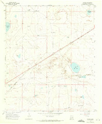 1967 Elkins1971 Print · USGSThe rail-and-ranching landscape of Chaves County comes into focus in the late 1960s, centered on the railroad siding at Elkins. Researchers can locate family landmarks like the South Chatten-Muncy Ranch and the critical water network of Little Red Lake and Cocklebur Tank.2 unique versions available
 - 1979 Map of Salt Creek
 1979 Salt Creek1979 Print · USGSChaves County's high plains and river valleys are captured here in the late seventies as the region balanced ranching life with historic aerospace milestones. Trace the Atchison Topeka and Santa Fe Railroad past Elkins or locate the Dr Robert Goddard Original Rocket Tower Site.
 - 2010 Map of Elkins, 2010 Print
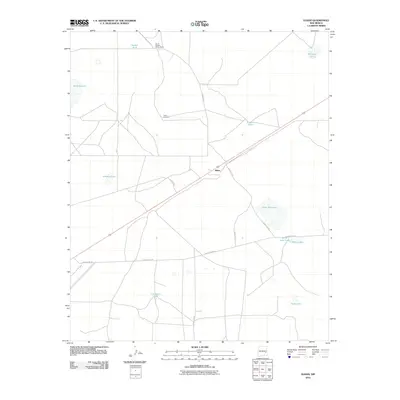 2010 Elkins2010 Print · USGSCovers Elkins, including Chaves County, United States, and other nearby areas
 - 2013 Map of Elkins, 2013 Print
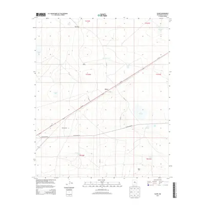 2013 Elkins2013 Print · USGSCovers Elkins, including Chaves County, United States, and other nearby areas
 - 2017 Map of Elkins, 2017 Print
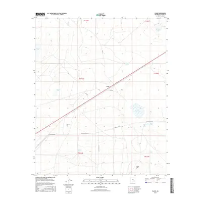 2017 Elkins2017 Print · USGSCovers Elkins, including Chaves County, United States, and other nearby areas
 - 2020 Map of Elkins, 2020 Print
 2020 Elkins2020 Print · USGSCovers Elkins, including Chaves County, United States, and other nearby areas
 - 2023 Map of Elkins, 2023 Print
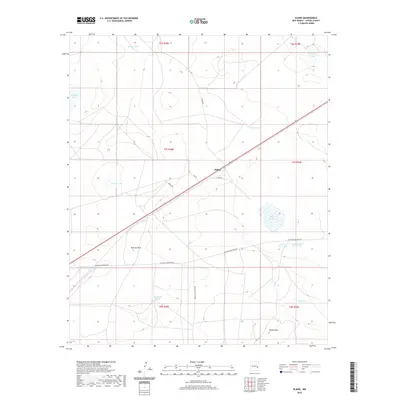
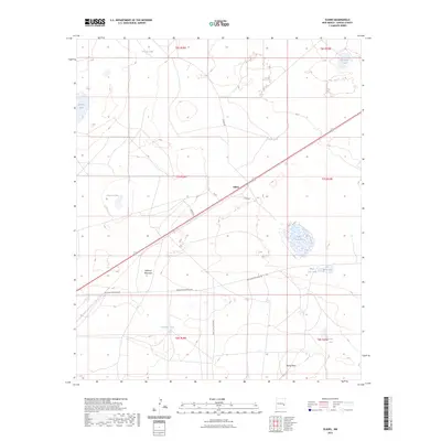 2023 Elkins2023 Print · USGSThe settlement of Elkins and its surrounding ranch lands are documented here in the early twenty-first century. Genealogists and local historians can trace family-named landmarks and essential water sources like Seesaw Tank, Johnson Lake, and Railroad Mountain.
End of results
Showing maps 1-10 of 10
Frequently asked questions
- What are the different types of historical maps available for Elkins?
- What is the oldest map of Elkins?
- Where can I purchase historical maps of Elkins for my home or office?
- Where can I download high-res historical maps of Elkins?
- Are there historical topographic maps available for Elkins?
- Is there historical aerial imagery available for Elkins?
- Where are historical maps of Elkins sourced from?