Old Maps of Acoma Pueblo, New Mexico for Academic Research
Study the evolution of Acoma Pueblo with 11 high-resolution historic maps. Whether you're teaching, researching, or modeling changes in land use, these maps provide essential visual documentation of urban, environmental, and geographic change.
- Analyze long-term change: Track patterns in development, transportation, and natural features.
- Ideal for environmental or urban studies: Support academic projects with primary historical map data.
- Use in the classroom or lab: Educators and researchers rely on these maps to bring historical context to life.
These maps are a powerful tool for teaching, research, and visualizing how Acoma Pueblo has changed over the decades.
Acoma Pueblo, NM maps
(11)- 1917 Map of Broom Mountain
 1917 Broom Mountain1917 Print · USGSValencia County at the close of the First World War shows a landscape of high mesas and scattered homesteads. Genealogists and historians can trace early ranching outposts like Bodenheimer and Th Garcia or locate the former Miller Post Office.
 - 1954 Map of Socorro, 1972 Print
 1954 Socorro1972 Print · USGSMid-century New Mexico comes into focus as the Rio Grande valley and the surrounding high desert undergo post-war growth. Genealogists and historians can trace old mountain settlements like Tajique and Punta de Agua or locate remote sites like the Torrance Mine.2 unique versions available
 - 1958 Map of Socorro
 1958 Socorro1958 Print · USGSNew Mexico's high desert during the late fifties reveals a landscape of massive land grants and remote mining outposts. Researchers can trace the path of the Atchison Topeka and Santa Fe railroad as it connects Socorro and Belen to industrial sites like the Manganese Mill.
 - 1961 Map of Acoma Pueblo, 1963 Print
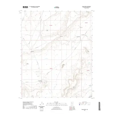
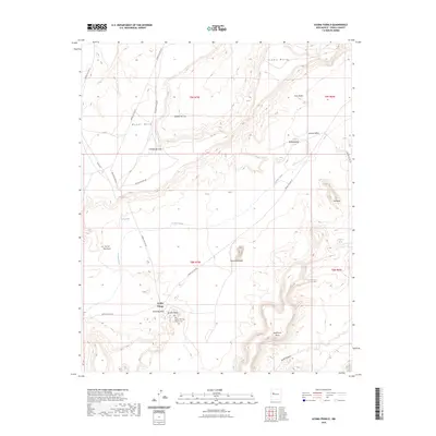
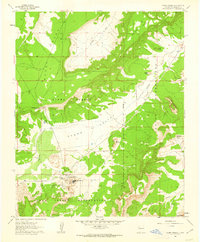 1961 Acoma Pueblo1963 Print · USGSThe ancient community of Acoma Pueblo is documented in the early 1960s, showing the settlement and its surrounding mesa landscape. Researchers can trace the proximity of Acoma Village to landmarks like Mesa Encantada and Dinosaur Rock.2 unique versions available
 - 1962 Map of Socorro
 1962 Socorro1962 Print · USGSCentral New Mexico comes alive in the early sixties as the rail-and-river corridor of the Rio Grande connects historic pueblos and ranching towns. Local historians can trace the route of the Atchison Topeka and Santa Fe through Belen or locate the Torrance Mine near Mountainair.
 - 1978 Map of Acoma Pueblo, 1979 Print
 1978 Acoma Pueblo1979 Print · USGSCibola and Valencia counties are captured here in the late seventies, showing a landscape of ancient pueblos and modern transit corridors. Genealogists and historians can trace the paths of U.S. 66 and the Atchison Topeka and Santa Fe RR past Acoma Pueblo and Suwanee.
 - 2010 Map of Acoma Pueblo, 2010 Print
 2010 Acoma Pueblo2010 Print · USGSCovers Acoma Pueblo, including Cibola County, United States, and other nearby areas
 - 2013 Map of Acoma Pueblo, 2013 Print
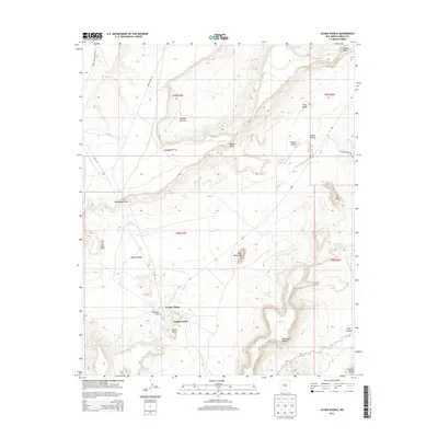 2013 Acoma Pueblo2013 Print · USGSCovers Acoma Pueblo, including Cibola County, United States, and other nearby areas
 - 2017 Map of Acoma Pueblo, 2017 Print
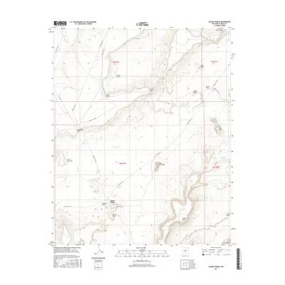 2017 Acoma Pueblo2017 Print · USGSCovers Acoma Pueblo, including Cibola County, United States, and other nearby areas
 - 2020 Map of Acoma Pueblo, 2020 Print
 2020 Acoma Pueblo2020 Print · USGSCovers Acoma Pueblo, including Cibola County, United States, and other nearby areas
 - 2023 Map of Acoma Pueblo, 2023 Print
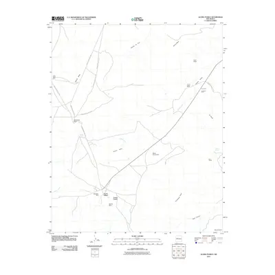
 2023 Acoma Pueblo2023 Print · USGSCibola County mesa country is captured in contemporary detail, showing the ancestral lands surrounding the iconic Acoma Village. Researchers can trace the proximity of the San Esteban Del Rey Mission Cem to landmarks like Mesa Encantada and Dinosaur Rock.
End of results
Showing maps 1-11 of 11
Top cities near Acoma Pueblo
Frequently asked questions
- What are the different types of historical maps available for Acoma Pueblo?
- What is the oldest map of Acoma Pueblo?
- Where can I purchase historical maps of Acoma Pueblo for my home or office?
- Where can I download high-res historical maps of Acoma Pueblo?
- Are there historical topographic maps available for Acoma Pueblo?
- Is there historical aerial imagery available for Acoma Pueblo?
- Where are historical maps of Acoma Pueblo sourced from?