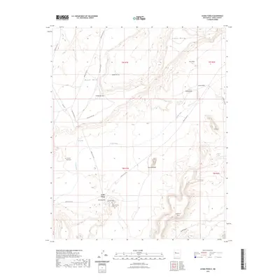
2023 Map of Acoma Pueblo
USGS Topo · Published 2023About this map
Acoma Village stands as a focal point of this cultural landscape, centered around the San Esteban Del Rey Mission Cem and the towering formation of Acoma Rock. The map illustrates a high-desert environment defined by massive mesa systems and distinctive rock features, including the famous Mesa Encantada and the oddly named Dinosaur Rock. The terrain is deeply sculpted by drainages like Acoma Creek and Cañada de Cruz, which separate elevated plateaus such as Woods Mesa and Seama Mesa.
Find a feature on this map
30 named features on this map. Tap any name to fly to it.
Don’t see what you’re looking for? This feature index may not catch every label — zoom into the map to look around manually.
Map Details
Editions of this 2023 Acoma Pueblo Map
This is the sole edition of this map. No revisions or reprints were ever made.
Other maps of this area

1883 · Mt. Taylor
USGS Topo · 1:250,000

1886 · Mt. Taylor
USGS Topo · 1:250,000

1892 · Mt. Taylor
USGS Topo · 1:250,000

1899 · Mt. Taylor
USGS Topo · 1:250,000

1917 · Cerro Verde
USGS Topo · 1:125,000

1917 · Broom Mountain
USGS Topo · 1:125,000

1954 · Socorro
USGS Topo · 1:250,000

1957 · Laguna
USGS Topo · 1:24,000

1957 · Mc Cartys
USGS Topo · 1:24,000

1957 · Cubero
USGS Topo · 1:24,000