Old Maps of Banning Place, New Mexico for Academic Research
Study the evolution of Banning Place with 11 high-resolution historic maps. Whether you're teaching, researching, or modeling changes in land use, these maps provide essential visual documentation of urban, environmental, and geographic change.
- Analyze long-term change: Track patterns in development, transportation, and natural features.
- Ideal for environmental or urban studies: Support academic projects with primary historical map data.
- Use in the classroom or lab: Educators and researchers rely on these maps to bring historical context to life.
These maps are a powerful tool for teaching, research, and visualizing how Banning Place has changed over the decades.
Banning Place, NM maps
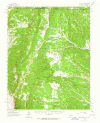
(11)- 1954 Map of Raton, 1963 Print
 1954 Raton1963 Print · USGSNorthern New Mexico's high-country and plains are documented here in the early sixties, showing the region's ranching and mining infrastructure. Trace the legacy of the Maxwell Land Grant, locate remote rural sites like Tafoya School, and follow the Atchison Topeka and Santa Fe Railway through the heart of Raton.3 unique versions available
 - 1958 Map of Raton
 1958 Raton1958 Print · USGSNorthern New Mexico and the Colorado borderlands are mapped here in the late fifties, showcasing a landscape of high peaks and historic land grants. Genealogists and historians can trace families across Picuris Pueblo, find old schoolhouses like Piedra Lumbre School, or follow the Atchison Topeka and Santa Fe rail line.3 unique versions available
 - 1962 Map of Ash Mountain, 1964 Print
 1962 Ash Mountain1964 Print · USGSThe Sangre de Cristo Mountains and the historic Maxwell Land Grant are captured here in the early sixties. Researchers can trace high-altitude ranching and mining history through sites like the Van Lint Mine, Penatlor Ruins, and family-named landmarks like Banning Place.3 unique versions available
 - 1982 Map of Wheeler Peak, 1983 Print
 1982 Wheeler Peak1983 Print · USGSNorthern New Mexico in the early eighties shows a high-altitude landscape of historic mining camps and massive land grants. Researchers can trace the Old Railroad Grade near Elizabethtown or locate remote sites like the French-Henry Mine and Vermejo Park.
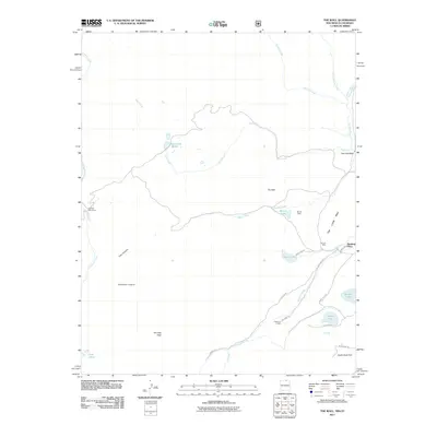
 - 1986 Map of The Wall
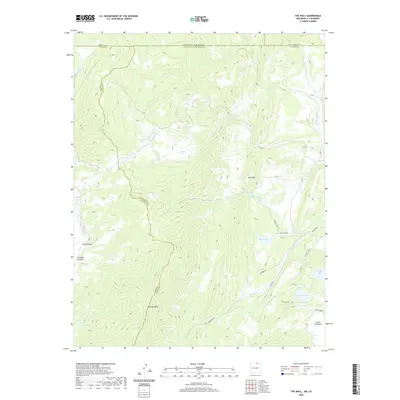
 1986 The Wall1986 Print · USGSThe Sangre de Cristo high country on the Colorado-New Mexico border is captured here in the mid-1980s, documenting the remote land grants and watersheds of Colfax County. Researchers can trace historic mining and land use through the Van Lint Mine, a lone Cemetery, and high-altitude water sources like Underwood Lakes and Bernal Lake.
 - 1995 Map of The Wall, 1997 Print
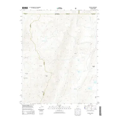
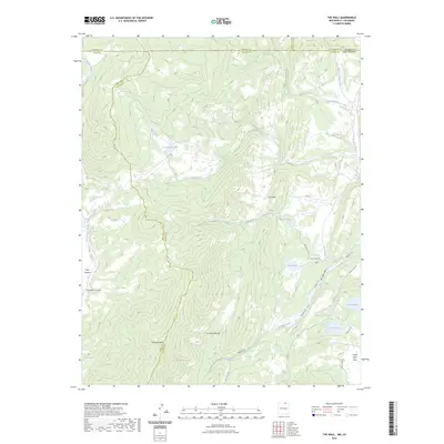
 1995 The Wall1997 Print · USGSNorthern New Mexico and the Colorado borderland are shown in the mid-nineties, featuring the intersection of historic land grants and national forest. Researchers can trace remote mountain outposts like Bernal Cabin, the Van Diest Mine, and landmarks like Vermejo Peak.
 - 2011 Map of The Wall, 2011 Print
 2011 The Wall2011 Print · USGSCovers Banning Place, including Taos County, Las Animas County, and other nearby areas
 - 2013 Map of The Wall, 2013 Print
 2013 The Wall2013 Print · USGSCovers Banning Place, including Taos County, Las Animas County, and other nearby areas
 - 2017 Map of The Wall, 2017 Print
 2017 The Wall2017 Print · USGSCovers Banning Place, including Taos County, Las Animas County, and other nearby areas
 - 2020 Map of The Wall, 2020 Print
 2020 The Wall2020 Print · USGSCovers Banning Place, including Taos County, Las Animas County, and other nearby areas
 - 2023 Map of The Wall, 2023 Print
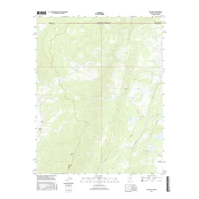
 2023 The Wall2023 Print · USGSThe high alpine country of the Culebra Range stands at the New Mexico-Colorado border in this modern survey. Researchers can trace remote routes like Leandro Rd to high-altitude landmarks including Vermejo Peak, The Wall, and Munn Lake.
End of results
Showing maps 1-11 of 11
Frequently asked questions
- What are the different types of historical maps available for Banning Place?
- What is the oldest map of Banning Place?
- Where can I purchase historical maps of Banning Place for my home or office?
- Where can I download high-res historical maps of Banning Place?
- Are there historical topographic maps available for Banning Place?
- Is there historical aerial imagery available for Banning Place?
- Where are historical maps of Banning Place sourced from?