Old Maps of Casa Grande, New Mexico for Academic Research
Study the evolution of Casa Grande with 10 high-resolution historic maps. Whether you're teaching, researching, or modeling changes in land use, these maps provide essential visual documentation of urban, environmental, and geographic change.
- Analyze long-term change: Track patterns in development, transportation, and natural features.
- Ideal for environmental or urban studies: Support academic projects with primary historical map data.
- Use in the classroom or lab: Educators and researchers rely on these maps to bring historical context to life.
These maps are a powerful tool for teaching, research, and visualizing how Casa Grande has changed over the decades.
Casa Grande, NM maps
(10)- 1954 Map of Raton, 1963 Print
 1954 Raton1963 Print · USGSNorthern New Mexico's high-country and plains are documented here in the early sixties, showing the region's ranching and mining infrastructure. Trace the legacy of the Maxwell Land Grant, locate remote rural sites like Tafoya School, and follow the Atchison Topeka and Santa Fe Railway through the heart of Raton.3 unique versions available
 - 1958 Map of Raton
 1958 Raton1958 Print · USGSNorthern New Mexico and the Colorado borderlands are mapped here in the late fifties, showcasing a landscape of high peaks and historic land grants. Genealogists and historians can trace families across Picuris Pueblo, find old schoolhouses like Piedra Lumbre School, or follow the Atchison Topeka and Santa Fe rail line.3 unique versions available
 - 1962 Map of Casa Grande, 1965 Print
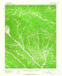 1962 Casa Grande1965 Print · USGSThe Maxwell land grant area of Colfax County is shown in the early sixties as a rugged network of ranching camps and old timber routes. Researchers can locate the Catskill (Site), trace the Old Railroad Grade, and find historic Charcoal Kilns.2 unique versions available
 - 1981 Map of Raton
 1981 Raton1981 Print · USGSNorthern New Mexico's high mesas and mining corridors are preserved here as they appeared in the early eighties. Genealogists and historians can trace the transit networks of the Santa Fe Trail and find company towns like Van Houten and Koehler.
 - 1986 Map of Casa Grande
 1986 Casa Grande1986 Print · USGSColfax County in the mid-1980s reveals a high-country landscape shaped by the historic Maxwell Land Grant and deep-canyon coal mining. Researchers can trace the Old Railroad Grade and locate mining operations near Casa Grande and York Canyon.
 - 2010 Map of Casa Grande, 2010 Print
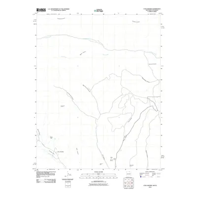 2010 Casa Grande2010 Print · USGSCovers Casa Grande, including Las Animas County, Colfax County, and other nearby areas
 - 2013 Map of Casa Grande, 2013 Print
 2013 Casa Grande2013 Print · USGSCovers Casa Grande, including Las Animas County, Colfax County, and other nearby areas
 - 2017 Map of Casa Grande, 2017 Print
 2017 Casa Grande2017 Print · USGSCovers Casa Grande, including Las Animas County, Colfax County, and other nearby areas
 - 2020 Map of Casa Grande, 2020 Print
 2020 Casa Grande2020 Print · USGSCovers Casa Grande, including Las Animas County, Colfax County, and other nearby areas
 - 2023 Map of Casa Grande, 2023 Print
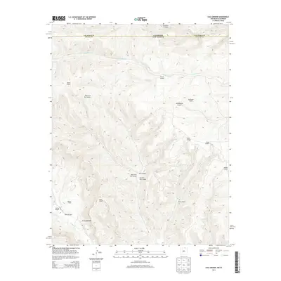
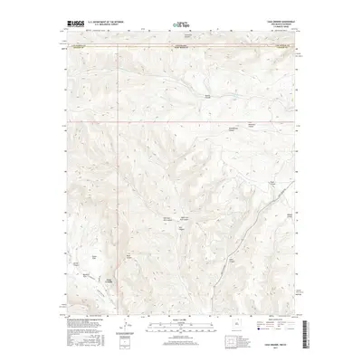
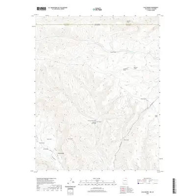
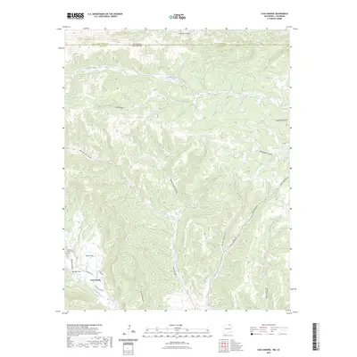 2023 Casa Grande2023 Print · USGSThe high country of Colfax County near the Colorado border remains a landscape of deep canyons and high mesas in this 2023 survey. You can trace the winding roads through Butler Flats or follow the remote Canadian River as it cuts across the state line near Casa Grande.
End of results
Showing maps 1-10 of 10
Frequently asked questions
- What are the different types of historical maps available for Casa Grande?
- What is the oldest map of Casa Grande?
- Where can I purchase historical maps of Casa Grande for my home or office?
- Where can I download high-res historical maps of Casa Grande?
- Are there historical topographic maps available for Casa Grande?
- Is there historical aerial imagery available for Casa Grande?
- Where are historical maps of Casa Grande sourced from?