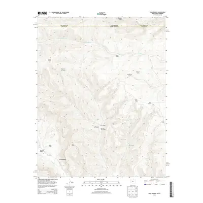
2013 Map of Casa Grande
USGS Topo · Published 2013About this map
Casa Grande and the neighboring headquarters of Vermejo Park anchor this high-altitude landscape where the headwaters of the Vermejo River and Canadian River carve through the Southern Rockies. The topography is defined by a dense network of drainages, including Stubblefield Canyon, Penitente Canyon, and the distinct York Canyon with its various forks. Along the southwest, Butler Flats provides a rare level opening among the steep ridges. The map captures a moment of modern land management in this remote section of Colfax County, showing the intersection of private parklands and historic ranching territory near the Colorado New Mexico border. Transportation is sparse, primarily limited to corridors like Vermejo Rd that follow the natural contours of the valley floors between rising peaks and canyon walls.
Find a feature on this map
21 named features on this map. Tap any name to fly to it.
Don’t see what you’re looking for? This feature index may not catch every label — zoom into the map to look around manually.
Map Details
Editions of this 2013 Casa Grande Map
This is the sole edition of this map. No revisions or reprints were ever made.
Other maps of this area

1891 · Spanish Peaks
USGS Topo · 1:125,000

1893 · Spanish Peaks
USGS Topo · 1:125,000

1895 · Spanish Peaks
USGS Topo · 1:125,000

1897 · Spanish Peaks
USGS Topo · 1:125,000

1900 · Spanish Peaks
USGS Topo · 1:125,000

1954 · Raton
USGS Topo · 1:250,000

1954 · Trinidad
USGS Topo · 1:250,000

1955 · Trinidad
USGS Topo · 1:250,000

1958 · Raton
USGS Topo · 1:250,000

1958 · Trinidad
USGS Topo · 1:250,000