1900s (20th Century) Maps of Eagle Nest, New Mexico
Explore 7 historic maps of Eagle Nest from the 1900s (20th Century). These maps offer a rare glimpse into what life looked like during the 1900s — showing old roads, neighborhoods, homes, and landmarks that have changed or disappeared over time.
Whether you're researching your family's past, planning a metal detecting trip, or studying how Eagle Nest's landscape evolved across the 1900s, these high-resolution maps are a powerful tool for exploring the history of this region.
- Focus on a specific era: All maps on this page are from the 1900s, giving you a focused view of this time period.
- See what’s changed: Compare century-old streets, trails, and buildings to today's modern landscape using overlays and satellite layers.
- Research with precision: Use these maps for genealogy, historical research, land use analysis, or educational projects.
- View, download, or print: Maps are fully viewable online in high resolution, and can be downloaded or printed for your own records.
Start exploring Eagle Nest's history through authentic maps from the 1900s. This is your window into the past.
Eagle Nest, NM maps
(7)- 1954 Map of Raton, 1963 Print
 1954 Raton1963 Print · USGSNorthern New Mexico's high-country and plains are documented here in the early sixties, showing the region's ranching and mining infrastructure. Trace the legacy of the Maxwell Land Grant, locate remote rural sites like Tafoya School, and follow the Atchison Topeka and Santa Fe Railway through the heart of Raton.3 unique versions available
 - 1955 Map of Ute Park, 1957 Print
 1955 Ute Park1957 Print · USGSColfax County in the mid-1950s shows a landscape of storied land grants and high-country mining. You can trace the legacy of the Maxwell Grant and locate old workings at the Aztec Mine or the historic Virginia City site.5 unique versions available
 - 1958 Map of Raton
 1958 Raton1958 Print · USGSNorthern New Mexico and the Colorado borderlands are mapped here in the late fifties, showcasing a landscape of high peaks and historic land grants. Genealogists and historians can trace families across Picuris Pueblo, find old schoolhouses like Piedra Lumbre School, or follow the Atchison Topeka and Santa Fe rail line.3 unique versions available
 - 1963 Map of Eagle Nest, 1967 Print
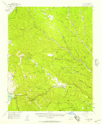
 1963 Eagle Nest1967 Print · USGSThe Moreno Valley and the Sangre de Cristo high country come into focus during the early sixties, centered on the waters of Eagle Nest Lake. Local historians can trace the Maxwell Grant boundaries and find remote sites like the Klondike Mine and Idlewild.3 unique versions available
 - 1982 Map of Wheeler Peak, 1983 Print
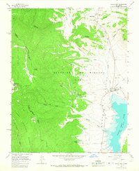
 1982 Wheeler Peak1983 Print · USGSNorthern New Mexico in the early eighties shows a high-altitude landscape of historic mining camps and massive land grants. Researchers can trace the Old Railroad Grade near Elizabethtown or locate remote sites like the French-Henry Mine and Vermejo Park.
 - 1987 Map of Touch-Me-Not Mountain
 1987 Touch-Me-Not Mountain1987 Print · USGSThe high Sangre de Cristo foothills of Colfax County appear in the late eighties as a landscape of scouting tradition and mining history. Trace the trails between Philmont Scout Ranch outposts like Ewells Park Camp or locate the site of Virginia City and the Horseshoe Mine.
 - 1995 Map of Eagle Nest, 1997 Print
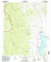 1995 Eagle Nest1997 Print · USGSThe Moreno Valley comes into focus during the mid-nineties, showing the intersection of historic land grants and high-country wilderness. Trace the remnants of the gold-mining era at Elizabethtown or the Klondike Mine while exploring the shores of Eagle Nest Lake.
End of results
Showing maps 1-7 of 7
Top cities near Eagle Nest
Top neighborhoods of Eagle Nest
Frequently asked questions
- What are the different types of historical maps available for Eagle Nest?
- What is the oldest map of Eagle Nest?
- Where can I purchase historical maps of Eagle Nest for my home or office?
- Where can I download high-res historical maps of Eagle Nest?
- Are there historical topographic maps available for Eagle Nest?
- Is there historical aerial imagery available for Eagle Nest?
- Where are historical maps of Eagle Nest sourced from?