1970s Maps of Raton, New Mexico
Explore 2 historic maps of Raton from the 1970s. These maps offer a rare glimpse into what life looked like during the 1970s — showing old roads, neighborhoods, homes, and landmarks that have changed or disappeared over time.
Whether you're researching your family's past, planning a metal detecting trip, or studying how Raton's landscape evolved across the 1970s, these high-resolution maps are a powerful tool for exploring the history of this region.
- Focus on a specific era: All maps on this page are from the 1970s, giving you a focused view of this time period.
- See what’s changed: Compare century-old streets, trails, and buildings to today's modern landscape using overlays and satellite layers.
- Research with precision: Use these maps for genealogy, historical research, land use analysis, or educational projects.
- View, download, or print: Maps are fully viewable online in high resolution, and can be downloaded or printed for your own records.
Start exploring Raton's history through authentic maps from the 1970s. This is your window into the past.
Raton, NM maps
(2)- 1971 Map of Clifton House, 1974 Print
 1971 Clifton House1974 Print · USGSColfax County's high plains are revealed here in the early 1970s, showing the intersection of frontier history and modern transport. Researchers can trace the Old Santa Fe Trail past the Clifton House site and along the Canadian River.
 - 1971 Map of Raton, 1974 Print
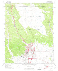 1971 Raton1974 Print · USGSRaton stood as a vital mountain transit hub in the early seventies, marking the high-altitude transition between New Mexico and Colorado. Genealogists and historians can trace the intersection of the Santa Fe Trail with coal-era landmarks like the Coke Ovens at Gardiner and Blossburg.
End of results
Showing maps 1-2 of 2
Frequently asked questions
- What are the different types of historical maps available for Raton?
- What is the oldest map of Raton?
- Where can I purchase historical maps of Raton for my home or office?
- Where can I download high-res historical maps of Raton?
- Are there historical topographic maps available for Raton?
- Is there historical aerial imagery available for Raton?
- Where are historical maps of Raton sourced from?