Old Maps of Hachita, New Mexico for Academic Research
Study the evolution of Hachita with 12 high-resolution historic maps. Whether you're teaching, researching, or modeling changes in land use, these maps provide essential visual documentation of urban, environmental, and geographic change.
- Analyze long-term change: Track patterns in development, transportation, and natural features.
- Ideal for environmental or urban studies: Support academic projects with primary historical map data.
- Use in the classroom or lab: Educators and researchers rely on these maps to bring historical context to life.
These maps are a powerful tool for teaching, research, and visualizing how Hachita has changed over the decades.
Hachita, NM maps
(12)- 1918 Map of Hachita
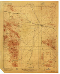 1918 Hachita1918 Print · USGSIn the southwestern New Mexico desert during the Great War, the rail hub at Hachita connected vital mining and ranching interests. Trace the early mining camps of Old Hachita and Sylvanite, or follow the Hueco Alamo Road to the remote Twelvemile Wells.4 unique versions available
 - 1955 Map of Douglas
 1955 Douglas1955 Print · USGSThe Arizona and New Mexico borderlands come into focus in the mid-1950s, highlighting the mining and ranching hubs of the Desert Southwest. Genealogists and historians can trace the foundations of Bisbee, the operations at Hachita Mine, and rural landmarks like the Double Adobe School.2 unique versions available
 - 1959 Map of Douglas, 1968 Print
 1959 Douglas1968 Print · USGSSoutheast Arizona and southwest New Mexico meet at the border in the late fifties, showcasing a high-desert landscape defined by industrial copper mining and ranching. Genealogists and historians can trace the foundations of Bisbee, locate the Lavender Pit, and follow the Southern Pacific line through Douglas.4 unique versions available
 - 1961 Map of Douglas
 1961 Douglas1961 Print · USGSThe Arizona-Mexico borderlands come into focus at mid-century, detailing the vital mining and ranching hubs of Cochise County and southwest New Mexico. Genealogists and historians can trace the Southern Pacific Railroad through Bisbee and Douglas, or locate early sites like the Old Hachita Mine and Rucker School.
 - 1964 Map of Douglas
 1964 Douglas1964 Print · USGSThe Arizona-New Mexico borderlands in the early sixties reveal a landscape of deep-rooted copper mining and high-desert ranching. Genealogists and researchers can trace the legacy of settlements like Pirtleville, the industrial site of the Copper Smelter, and remnants of the Cochise Mines.
 - 1982 Map of Hachita
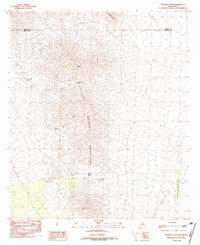 1982 Hachita1982 Print · USGSIn the early eighties, this desert landscape along the Grant and Hidalgo county line reveals a history of mining and exploration. Researchers can trace historic activity through the Mine Shaft and Prospects found near Hachita Peak and Stone Cabin Gulch.2 unique versions available
 - 1983 Map of Animas
 1983 Animas1983 Print · USGSSouthern New Mexico’s Bootheel remains a landscape of high-desert ranching and remote mining districts during the early eighties. Researchers can trace the Southern Pacific Railroad past historic hubs like Animas and Hachita or locate mining sites such as the Gillespie Mine.
 - 2010 Map of Hachita, 2010 Print
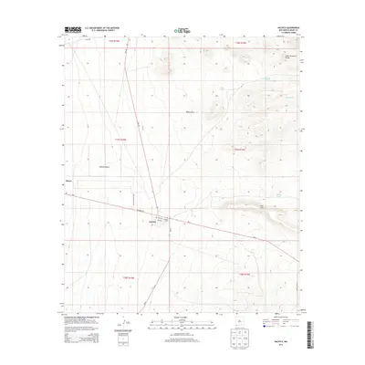
 2010 Hachita2010 Print · USGSCovers Hachita, including Grant County, United States, and other nearby areas
 - 2013 Map of Hachita, 2013 Print
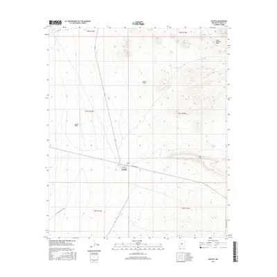
 2013 Hachita2013 Print · USGSCovers Hachita, including Grant County, United States, and other nearby areas
 - 2017 Map of Hachita, 2017 Print
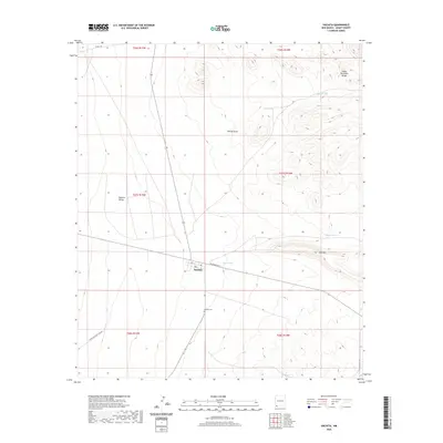
 2017 Hachita2017 Print · USGSCovers Hachita, including Grant County, United States, and other nearby areas
 - 2020 Map of Hachita, 2020 Print
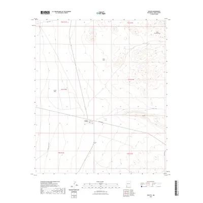
 2020 Hachita2020 Print · USGSCovers Hachita, including Grant County, United States, and other nearby areas
 - 2023 Map of Hachita, 2023 Print
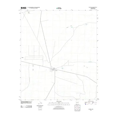
 2023 Hachita2023 Print · USGSHachita and the surrounding high desert of Grant County are captured here in the modern era. Genealogists and local historians can trace the town’s layout along Railroad Ave and locate the Hachita Cem south of the settlement.
End of results
Showing maps 1-12 of 12
Frequently asked questions
- What are the different types of historical maps available for Hachita?
- What is the oldest map of Hachita?
- Where can I purchase historical maps of Hachita for my home or office?
- Where can I download high-res historical maps of Hachita?
- Are there historical topographic maps available for Hachita?
- Is there historical aerial imagery available for Hachita?
- Where are historical maps of Hachita sourced from?