Old Maps of Harden Cienega, New Mexico for Academic Research
Study the evolution of Harden Cienega with 16 high-resolution historic maps. Whether you're teaching, researching, or modeling changes in land use, these maps provide essential visual documentation of urban, environmental, and geographic change.
- Analyze long-term change: Track patterns in development, transportation, and natural features.
- Ideal for environmental or urban studies: Support academic projects with primary historical map data.
- Use in the classroom or lab: Educators and researchers rely on these maps to bring historical context to life.
These maps are a powerful tool for teaching, research, and visualizing how Harden Cienega has changed over the decades.
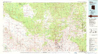
Harden Cienega, NM maps
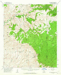
(16)- 1913 Map of Morenci, 1954 Print
 1913 Morenci1954 Print · USGSArizona's copper country and high timberlands meet in this pre-war survey of the Morenci district and Apache National Forest. Researchers can trace the early industrial footprint of Morenci and Clifton or find family landmarks like Miller Cabin and Cooks Ranch.2 unique versions available
 - 1915 Map of Morenci
 1915 Morenci1915 Print · USGSGreenlee County during the early 1900s shows a landscape defined by industrial copper mining and isolated high-desert ranching. Genealogists and historians can trace family locations from the Eagle Creek School to historic homesteads like Dudley Ranch and the settlement of Oroville.3 unique versions available
 - 1954 Map of Clifton, 1968 Print
 1954 Clifton1968 Print · USGSThe high timber and copper country of the Arizona-New Mexico border is captured here during the mid-fifties. Genealogists and historians can trace family holdings like the Double Circle Ranch or study the industrial footprint of the Smelting Plant at Clifton.3 unique versions available
 - 1957 Map of Clifton
 1957 Clifton1957 Print · USGSThe copper-mining district around Clifton and Morenci meets the high timberlands of the Mogollon Rim during the mid-1950s. Genealogists and researchers can trace family-named outposts and remote mountain settlements like Reserve, Stargo, and Fort Thomas.
 - 1958 Map of Clifton
 1958 Clifton1958 Print · USGSThe rugged high country of the Arizona-New Mexico border comes into focus in the mid-fifties, showing a landscape of mining camps and forest outposts. Genealogists and researchers can trace old settlements and remote sites like Mogollon, East Fork Mission, and the Tidwell Mine.
 - 1962 Map of Clifton
 1962 Clifton1962 Print · USGSThe copper-rich Arizona-New Mexico borderlands come into focus in the early sixties, centered on the mining complexes of Morenci and Clifton. Researchers can trace the Southern Pacific rail lines and locate remote outposts like Honeymoon and the Double Circle Ranch.
 - 1962 Map of Big Lue Mts, 1964 Print
 1962 Big Lue Mts1964 Print · USGSThe Arizona and New Mexico borderlands come to life in this early 1960s survey of the high mesas and deep river canyons. Genealogists and researchers can trace isolated homesteads like Martinez Ranch and historic landmarks like the Cliff Dwelling or Black Jack Cave.2 unique versions available
 - 1986 Map of Clifton, 1987 Print
 1986 Clifton1987 Print · USGSArizona's copper country and the rugged borderlands come into sharp focus in the mid-1980s. Researchers can trace the massive Morenci Open Pit and its rail connections to Clifton, alongside remote outposts like Point of Pines and Fort Thomas.2 unique versions available
 - 1989 Map of Harden Cienega, 1990 Print
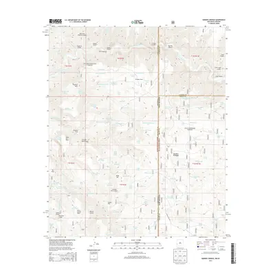
 1989 Harden Cienega1990 Print · USGSThe Arizona and New Mexico borderlands come alive in the late eighties, showing a landscape defined by forest boundaries and high mesas. Researchers can trace the winding Harden Cienega Road and locate remote water sources like Indian Cave Spring and Rock Spring.
 - 1998 Map of Harden Cienega, 2000 Print
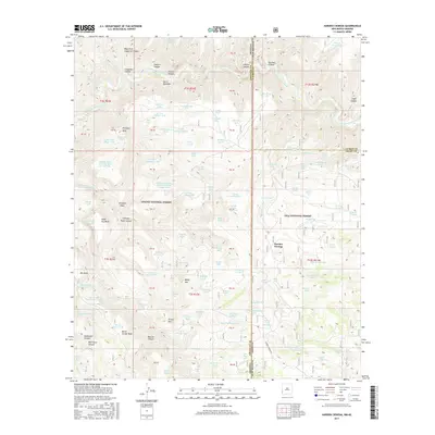
 1998 Harden Cienega2000 Print · USGSThe high-desert borderlands of Arizona and New Mexico come to life in this late-nineties survey of the Apache National Forest. Researchers can locate specialized ranching infrastructure like the Horse Range Corral and family-named landmarks such as Coalson Spring.
 - 2005 Map of Harden Cienega, 2006 Print
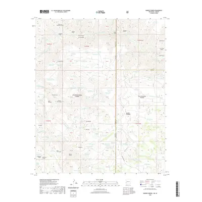
 2005 Harden Cienega2006 Print · USGSThe high borderlands of Grant and Catron Counties are captured here in the early 2000s, where the Arizona state line meets the national forests. Researchers can trace the ranching history of this high-elevation landscape through landmarks like Harden Cienega, Chimney Rock, and the Arizona Antelope Corral.
 - 2011 Map of Harden Cienega, 2011 Print
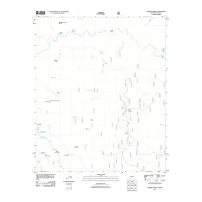 2011 Harden Cienega2011 Print · USGSCovers Harden Cienega, including Grant County, Greenlee County, and other nearby areas
 - 2013 Map of Harden Cienega, 2013 Print
 2013 Harden Cienega2013 Print · USGSCovers Harden Cienega, including Grant County, Greenlee County, and other nearby areas
 - 2017 Map of Harden Cienega, 2017 Print
 2017 Harden Cienega2017 Print · USGSCovers Harden Cienega, including Grant County, Greenlee County, and other nearby areas
 - 2020 Map of Harden Cienega, 2020 Print
 2020 Harden Cienega2020 Print · USGSCovers Harden Cienega, including Grant County, Greenlee County, and other nearby areas
 - 2023 Map of Harden Cienega, 2023 Print
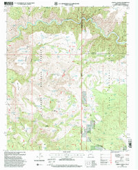
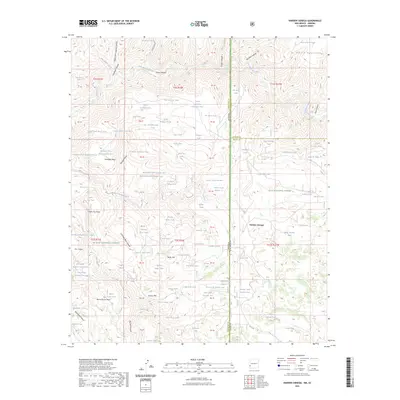 2023 Harden Cienega2023 Print · USGSThe Arizona and New Mexico borderlands come alive in this recent survey of the Gila and Apache National Forests. Researchers can trace land use patterns through dozens of cattle tanks and remote landmarks like Baldy Mtn, Table Top Mesa, and Harden Cienega Creek.
End of results
Showing maps 1-16 of 16
Top cities near Harden Cienega
Frequently asked questions
- What are the different types of historical maps available for Harden Cienega?
- What is the oldest map of Harden Cienega?
- Where can I purchase historical maps of Harden Cienega for my home or office?
- Where can I download high-res historical maps of Harden Cienega?
- Are there historical topographic maps available for Harden Cienega?
- Is there historical aerial imagery available for Harden Cienega?
- Where are historical maps of Harden Cienega sourced from?