
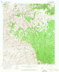
1962 Map of Big Lue Mts
USGS Topo · Published 1964About this map
The San Francisco River and Blue River converge in this 1960s survey of the high desert and mountain borderlands where Arizona meets New Mexico. This region is defined by deep drainages and sprawling plateaus, including High Mesa and Antelope Mesa, which rise between the canyon floors and mountain peaks. Human presence in this environment is marked by early Cliff Dwelling sites and established homesteads such as Martinez Ranch and Big Lue Ranch. The landscape reflects a legacy of ranching and early exploration within the Apache National Forest and Gila National Forest.
Find a feature on this map
124 named features on this map. Tap any name to fly to it.
Don’t see what you’re looking for? This feature index may not catch every label — zoom into the map to look around manually.
Map Details
Editions of this 1962 Big Lue Mts Map
2 editions found
Other maps of this area

1902 · Clifton
USGS Topo · 1:62,500

1910 · Mogollon
USGS Topo · 1:125,000

1912 · Mogollon
USGS Topo · 1:125,000

1913 · Morenci
USGS Topo · 1:125,000

1915 · Morenci
USGS Topo · 1:125,000

1954 · Silver City
USGS Topo · 1:250,000

1954 · Clifton
USGS Topo · 1:250,000

1957 · Clifton
USGS Topo · 1:250,000

1958 · Silver City
USGS Topo · 1:250,000

1958 · Clifton
USGS Topo · 1:250,000