Old Maps of Andrews Place, New Mexico for Academic Research
Study the evolution of Andrews Place with 9 high-resolution historic maps. Whether you're teaching, researching, or modeling changes in land use, these maps provide essential visual documentation of urban, environmental, and geographic change.
- Analyze long-term change: Track patterns in development, transportation, and natural features.
- Ideal for environmental or urban studies: Support academic projects with primary historical map data.
- Use in the classroom or lab: Educators and researchers rely on these maps to bring historical context to life.
These maps are a powerful tool for teaching, research, and visualizing how Andrews Place has changed over the decades.
Andrews Place, NM maps
(9)- 1954 Map of Hobbs, 1963 Print
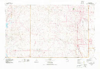
 1954 Hobbs1963 Print · USGSThe High Plains and Permian Basin transition is captured here at the height of the mid-century energy boom. Genealogists and industrial historians can trace the foundations of Humble City, locate the Potash Mine and Plant, and follow the Texas-New Mexico RR.2 unique versions available
 - 1958 Map of Hobbs
 1958 Hobbs1958 Print · USGSThe High Plains of the Texas-New Mexico border are shown here during the height of the mid-century oil boom. Genealogists and historians can trace the development of Hobbs, Lovington, and Jal, alongside ranching landmarks like James Ranch and the early Texas-New Mexico Railway.
 - 1973 Map of Andrews Place, 1976 Print
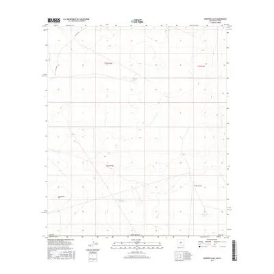
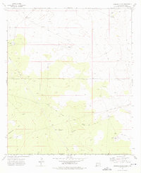 1973 Andrews Place1976 Print · USGSThe high plains of the New Mexico and Texas border come into focus during the early 1970s, showing a landscape of ranching and energy extraction. Researchers can trace the layout of the Diamond and a Half Ranch, remote water sources like Hardin Tank, and an extensive network of pipelines.
 - 1978 Map of Jal, 1979 Print
 1978 Jal1979 Print · USGSSoutheast New Mexico in the late seventies is a landscape shaped by energy production and the rugged Llano Estacado. Genealogists and industrial historians can trace the growth of Jal and Eunice along the Texas-New Mexico RR and across the Jal Oil Field.
 - 2010 Map of Andrews Place, 2010 Print
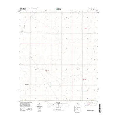
 2010 Andrews Place2010 Print · USGSCovers Andrews Place, including Lea County, Loving County, and other nearby areas
 - 2013 Map of Andrews Place, 2013 Print
 2013 Andrews Place2013 Print · USGSCovers Andrews Place, including Lea County, Loving County, and other nearby areas
 - 2017 Map of Andrews Place, 2017 Print
 2017 Andrews Place2017 Print · USGSCovers Andrews Place, including Lea County, Loving County, and other nearby areas
 - 2020 Map of Andrews Place, 2020 Print
 2020 Andrews Place2020 Print · USGSCovers Andrews Place, including Lea County, Loving County, and other nearby areas
 - 2023 Map of Andrews Place, 2023 Print
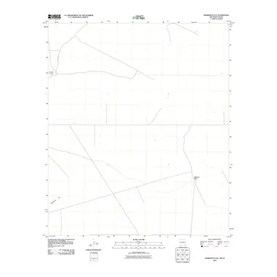
 2023 Andrews Place2023 Print · USGSLea County at the turn of the decade presents a landscape of industrial potential and wide-open desert. Landowners and researchers can trace township boundaries and navigate the sparse road network through Rattlesnake Flat via Battle Axe Rd and Co Rd 2.
End of results
Showing maps 1-9 of 9
Top cities near Andrews Place
Frequently asked questions
- What are the different types of historical maps available for Andrews Place?
- What is the oldest map of Andrews Place?
- Where can I purchase historical maps of Andrews Place for my home or office?
- Where can I download high-res historical maps of Andrews Place?
- Are there historical topographic maps available for Andrews Place?
- Is there historical aerial imagery available for Andrews Place?
- Where are historical maps of Andrews Place sourced from?