Old Maps of Corona, New Mexico
Explore 16 old maps of Corona, spanning from 1954 to today. These high-resolution historic maps reveal how streets, neighborhoods, landmarks, and natural features evolved over time — perfect for genealogy, metal detecting, research, and local history exploration.
What you can do with these maps:
- See how Corona changed over time: Compare historical maps to modern-day views to trace roads, homesites, rail lines & more.
- View detailed metadata: Each map includes creators, publishers, year, scale, and archive source.
- Overlay maps with satellite & LiDAR: Visualize the past alongside modern tools to explore terrain & human change.
- Trusted historical sources: Maps sourced from the USGS, Library of Congress, and other archives.
- Access maps your way: View online, download high-res files, or order prints for personal or research use.
Start exploring old maps of Corona to uncover forgotten places, hidden landmarks, and the deep history beneath your feet.
Corona, NM maps
(16)- 1954 Map of Fort Sumner, 1964 Print
 1954 Fort Sumner1964 Print · USGSEast-central New Mexico's ranching and rail heartland is captured here in the mid-1950s, centered on the strategic junctions of the high plains. Researchers can trace the development of early highway networks and rail towns like Vaughn, Fort Sumner, and the copper operations at Guadalupe Mine.3 unique versions available
 - 1958 Map of Fort Sumner
 1958 Fort Sumner1958 Print · USGSEast-central New Mexico in the mid-fifties is captured here as a sprawling landscape of high mesas and cattle ranching. Researchers can trace the convergence of the Southern Pacific railroad at Vaughn and locate family landmarks like Borica School or Marquez Ranch.
 - 1980 Map of Corona, 1981 Print
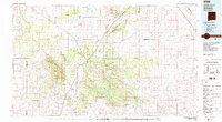 1980 Corona1981 Print · USGSThe high-desert ranching and rail country of Lincoln County is documented here during the early eighties. Genealogists and local historians can trace the Southern Pacific line through Corona, locate the Old Railroad Grade, and find remote outposts like Claunch and Gallinas.
 - 1981 Map of Corona South
 1981 Corona South1981 Print · USGSThe high mesas of Lincoln County are captured in the early 1980s, centered on the railroad town of Corona. Researchers can trace the Southern Pacific rail line and locate local landmarks like the Cem, Simpson Tank, and Gallo Canyon.
 - 1981 Map of Corona North
 1981 Corona North1981 Print · USGSCentral New Mexico rail and ranching country comes into focus in the early 1980s, documenting the corridor between the settlements of Torrance and Corona. Genealogists and researchers can trace the Southern Pacific line, the Old Railroad Grade, and local landmarks like the Rodeo Ground.
 - 1995 Map of Corona North, 1998 Print
 1995 Corona North1998 Print · USGSHigh-desert ranching and rail history converge in central New Mexico during the 1990s. Researchers can trace family ranching sites like Brunson Ranch and follow the Southern Pacific tracks through Torrance and Corona.
 - 2010 Map of Corona South, 2010 Print
 2010 Corona South2010 Print · USGSCovers Corona, including Lincoln County, United States, and other nearby areas
 - 2011 Map of Corona North, 2011 Print
 2011 Corona North2011 Print · USGSCovers Corona, including Torrance, Varney, and other nearby areas
 - 2013 Map of Corona North, 2013 Print
 2013 Corona North2013 Print · USGSCovers Corona, including Torrance, Varney, and other nearby areas
 - 2013 Map of Corona South, 2013 Print
 2013 Corona South2013 Print · USGSCovers Corona, including Lincoln County, United States, and other nearby areas
 - 2017 Map of Corona North, 2017 Print
 2017 Corona North2017 Print · USGSCovers Corona, including Torrance, Varney, and other nearby areas
 - 2017 Map of Corona South, 2017 Print
 2017 Corona South2017 Print · USGSCovers Corona, including Lincoln County, United States, and other nearby areas
 - 2020 Map of Corona South, 2020 Print
 2020 Corona South2020 Print · USGSCovers Corona, including Lincoln County, United States, and other nearby areas
 - 2020 Map of Corona North, 2020 Print
 2020 Corona North2020 Print · USGSCovers Corona, including Torrance, Varney, and other nearby areas
 - 2023 Map of Corona North, 2023 Print
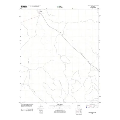
 2023 Corona North2023 Print · USGSTorrance and Lincoln counties meet in this 2023 survey of the New Mexico high desert near the settlement of Corona. Researchers can trace old cattle-country routes like Crow Bait Trl and Swayback Rd or locate the community of Varney.
 - 2023 Map of Corona South, 2023 Print
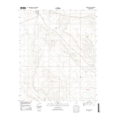
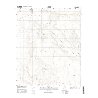
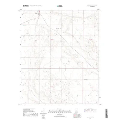
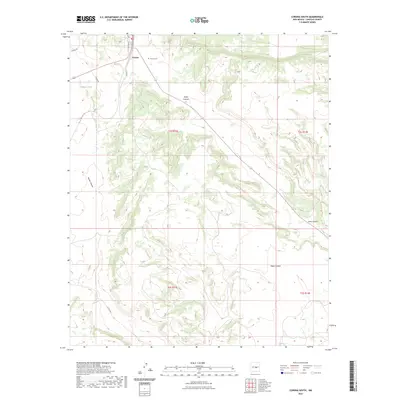 2023 Corona South2023 Print · USGSLincoln County’s high-desert ranching country is captured here in the contemporary era. Researchers can locate the Corona Cem near the town of Corona or trace geographical landmarks like Simpson Tank and the depths of Gallo Canyon.
End of results
Showing maps 1-16 of 16
Frequently asked questions
- What are the different types of historical maps available for Corona?
- What is the oldest map of Corona?
- Where can I purchase historical maps of Corona for my home or office?
- Where can I download high-res historical maps of Corona?
- Are there historical topographic maps available for Corona?
- Is there historical aerial imagery available for Corona?
- Where are historical maps of Corona sourced from?