Old Maps of Ramon, New Mexico for Genealogy
Trace your family roots with 9 historic maps of Ramon. These high-res maps reveal old neighborhoods, homesites, landmarks, and streets — helping you uncover where your ancestors lived and how the area evolved over time.
- Explore historic neighborhoods: Identify where your relatives may have lived in the 1800s or 1900s.
- Compare maps over time: Trace the changes in streets, buildings, and landmarks for multi-generational research.
- Perfect for genealogy & ancestry research: Used by family historians and researchers to map out lineage and migration.
These maps are an incredible resource for exploring your personal connection to Ramon's past.
Ramon, NM maps
(9)- 1954 Map of Fort Sumner, 1964 Print
 1954 Fort Sumner1964 Print · USGSEast-central New Mexico's ranching and rail heartland is captured here in the mid-1950s, centered on the strategic junctions of the high plains. Researchers can trace the development of early highway networks and rail towns like Vaughn, Fort Sumner, and the copper operations at Guadalupe Mine.3 unique versions available
 - 1958 Map of Fort Sumner
 1958 Fort Sumner1958 Print · USGSEast-central New Mexico in the mid-fifties is captured here as a sprawling landscape of high mesas and cattle ranching. Researchers can trace the convergence of the Southern Pacific railroad at Vaughn and locate family landmarks like Borica School or Marquez Ranch.
 - 1967 Map of Ramon, 1971 Print
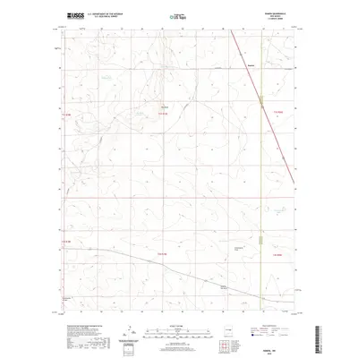
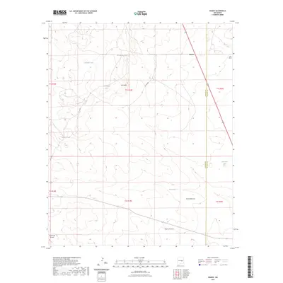
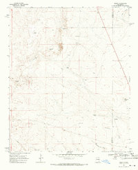 1967 Ramon1971 Print · USGSRanching life on the high plains of Lincoln County was defined by water and isolation in the late sixties. Researchers can trace the legacy of families at the Simpson Ranch, Merritt Ranch, and Ramon, or locate remote water sites like Corona Well and Schoolhouse Tank.2 unique versions available
 - 1979 Map of Fort Sumner
 1979 Fort Sumner1979 Print · USGSThe Pecos River valley in the late seventies reveals a landscape shaped by irrigation and the rail lines of the Atchison Topeka and Santa Fe. Genealogists and historians can trace small communities like Taiban and Yeso alongside landmarks like The Caprock.
 - 2010 Map of Ramon, 2010 Print
 2010 Ramon2010 Print · USGSCovers Ramon, including Lincoln County, De Baca County, and other nearby areas
 - 2013 Map of Ramon, 2013 Print
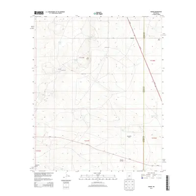 2013 Ramon2013 Print · USGSCovers Ramon, including Lincoln County, De Baca County, and other nearby areas
 - 2017 Map of Ramon, 2017 Print
 2017 Ramon2017 Print · USGSCovers Ramon, including Lincoln County, De Baca County, and other nearby areas
 - 2020 Map of Ramon, 2020 Print
 2020 Ramon2020 Print · USGSCovers Ramon, including Lincoln County, De Baca County, and other nearby areas
 - 2023 Map of Ramon, 2023 Print
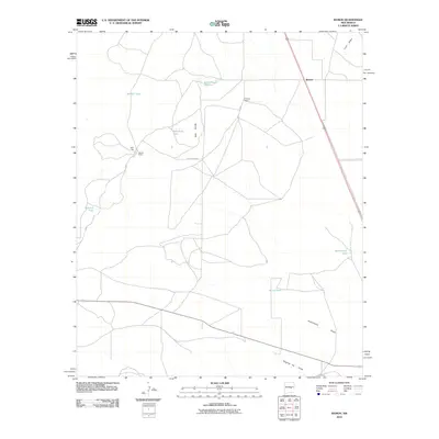
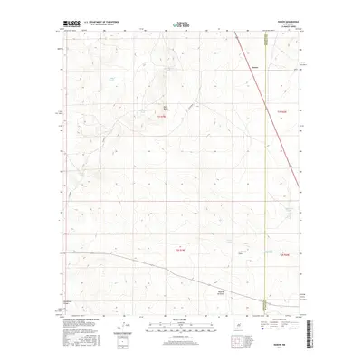
 2023 Ramon2023 Print · USGSLincoln County ranching country is mapped here in the early twenty-first century, showing the small settlement of Ramon near the De Baca County line. Researchers can trace land use through named water features like Schoolhouse Tank, Automobile Lake, and the winding Fifteenmile Arroyo.
End of results
Showing maps 1-9 of 9
Frequently asked questions
- What are the different types of historical maps available for Ramon?
- What is the oldest map of Ramon?
- Where can I purchase historical maps of Ramon for my home or office?
- Where can I download high-res historical maps of Ramon?
- Are there historical topographic maps available for Ramon?
- Is there historical aerial imagery available for Ramon?
- Where are historical maps of Ramon sourced from?