Old Maps of Eldorado at Santa Fe, New Mexico for Metal Detecting
Plan your next treasure hunt with 12 historic maps of Eldorado at Santa Fe. Find old homesites, ghost towns, trails, and gathering spots that may be lost to time — perfect for identifying promising metal detecting locations.
- Locate forgotten sites: Uncover places like long-lost settlements, abandoned rail lines, or gathering spots.
- Plan better hunts: Use map overlays combined with LiDAR or satellite views to narrow in on historically rich areas.
- Made for detectorists: Thousands of hobbyists use these maps to discover relics, coins, and hidden history.
Use these historic maps to boost your research and find new opportunities beneath the surface of Eldorado at Santa Fe.
Eldorado at Santa Fe, NM maps
(12)- 1889 Map of Santa Fe, 1963 Print
 1889 Santa Fe1963 Print · USGSSanta Fe and the surrounding high country appear here in the late nineteenth century as the railroad began transforming the territory. Genealogists and historians can trace early settlements like Santuario, identify family sites at Gonzales Ranch, and locate the historic Old Fort Marcy.
 - 1894 Map of Santa Fe
 1894 Santa Fe1894 Print · USGSSanta Fe and its surrounding high-country villages appear here during the territorial era of the late nineteenth century. Genealogists and historians can trace the routes of early railroads and locate specific landmarks like Old Fort Marcy, Gonzales Ranch, and Tesuque Pueblo.5 unique versions available
 - 1952 Map of Seton Village, 1953 Print
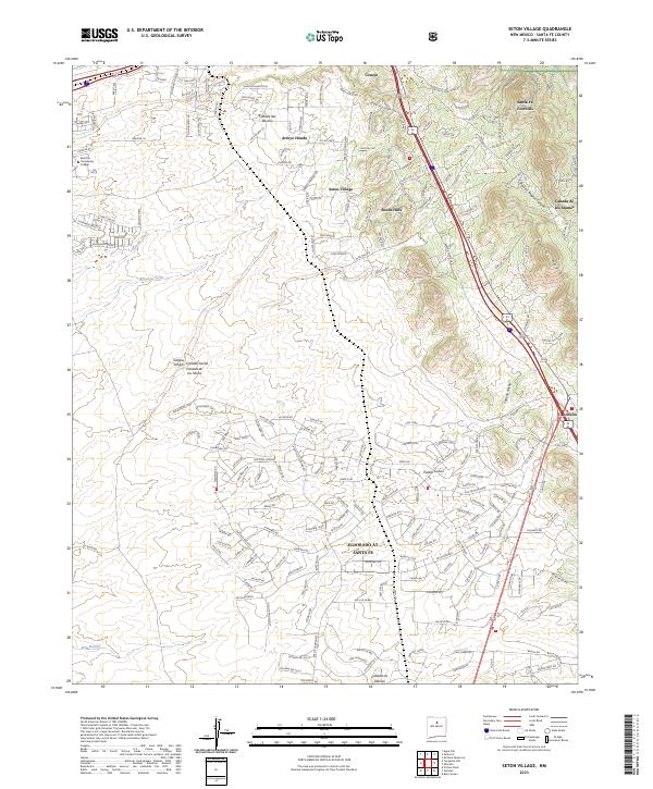
 1952 Seton Village1953 Print · USGSSouth of Santa Fe in the early fifties, this landscape is defined by vast historic land grants and the steel of the railroad. Researchers can trace the borders of the Bishop John Lamy Grant or locate old outposts like Ninemile Ranch and Gallina Camp.5 unique versions available
 - 1954 Map of Santa Fe, 1963 Print
 1954 Santa Fe1963 Print · USGSNew Mexico's high mountains and eastern plains meet in the mid-fifties, showing a landscape defined by the Sangre de Cristo Mountains and the Pecos River. Trace family roots and local history through San Christobal Church, Sena School, and the historic Las Vegas rail corridor.4 unique versions available
 - 1958 Map of Santa Fe
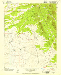
 1958 Santa Fe1958 Print · USGSThe Sangre De Cristo Mountains meet the high plains in the late 1950s, showing a landscape defined by rail corridors and ranching. Genealogists can trace family-named sites like Upton Ranch or visit the Fort Union (Ruins) and Tuloso School.
 - 1983 Map of Santa Fe, 1984 Print
 1983 Santa Fe1984 Print · USGSThe high Sangre de Cristo Mountains and the growing state capital define this early 1980s landscape during a period of expanding infrastructure. Researchers can trace historic land patterns and transit routes from Nambe Pueblo and Glorieta Pass to the Atchison Topeka and Santa Fe RR line.
 - 2002 Map of Seton Village, 2003 Print
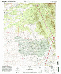 2002 Seton Village2003 Print · USGSSoutheast of Santa Fe at the turn of the millennium, this area shows a landscape defined by historic land grants and growing residential pockets. Researchers can trace the legacy of the Santa Fe Trail and the AT & SF RR alongside settlements like Seton Village and Eldorado.
 - 2011 Map of Seton Village, 2011 Print
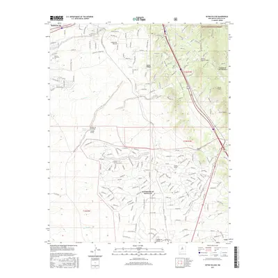
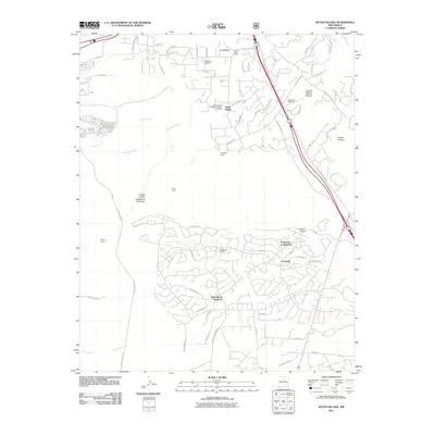 2011 Seton Village2011 Print · USGSCovers Eldorado at Santa Fe, including Santa Fe, La Loma, and other nearby areas
 - 2013 Map of Seton Village, 2013 Print
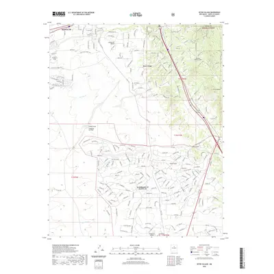
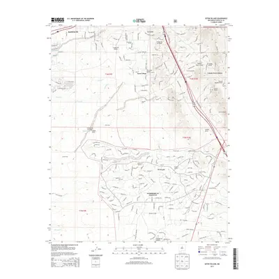 2013 Seton Village2013 Print · USGSCovers Eldorado at Santa Fe, including Santa Fe, La Loma, and other nearby areas
 - 2017 Map of Seton Village, 2017 Print
 2017 Seton Village2017 Print · USGSCovers Eldorado at Santa Fe, including Santa Fe, La Loma, and other nearby areas
 - 2020 Map of Seton Village, 2020 Print
 2020 Seton Village2020 Print · USGSCovers Eldorado at Santa Fe, including Santa Fe, La Loma, and other nearby areas
 - 2023 Map of Seton Village, 2023 Print
 2023 Seton Village2023 Print · USGSSoutheast of the city in the early 2020s, this area showcases the modern residential layout of the high-desert foothills. Researchers can trace the sprawling road networks of Eldorado at Santa Fe or locate landmarks like Santa Fe Community College and Seton Village.
End of results
Showing maps 1-12 of 12
Top cities near Eldorado at Santa Fe
Frequently asked questions
- What are the different types of historical maps available for Eldorado at Santa Fe?
- What is the oldest map of Eldorado at Santa Fe?
- Where can I purchase historical maps of Eldorado at Santa Fe for my home or office?
- Where can I download high-res historical maps of Eldorado at Santa Fe?
- Are there historical topographic maps available for Eldorado at Santa Fe?
- Is there historical aerial imagery available for Eldorado at Santa Fe?
- Where are historical maps of Eldorado at Santa Fe sourced from?