Old Maps of Chupadera, New Mexico for Genealogy
Trace your family roots with 10 historic maps of Chupadera. These high-res maps reveal old neighborhoods, homesites, landmarks, and streets — helping you uncover where your ancestors lived and how the area evolved over time.
- Explore historic neighborhoods: Identify where your relatives may have lived in the 1800s or 1900s.
- Compare maps over time: Trace the changes in streets, buildings, and landmarks for multi-generational research.
- Perfect for genealogy & ancestry research: Used by family historians and researchers to map out lineage and migration.
These maps are an incredible resource for exploring your personal connection to Chupadera's past.
Chupadera, NM maps
(10)- 1954 Map of Socorro, 1972 Print
 1954 Socorro1972 Print · USGSMid-century New Mexico comes into focus as the Rio Grande valley and the surrounding high desert undergo post-war growth. Genealogists and historians can trace old mountain settlements like Tajique and Punta de Agua or locate remote sites like the Torrance Mine.2 unique versions available
 - 1958 Map of Socorro
 1958 Socorro1958 Print · USGSNew Mexico's high desert during the late fifties reveals a landscape of massive land grants and remote mining outposts. Researchers can trace the path of the Atchison Topeka and Santa Fe railroad as it connects Socorro and Belen to industrial sites like the Manganese Mill.
 - 1962 Map of Socorro
 1962 Socorro1962 Print · USGSCentral New Mexico comes alive in the early sixties as the rail-and-river corridor of the Rio Grande connects historic pueblos and ranching towns. Local historians can trace the route of the Atchison Topeka and Santa Fe through Belen or locate the Torrance Mine near Mountainair.
 - 1972 Map of Chupadera, 1975 Print
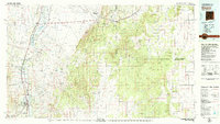
 1972 Chupadera1975 Print · USGSThe high desert border of Torrance and Socorro counties is captured here in the early seventies, revealing a landscape of remote ranching and resource utility. Genealogists and historians can locate Chupadera Cem, the Fite Mine, and vital water sources like San Antonio Spring.
 - 1979 Map of Socorro
 1979 Socorro1979 Print · USGSThe Rio Grande corridor south of Belen comes into focus during the late seventies, showing the vital link between river-valley agriculture and high-desert ranching. Genealogists and historians can trace riverside settlements like Polvadera and La Joya or locate the Abo Mine and Dewey Lode Mine.2 unique versions available
 - 2010 Map of Chupadera, 2010 Print
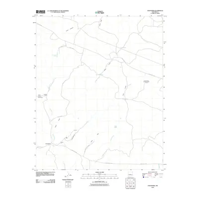 2010 Chupadera2010 Print · USGSCovers Chupadera, including Socorro County, Torrance County, and other nearby areas
 - 2013 Map of Chupadera, 2013 Print
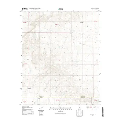 2013 Chupadera2013 Print · USGSCovers Chupadera, including Socorro County, Torrance County, and other nearby areas
 - 2017 Map of Chupadera, 2017 Print
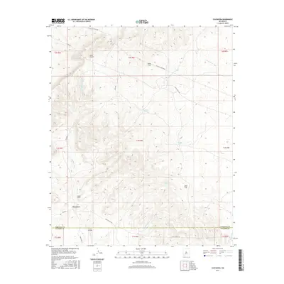 2017 Chupadera2017 Print · USGSCovers Chupadera, including Socorro County, Torrance County, and other nearby areas
 - 2020 Map of Chupadera, 2020 Print
 2020 Chupadera2020 Print · USGSCovers Chupadera, including Socorro County, Torrance County, and other nearby areas
 - 2023 Map of Chupadera, 2023 Print
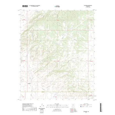 2023 Chupadera2023 Print · USGSThe high desert of New Mexico at the Socorro and Torrance county line is mapped here in the early 2020s. Researchers can trace the essential water systems of the region, from the San Antonio Spring to the network of tanks and arroyos like Chupadera Arroyo and Cañon Trigo.
End of results
Showing maps 1-10 of 10
Frequently asked questions
- What are the different types of historical maps available for Chupadera?
- What is the oldest map of Chupadera?
- Where can I purchase historical maps of Chupadera for my home or office?
- Where can I download high-res historical maps of Chupadera?
- Are there historical topographic maps available for Chupadera?
- Is there historical aerial imagery available for Chupadera?
- Where are historical maps of Chupadera sourced from?