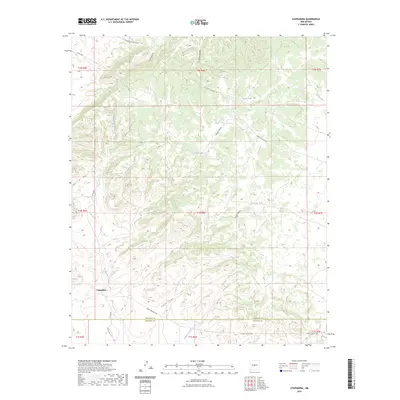
2023 Map of Chupadera
USGS Topo · Published 2023About this map
Chupadera sits at the southwestern edge of this landscape where the high desert terrain meets a complex system of drainage and canyon networks. The area is defined by its water management history in an arid environment, marked by numerous storage points such as La Cueva Tank, Torcido Tank, and Trigo Tank. These features, alongside the San Antonio Spring, suggest a long-standing reliance on concentrated water sources for ranching or local survival in the high country between the Socorro and Torrance county lines.
Find a feature on this map
29 named features on this map. Tap any name to fly to it.
Don’t see what you’re looking for? This feature index may not catch every label — zoom into the map to look around manually.
Map Details
Editions of this 2023 Chupadera Map
This is the sole edition of this map. No revisions or reprints were ever made.
Other maps of this area

1954 · Socorro
USGS Topo · 1:250,000

1958 · Socorro
USGS Topo · 1:250,000

1962 · Socorro
USGS Topo · 1:250,000

1972 · Turkey Ridge
USGS Topo · 1:24,000
1972 · Chupadera Spring
USGS Topo · 1:24,000

1972 · Chupadera
USGS Topo · 1:24,000

1972 · Bigbee Draw
USGS Topo · 1:24,000

1972 · Abo
USGS Topo · 1:24,000
1972 · Scholle
USGS Topo · 1:24,000
1972 · Mesa Draw
USGS Topo · 1:24,000