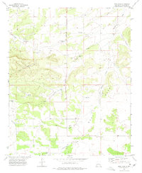
1972 Map of Mesa Draw
USGS Topo · Published 1975About this map
Eisenhart Hill and the high country of West Mesa define this landscape in Torrance County, where water management is the primary evidence of human industry. This early 1970s survey captures a sparse ranching environment dependent on a network of family-named landmarks and water sources. The terrain is deeply incised by drainages such as Goat Canyon, Chavez Draw, and Lion Canyon, with the broad expanse of Big Draw cutting through the central portion of the quadrangle.
Find a feature on this map
25 named features on this map. Tap any name to fly to it.
Don’t see what you’re looking for? This feature index may not catch every label — zoom into the map to look around manually.
Map Details
Editions of this 1972 Mesa Draw Map
This is the sole edition of this map. No revisions or reprints were ever made.
Other maps of this area

1917 · Estancia
USGS Topo · 1:125,000

1954 · Torreon
USGS Topo · 1:62,500

1954 · Socorro
USGS Topo · 1:250,000

1956 · Mountainair
USGS Topo · 1:62,500

1958 · Socorro
USGS Topo · 1:250,000

1962 · Socorro
USGS Topo · 1:250,000

1972 · Gran Quivira
USGS Topo · 1:24,000

1972 · Chupadera
USGS Topo · 1:24,000

1972 · Bigbee Draw
USGS Topo · 1:24,000

1972 · Abo
USGS Topo · 1:24,000