
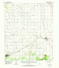
1956 Map of Mountainair
USGS Topo · Published 1958About this map
Mountainair and Willard anchor this mid-century survey of the Estancia Valley, where the Atchison Topeka and Santa Fe railway cuts across the high desert landscape. The map captures a transition from the historic Town of Torreon Grant Boundary in the northwest to the prominent Jumanes Mesa and Jumanes Knob in the south. Dozens of family-named outposts like the Dressler Ranch, Holliday Ranch, and Bullington Ranch are meticulously plotted, illustrating the scattered ranching economy of Torrance County.
Find a feature on this map
45 named features on this map. Tap any name to fly to it.
Don’t see what you’re looking for? This feature index may not catch every label — zoom into the map to look around manually.
Map Details
Editions of this 1956 Mountainair Map
2 editions found
Other maps of this area

1917 · Estancia
USGS Topo · 1:125,000

1954 · Torreon
USGS Topo · 1:24,000

1954 · Tajique
USGS Topo · 1:24,000

1954 · Milbourn Ranch
USGS Topo · 1:24,000

1954 · Torreon
USGS Topo · 1:62,500

1954 · Fort Sumner
USGS Topo · 1:250,000

1954 · Socorro
USGS Topo · 1:250,000

1956 · Estancia
USGS Topo · 1:62,500

1958 · Socorro
USGS Topo · 1:250,000

1958 · Fort Sumner
USGS Topo · 1:250,000