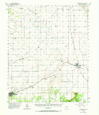
1956 Map of Mountainair
USGS Topo · Published 1973About this map
Mountainair and Willard serve as the primary rail hubs for this high-altitude landscape in the mid-1950s, linked by the Atchison Topeka and Santa Fe railroad. The terrain is defined by wide arroyos like the Arroyo de Tajique and Arroyo de Manzano that cut through the plains, eventually giving way to the prominent Jumanes Mesa and Jumanes Knob in the south. The area within the Cibola National Forest boundary transitions into the more varied topography of Dead Dog Canyon.
Find a feature on this map
47 named features on this map. Tap any name to fly to it.
Don’t see what you’re looking for? This feature index may not catch every label — zoom into the map to look around manually.
Map Details
Editions of this 1956 Mountainair Map
2 editions found
Other maps of this area

1917 · Estancia
USGS Topo · 1:125,000

1954 · Torreon
USGS Topo · 1:24,000

1954 · Tajique
USGS Topo · 1:24,000

1954 · Milbourn Ranch
USGS Topo · 1:24,000

1954 · Torreon
USGS Topo · 1:62,500

1954 · Fort Sumner
USGS Topo · 1:250,000

1954 · Socorro
USGS Topo · 1:250,000

1956 · Estancia
USGS Topo · 1:62,500

1956 · Mountainair
USGS Topo · 1:62,500

1958 · Socorro
USGS Topo · 1:250,000