1900s (20th Century) Maps of Wagon Wheel, New Mexico
Explore 10 historic maps of Wagon Wheel from the 1900s (20th Century). These maps offer a rare glimpse into what life looked like during the 1900s — showing old roads, neighborhoods, homes, and landmarks that have changed or disappeared over time.
Whether you're researching your family's past, planning a metal detecting trip, or studying how Wagon Wheel's landscape evolved across the 1900s, these high-resolution maps are a powerful tool for exploring the history of this region.
- Focus on a specific era: All maps on this page are from the 1900s, giving you a focused view of this time period.
- See what’s changed: Compare century-old streets, trails, and buildings to today's modern landscape using overlays and satellite layers.
- Research with precision: Use these maps for genealogy, historical research, land use analysis, or educational projects.
- View, download, or print: Maps are fully viewable online in high resolution, and can be downloaded or printed for your own records.
Start exploring Wagon Wheel's history through authentic maps from the 1900s. This is your window into the past.
Wagon Wheel, NM maps
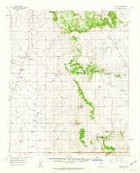
(10)- 1954 Map of Santa Fe, 1963 Print
 1954 Santa Fe1963 Print · USGSNew Mexico's high mountains and eastern plains meet in the mid-fifties, showing a landscape defined by the Sangre de Cristo Mountains and the Pecos River. Trace family roots and local history through San Christobal Church, Sena School, and the historic Las Vegas rail corridor.4 unique versions available
 - 1954 Map of Fort Sumner, 1964 Print
 1954 Fort Sumner1964 Print · USGSEast-central New Mexico's ranching and rail heartland is captured here in the mid-1950s, centered on the strategic junctions of the high plains. Researchers can trace the development of early highway networks and rail towns like Vaughn, Fort Sumner, and the copper operations at Guadalupe Mine.3 unique versions available
 - 1958 Map of Fort Sumner
 1958 Fort Sumner1958 Print · USGSEast-central New Mexico in the mid-fifties is captured here as a sprawling landscape of high mesas and cattle ranching. Researchers can trace the convergence of the Southern Pacific railroad at Vaughn and locate family landmarks like Borica School or Marquez Ranch.
 - 1958 Map of Santa Fe
 1958 Santa Fe1958 Print · USGSThe Sangre De Cristo Mountains meet the high plains in the late 1950s, showing a landscape defined by rail corridors and ranching. Genealogists can trace family-named sites like Upton Ranch or visit the Fort Union (Ruins) and Tuloso School.
 - 1960 Map of Lobo Hill, 1963 Print
 1960 Lobo Hill1963 Print · USGSTorrance County ranching life in the early 1960s is captured here through a network of family homesteads and desert water draws. Researchers can locate specific legacy sites like the Lamb Homestead, Kincheloe Homestead, and Price Ranch.
 - 1960 Map of Stanley, 1963 Print
 1960 Stanley1963 Print · USGSRanching life in Santa Fe County during the early 1960s is defined here by isolated homesteads and high-altitude water holes. Genealogists can trace family legacies through sites like Mitchell Ranch, Montaño Ranch, and the Stanley Cem.3 unique versions available
 - 1983 Map of Villanueva, 1984 Print
 1983 Villanueva1984 Print · USGSThe Pecos River valley and its high mesa surroundings are captured here in the early eighties. Researchers can trace historic river settlements like Villanueva and Sena, the route of the Atchison Topeka and Santa Fe railroad, and the high-desert terrain of Glorieta Mesa.
 - 1984 Map of Vaughn, 1992 Print
 1984 Vaughn1992 Print · USGSCentral New Mexico’s high plains are captured here in the mid-1980s, revealing a landscape shaped by transcontinental rail and highway travel. Trace the paths of the Atchison Topeka and Santa Fe through settlements like Encino, Vaughn, and Milagro.
 - 1990 Map of El Cuervo Butte
 1990 El Cuervo Butte1990 Print · USGSHigh desert ranching and water management define the landscape along the Santa Fe and Torrance County line in the late twentieth century. Genealogists and local historians can trace the settlement of Osita and natural features like El Cuervo Butte or Dinosaur Tank.
 - 1990 Map of Lobo Hill NE
 1990 Lobo Hill NE1990 Print · USGSTorrance County ranching and rugged terrain are captured in this late twentieth-century survey of the New Mexico landscape. Researchers can trace the infrastructure of rural life through family-named landmarks like Red Canyon Ranch, Antelope Well, and Chavez Draw.
End of results
Showing maps 1-10 of 10
Top cities near Wagon Wheel
Frequently asked questions
- What are the different types of historical maps available for Wagon Wheel?
- What is the oldest map of Wagon Wheel?
- Where can I purchase historical maps of Wagon Wheel for my home or office?
- Where can I download high-res historical maps of Wagon Wheel?
- Are there historical topographic maps available for Wagon Wheel?
- Is there historical aerial imagery available for Wagon Wheel?
- Where are historical maps of Wagon Wheel sourced from?