1900s (20th Century) Maps of Colonie, New York
Explore 31 historic maps of Colonie from the 1900s (20th Century). These maps offer a rare glimpse into what life looked like during the 1900s — showing old roads, neighborhoods, homes, and landmarks that have changed or disappeared over time.
Whether you're researching your family's past, planning a metal detecting trip, or studying how Colonie's landscape evolved across the 1900s, these high-resolution maps are a powerful tool for exploring the history of this region.
- Focus on a specific era: All maps on this page are from the 1900s, giving you a focused view of this time period.
- See what’s changed: Compare century-old streets, trails, and buildings to today's modern landscape using overlays and satellite layers.
- Research with precision: Use these maps for genealogy, historical research, land use analysis, or educational projects.
- View, download, or print: Maps are fully viewable online in high resolution, and can be downloaded or printed for your own records.
Start exploring Colonie's history through authentic maps from the 1900s. This is your window into the past.
Colonie, NY maps
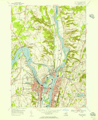
(31)- 1925 Map of Troy
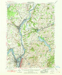
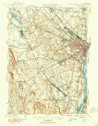
 1925 Troy1925 Print · USGSRensselaer County at the mid-twenties shows a landscape of established mill towns and developing lakefront retreats. Genealogists can trace family roots through numerous sites like St Josephs Cemetery, Teller Mill, and early schoolhouses from Albia to Hoags Corners.
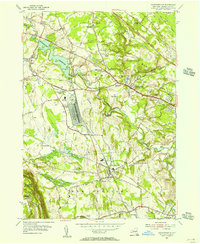
 - 1927 Map of Albany
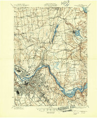
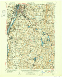
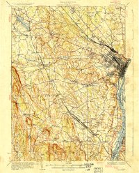 1927 Albany1927 Print · USGSThe Albany riverfront and the Helderberg escarpment define this mid-1920s portrait of New York's capital region. Genealogists can trace a dense network of country schoolhouses and old settlements like Feura Bush, Loudonville, and the Bethlehem Church.5 unique versions available
 - 1928 Map of Troy
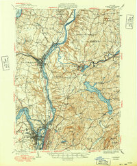
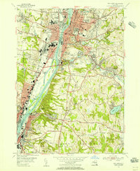
 1928 Troy1928 Print · USGSThe Hudson River valley at the height of its industrial era features the dense centers of Troy and Watervliet. Researchers can trace old neighborhoods near Rensselaer Polytechnic Institute or locate family plots in St Agnes Cemetery and St Marys Cemetery.5 unique versions available
 - 1929 Map of Cohoes
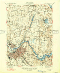
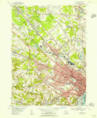
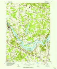
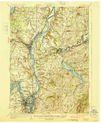 1929 Cohoes1929 Print · USGSThe industrial and revolutionary history of the Hudson Valley is clear in this late twenties survey of the river's confluence. Researchers can trace early rail stops at Stillwater Center Sta, explore the Saratoga Battlefield, or locate rural schoolhouses from School No 4 to School No 13.4 unique versions available
 - 1930 Map of Schenectady
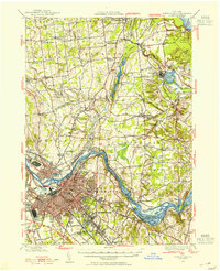
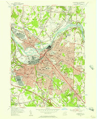
 1930 Schenectady1930 Print · USGSThe Mohawk Valley and southern Saratoga County are caught in a moment of transition in the late twenties, balancing industrial river life with rural farmsteads. Genealogists and historians can trace the Erie Canal (Abandoned) path and locate old family landmarks like Harmony Corners or Vischer Ferry.5 unique versions available
 - 1947 Map of Schenectady, 1954 Print
 1947 Schenectady1954 Print · USGSThe Schenectady region in the late 1940s reveals a powerful industrial hub at the intersection of rail, river, and canal. Researchers can trace the legacy of the Erie Canal, find rural district schools, and locate old family crossroads like Groom Corners and Vischer Ferry.2 unique versions available
 - 1947 Map of Albany, 1965 Print
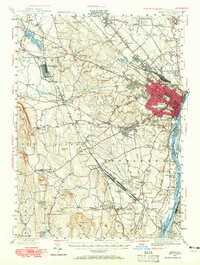 1947 Albany1965 Print · USGSThe Albany capital region is captured here shortly after the war, showing the city's transition into suburban Delmar and Loudonville. Researchers can trace the massive Voorheesville Army Sub Depot, the Albany Airport, and old landmarks like Graceland Cemetery.
 - 1947 Map of Cohoes, 1968 Print
 1947 Cohoes1968 Print · USGSThe Hudson and Mohawk river valleys converge here in the mid-1940s, revealing a dense network of canals and early industrial railroads. Researchers can trace the Champlain Canal (Abandoned), find old rural schoolhouses, and locate landmarks like the Fire Lookout Tower and Cohoes Falls.
 - 1948 Map of Schenectady
 1948 Schenectady1948 Print · USGSSchenectady and its surrounding Saratoga County townships are captured here in the late 1940s as industrial rail hubs and rural hamlets met. Genealogists and local historians can trace family-named sites like Groom Corners, the Erie Canal (Abandoned), and Vischer Ferry.
 - 1948 Map of Albany, 1951 Print
 1948 Albany1951 Print · USGSThe Hudson and Connecticut River valleys are captured here in the late 1940s, showing the vital rail and water corridors of the Northeast. You can trace the Boston and Maine tracks past Mt Greylock or locate early settlements like Great Barrington and Bennington.
 - 1949 Map of Cohoes
 1949 Cohoes1949 Print · USGSThe Hudson and Mohawk river valleys meet in the late 1940s at the industrial nexus of Cohoes and Troy. Local historians can trace early transport routes along the Champlain Canal, find family names near Bemis Heights, or locate old landmarks like the Fire Lookout Tower.2 unique versions available
 - 1949 Map of Schenectady
 1949 Schenectady1949 Print · USGSSchenectady and its surrounding Saratoga County townships are captured here in the late 1940s as the riverfront industry and rail networks remained in full swing. Genealogists can locate family landmarks in old hamlets like Maltaville and Groom Corners or trace the historic Erie Canal (Abandoned).
 - 1950 Map of Albany
 1950 Albany1950 Print · USGSMid-century Albany and its burgeoning suburbs are captured here at a peak of rail and river commerce. Genealogy and local history researchers can trace the New York Central lines to the Selkirk Yards or find family landmarks like Keefers Corners and Bethlehem Church.
 - 1950 Map of Troy
 1950 Troy1950 Print · USGSThe Hudson River valley and the Rensselaer hills are shown here just after the war, capturing a landscape of dense industrial riverfronts and rural upland hamlets. Genealogists can trace family sites at Albany Rural Cemetery, identify early landmarks like Draper School No 9, or locate rail stops at East Greenbush Station.
 - 1953 Map of Troy South, 1955 Print
 1953 Troy South1955 Print · USGSThe Hudson River industrial corridor comes alive in the early fifties, documenting the urban centers of Troy, Watervliet, and Rensselaer. Researchers can trace institutional footprints from the Watervliet Arsenal to Emma Willard College and old burial grounds like Albany Rural Cemetery.5 unique versions available
 - 1953 Map of Albany, 1956 Print
 1953 Albany1956 Print · USGSMid-century Albany and its northern suburbs are shown here just as the highway network began to reshape the capital region. Genealogists can trace family names and institutions across Graceland Cemetery, the Ann Lee Home Cem, and numerous historic campuses like the Mater Christi Seminary.3 unique versions available
 - 1954 Map of Troy North, 1956 Print
 1954 Troy North1956 Print · USGSThe industrial corridor of the upper Hudson River is captured here in the mid-1950s as a hub of rail and water transport. Genealogists can trace family names at Oakwood Cemetery or explore established neighborhoods near Crescent Station and Speigletown.4 unique versions available
 - 1954 Map of Voorheesville, 1956 Print
 1954 Voorheesville1956 Print · USGSAlbany County during the mid-fifties reveals a landscape balancing heavy infrastructure with growing residential hamlets. Local historians can trace the massive Schenectady General Depot or locate family plots at Guilderland Cem and Mt Pleasant Cem.3 unique versions available
 - 1954 Map of Niskayuna, 1956 Print
 1954 Niskayuna1956 Print · USGSThe Mohawk River valley in the mid-1950s shows the shifting landscape of upstate New York as suburban growth meets traditional canal routes. Trace the old waterway path through Vischer Ferry, locate family plots at Most Holy Redeemer Cemetery, or explore the early layout of Albany Municipal Airport.4 unique versions available
 - 1954 Map of Schenectady, 1957 Print
 1954 Schenectady1957 Print · USGSSchenectady and the Mohawk River valley appear here at a mid-century peak of industrial and military activity. Researchers can trace historic family burial sites at Vale Cemetery, follow the old Erie Canal, or locate vanished neighborhoods near the U S Mil Res Schenectady General Depot.4 unique versions available
 - 1954 Map of Schenectady, 1957 Print
 1954 Schenectady1957 Print · USGSThe Mohawk Valley's industrial and transit networks are in full view at mid-century, from the rail yards of Schenectady to the waters of the Erie Canal. Genealogists can locate legacy sites like Vischer Ferry, Pine Grove Cem, and numerous rural schoolhouses.
 - 1956 Map of Albany, 1968 Print
 1956 Albany1968 Print · USGSThe industrial heart of the Northeast is revealed in the mid-1950s, from the Hudson Valley to the Connecticut River. Researchers can trace the legacy of the Quabbin Reservoir, locate Westover Air Force Base, or follow the Rutland RR through the Green Mountains.2 unique versions available
 - 1957 Map of Albany
 1957 Albany1957 Print · USGSThe Tri-State region and Connecticut River Valley are captured here during a period of significant postwar growth and infrastructure expansion. Genealogists and historians can trace the rail-and-river economy through landmarks like the Boston and Maine railroad, Quabbin Reservoir, and Westover Air Force Base.
 - 1959 Map of Albany
 1959 Albany1959 Print · USGSThe Hudson and Connecticut River valleys are captured here during the late fifties, showing the region's dense rail networks and massive water projects. Researchers can trace the New York State Thruway or locate local landmarks like Mt Greylock and the Quabbin Reservoir.
 - 1962 Map of Albany
 1962 Albany1962 Print · USGSThe Hudson and Connecticut River valleys meet the Green Mountains and Berkshires in this mid-century overview of the Northeast. Genealogists and historians can trace the industrial hearts of Albany and Springfield or locate features like Quabbin Reservoir and Westover Air Force Base.
Showing maps 1-25 of 31
Top cities near Colonie
- Albany historical maps
- Schenectady historical maps
- Troy historical maps
- Clifton Park historical maps
- Guilderland historical maps
- Bethlehem historical maps
See more
Top neighborhoods of Colonie
- Verdoy historical maps
- Lisha Kill historical maps
- Shakers historical maps
- Whitney Estates historical maps
- Mohawk View historical maps
- Crescent Station historical maps
See more
Frequently asked questions
- What are the different types of historical maps available for Colonie?
- What is the oldest map of Colonie?
- Where can I purchase historical maps of Colonie for my home or office?
- Where can I download high-res historical maps of Colonie?
- Are there historical topographic maps available for Colonie?
- Is there historical aerial imagery available for Colonie?
- Where are historical maps of Colonie sourced from?